Property Record
548 S Gilbert Rd, Gilbert, AZ 85296

Property Detail
548 S Gilbert Rd
Phoenix-Mesa-Chandler, AZ
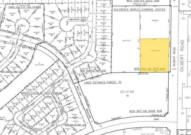
CHILDRENS WORLD LEARNING CENTER MCR 522-09
302-35-327B
MARICOPA
Commercialnec
Arizona
C-C
2
C and X Area of minimal flood hazard, usually depicted on FIRMs as above the 500-year flood level.
1.12 AC
2025
Chandler
2025
Phoenix
814600
NEARBY LISTINGS FOR SALE OR LEASE
DEMOGRAPHICS near 548 S Gilbert Rd
1 mile
3 mile
5 mile
2025 Total Population
16,089
124,079
365,054
2030 Population
16,608
127,678
376,340
Pop Growth 2025-2030
+ 3.23%
+ 2.90%
+ 3.09%
Average Age
39
38
37
2025 Total Households
5,809
44,138
129,093
HH Growth 2025-2030
+ 3.24%
+ 2.95%
+ 3.16%
Median Household Inc
$110,867
$112,302
$98,134
Avg Household Size
2.70
2.80
2.70
2025 Avg HH Vehicles
2.00
2.00
2.00
Median Home Value
$492,065
$509,084
$476,787
Median Year Built
1994
1993
1992
Nearby Places
Map Layers
Map Styles
 Street
 Aerial
Transit
 Traffic
 Biking
Places
Listings with unknown addresses are not visible on the map
- Restaurants
- Banks
- Shops
- Fitness
- Groceries
PUBLIC TRANSPORTATION
AIRPORT
Phoenix-Mesa Gateway
Drive
Walk
Distance
Phoenix-Mesa Gateway
19 min
9.6 mi
Phoenix Sky Harbor International
Drive
Walk
Distance
Phoenix Sky Harbor International
31 min
19.5 mi
Nearby Properties
Address
Land Use
TOTAL SIZE
Lot Size
Zoning
Address
Land Use
TOTAL SIZE
Lot Size
Zoning
184,558 SF
6.18 AC
Address
Land Use
TOTAL SIZE
Lot Size
Zoning
5.92 AC
I-1
Address
Land Use
TOTAL SIZE
Lot Size
Zoning
301,190 SF
77.17 AC
PF
Address
Land Use
TOTAL SIZE
Lot Size
Zoning
9.25 AC
I-1
Address
Land Use
TOTAL SIZE
Lot Size
Zoning
290,450 SF
38.47 AC
PF
Address
Land Use
TOTAL SIZE
Lot Size
Zoning
380,383 SF
14.79 AC
C-G
Address
Land Use
TOTAL SIZE
Lot Size
Zoning
112,628 SF
17.37 AC
I-1
Address
Land Use
TOTAL SIZE
Lot Size
Zoning
309,031 SF
18.55 AC
Address
Land Use
TOTAL SIZE
Lot Size
Zoning
16.57 AC
PF
Address
Land Use
TOTAL SIZE
Lot Size
Zoning
372,953 SF
14.36 AC
C-C
Address
Land Use
TOTAL SIZE
Lot Size
Zoning
16,133 SF
1.79 AC
PF
Address
Land Use
TOTAL SIZE
Lot Size
Zoning
267,868 SF
13.18 AC
R-CH
Address
Land Use
TOTAL SIZE
Lot Size
Zoning
357,691 SF
19.87 AC
PAD
Address
Land Use
TOTAL SIZE
Lot Size
Zoning
7,418 SF
2.37 AC
C-G
Address
Land Use
TOTAL SIZE
Lot Size
Zoning
237,329 SF
9.76 AC
C-N
Address
Land Use
TOTAL SIZE
Lot Size
Zoning
253,276 SF
18.33 AC
PAD
Address
Land Use
TOTAL SIZE
Lot Size
Zoning
115,920 SF
18.19 AC
Address
Land Use
TOTAL SIZE
Lot Size
Zoning
154,816 SF
35.89 AC
I-1
Address
Land Use
TOTAL SIZE
Lot Size
Zoning
1.62 AC
Address
Land Use
TOTAL SIZE
Lot Size
Zoning
270,243 SF
15.52 AC
M-M
Address
Land Use
TOTAL SIZE
Lot Size
Zoning
229,536 SF
13.94 AC
PAD
Address
Land Use
TOTAL SIZE
Lot Size
Zoning
222,882 SF
16.13 AC
PAD
Address
Land Use
TOTAL SIZE
Lot Size
Zoning
90,920 SF
2.27 AC
C-O
Address
Land Use
TOTAL SIZE
Lot Size
Zoning
82,212 SF
40 AC
PF
Address
Land Use
TOTAL SIZE
Lot Size
Zoning
3.83 AC
C-C
Address
Land Use
TOTAL SIZE
Lot Size
Zoning
93,287 SF
29.54 AC
PF
Address
Land Use
TOTAL SIZE
Lot Size
Zoning
1.48 AC
Address
Land Use
TOTAL SIZE
Lot Size
Zoning
312,526 SF
14.17 AC
PAD
Address
Land Use
TOTAL SIZE
Lot Size
Zoning
230,826 SF
25.95 AC
PAD
Address
Land Use
TOTAL SIZE
Lot Size
Zoning
219,685 SF
20.13 AC
I-1
The World's #1 Commercial Real Estate Marketplace
Connect with us
© 2026 CoStar Group
The information above has been obtained from sources believed reliable. While we do not doubt its accuracy we have not verified it and make no guarantee, warranty or representation about it. It is your responsibility to independently confirm its accuracy and completeness. Any projections, opinions, assumptions, or estimates used are for example only and do not represent the current or future performance of the property. The value of this transaction to you depends on tax and other factors which should be evaluated by your tax, financial, and legal advisors. You and your advisors should conduct a careful, independent investigation of the property to determine to your satisfaction the suitability of the property for your needs.