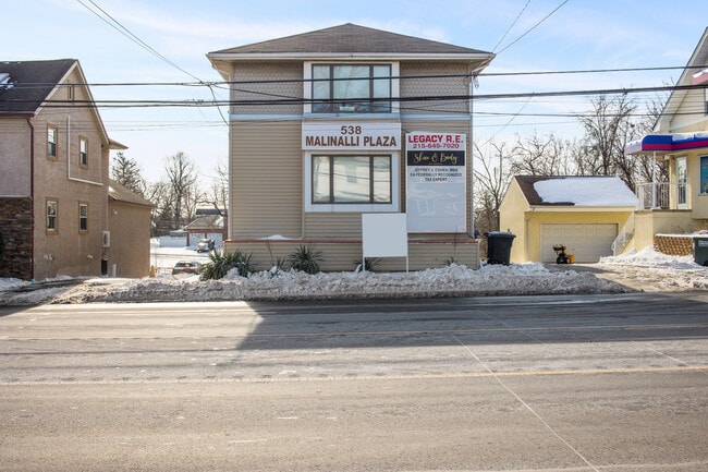
Property Record
538 Street Rd, Southampton, PA 18966

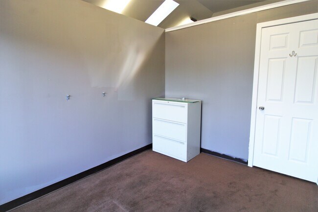
Current Lease Availabilities
Property Detail
538 Street Rd
48-013-003
S S SR132 282 FT W SUMMIT AV 50X141
Officebuilding
Bucks
CC
Pennsylvania
B and X Area of moderate flood hazard, usually the area between the limits of the 100-year and 500-year floods.
0.16 AC
2025
Lower Bucks County
2026
Philadelphia
101504
Philadelphia-Camden-Wilmington, PA-NJ-DE-MD
3,004 SF
NEARBY LISTINGS FOR SALE OR LEASE
DEMOGRAPHICS near 538 Street Rd
1 mile
3 mile
5 mile
2025 Total Population
10,833
65,869
212,426
2030 Population
11,180
66,867
213,932
Pop Growth 2025-2030
+ 3.20%
+ 1.52%
+ 0.71%
Average Age
46
45
44
2025 Total Households
4,614
25,616
81,279
HH Growth 2025-2030
+ 3.71%
+ 1.69%
+ 0.78%
Median Household Inc
$88,635
$105,881
$101,409
Avg Household Size
2.30
2.50
2.50
2025 Avg HH Vehicles
2.00
2.00
2.00
Median Home Value
$419,660
$466,103
$433,778
Median Year Built
1969
1969
1969
Nearby Places
Map Layers
Map Styles
 Street
 Aerial
Layers
 Traffic
 Biking
Places
Listings with unknown addresses are not visible on the map
- Restaurants
- Banks
- Shops
- Fitness
- Groceries
PUBLIC TRANSPORTATION
COMMUTER RAIL
Warminster (R2 - Southeastern Pennsylvania Transportation Authority Regional Rail (SEPTA Regional Rail))
Drive
Walk
Distance
Warminster (R2 - Southeastern Pennsylvania Transportation Authority Regional Rail (SEPTA Regional Rail))
6 min
2.9 mi
Hatboro (R2 - Southeastern Pennsylvania Transportation Authority Regional Rail (SEPTA Regional Rail))
Drive
Walk
Distance
Hatboro (R2 - Southeastern Pennsylvania Transportation Authority Regional Rail (SEPTA Regional Rail))
8 min
4.2 mi
AIRPORT
Trenton Mercer
Drive
Walk
Distance
Trenton Mercer
30 min
17.6 mi
Philadelphia International
Drive
Walk
Distance
Philadelphia International
50 min
29.8 mi
Lehigh Valley International
Drive
Walk
Distance
Lehigh Valley International
75 min
45.1 mi
Freight Ports
Port of Philadelphia
Drive
Walk
Distance
Port of Philadelphia
28 min
15.6 mi
Nearby Properties
Address
Land Use
TOTAL SIZE
Lot Size
Zoning
Address
Land Use
TOTAL SIZE
Lot Size
Zoning
377,044 SF
58.73 AC
INST
Address
Land Use
TOTAL SIZE
Lot Size
Zoning
282,292 SF
74.30 AC
IN
Address
Land Use
TOTAL SIZE
Lot Size
Zoning
251,655 SF
48.95 AC
SC
Address
Land Use
TOTAL SIZE
Lot Size
Zoning
420,736 SF
29.47 AC
LI
Address
Land Use
TOTAL SIZE
Lot Size
Zoning
256,679 SF
14 AC
MI
Address
Land Use
TOTAL SIZE
Lot Size
Zoning
110,198 SF
12.18 AC
R2
Address
Land Use
TOTAL SIZE
Lot Size
Zoning
273,531 SF
11.11 AC
INST
Address
Land Use
TOTAL SIZE
Lot Size
Zoning
127,251 SF
17.55 AC
L
Address
Land Use
TOTAL SIZE
Lot Size
Zoning
240,682 SF
4.81 AC
HI
Address
Land Use
TOTAL SIZE
Lot Size
Zoning
318,625 SF
19.01 AC
I
Address
Land Use
TOTAL SIZE
Lot Size
Zoning
84,000 SF
14.17 AC
LI
Address
Land Use
TOTAL SIZE
Lot Size
Zoning
162,363 SF
2.72 AC
HI
Address
Land Use
TOTAL SIZE
Lot Size
Zoning
91,446 SF
2.53 AC
R7
Address
Land Use
TOTAL SIZE
Lot Size
Zoning
69,680 SF
19 AC
LI
Address
Land Use
TOTAL SIZE
Lot Size
Zoning
64,000 SF
11.94 AC
LI
Address
Land Use
TOTAL SIZE
Lot Size
Zoning
60,945 SF
74.12 AC
Address
Land Use
TOTAL SIZE
Lot Size
Zoning
74,764 SF
10.17 AC
SC
Address
Land Use
TOTAL SIZE
Lot Size
Zoning
29,308 SF
15.96 AC
I
Address
Land Use
TOTAL SIZE
Lot Size
Zoning
56,595 SF
3.89 AC
Address
Land Use
TOTAL SIZE
Lot Size
Zoning
44,144 SF
7.30 AC
L
Address
Land Use
TOTAL SIZE
Lot Size
Zoning
44,309 SF
6.15 AC
IN
Address
Land Use
TOTAL SIZE
Lot Size
Zoning
85,060 SF
8.63 AC
I
Address
Land Use
TOTAL SIZE
Lot Size
Zoning
64,685 SF
7.91 AC
IN
Address
Land Use
TOTAL SIZE
Lot Size
Zoning
14,130 SF
83.31 AC
INST
Address
Land Use
TOTAL SIZE
Lot Size
Zoning
22,386 SF
15.52 AC
INST
Address
Land Use
TOTAL SIZE
Lot Size
Zoning
89,071 SF
8.13 AC
I
Address
Land Use
TOTAL SIZE
Lot Size
Zoning
30,921 SF
2.15 AC
L
Address
Land Use
TOTAL SIZE
Lot Size
Zoning
149,570 SF
16.76 AC
RS
Address
Land Use
TOTAL SIZE
Lot Size
Zoning
37,806 SF
21.50 AC
R5
Address
Land Use
TOTAL SIZE
Lot Size
Zoning
25,021 SF
10.82 AC
I
The World's #1 Commercial Real Estate Marketplace
Connect with us
© 2026 CoStar Group
The information above has been obtained from sources believed reliable. While we do not doubt its accuracy we have not verified it and make no guarantee, warranty or representation about it. It is your responsibility to independently confirm its accuracy and completeness. Any projections, opinions, assumptions, or estimates used are for example only and do not represent the current or future performance of the property. The value of this transaction to you depends on tax and other factors which should be evaluated by your tax, financial, and legal advisors. You and your advisors should conduct a careful, independent investigation of the property to determine to your satisfaction the suitability of the property for your needs.