Property Record
53800 Polk St, Coachella, CA 92236


NEARBY LISTINGS FOR SALE OR LEASE
-
-
View all Coachella listings for sale on LoopNet.com
Property Detail
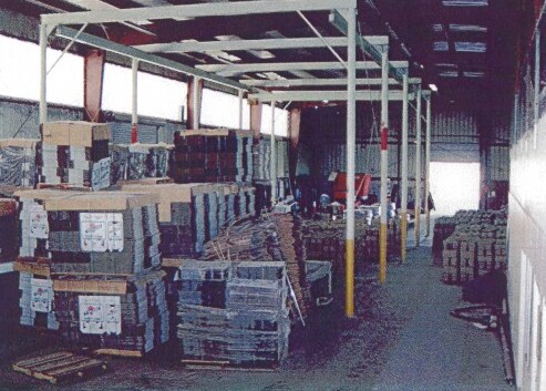
53800 Polk St
Riverside-San Bernardino-Ontario, CA
Parcel Map 15594
763-160-012
10.00 ACRES NET IN PAR 1 PM 076/044 PM 15594
Lightindustrial
Riverside
X
California
06065C2270H
1
2024
10 AC
2025
Coachella Valley
045616
Inland Empire (California)
16,010 SF
DEMOGRAPHICS near 53800 Polk St
1 Mile
3 Mile
5 Mile
2024 Total Population
69
28,441
54,671
2029 Population
68
29,947
57,685
Pop Growth 2024-2029
(1.45%)
+ 5.30%
+ 5.51%
Average Age
32
32
34
2024 Total Households
17
6,740
13,632
HH Growth 2024-2029
(5.88%)
+ 4.94%
+ 5.63%
Median Household Inc
$14,582
$34,332
$44,301
Avg Household Size
3.90
4.10
3.90
2024 Avg HH Vehicles
2.00
2.00
2.00
Median Home Value
$99,999
$241,673
$299,341
Median Year Built
1978
1988
1996
Nearby Places
Map Layers
Map Styles
 Street
 Aerial
- Restaurants
- Banks
- Shops
- Fitness
- Groceries
PUBLIC TRANSPORTATION
AIRPORT
Palm Springs International
DRIVE
WALK
Distance
Palm Springs International
37 min
28.5 mi
Freight Ports
Port of San Diego
DRIVE
WALK
Distance
Port of San Diego
182 min
152.6 mi
SALE & LEASE HISTORY
LISTING DATE
SALE/LEASE

Sep 12, 2019
For Lease
Sep 06, 2017
For Sale
Oct 15, 2019
For Sale
Nov 10, 2017
For Sale
Nearby Properties
Address
Land Use
TOTAL SIZE
Lot Size
Zoning
Address
Land Use
TOTAL SIZE
Lot Size
Zoning
133,694 SF
5.83 AC
Address
Land Use
TOTAL SIZE
Lot Size
Zoning
177,392 SF
25.40 AC
MH
Address
Land Use
TOTAL SIZE
Lot Size
Zoning
105,122 SF
2.23 AC
Address
Land Use
TOTAL SIZE
Lot Size
Zoning
275,931 SF
37.69 AC
Address
Land Use
TOTAL SIZE
Lot Size
Zoning
86,479 SF
6.46 AC
Address
Land Use
TOTAL SIZE
Lot Size
Zoning
30,000 SF
2.98 AC
Address
Land Use
TOTAL SIZE
Lot Size
Zoning
36,123 SF
108.59 AC
A220
Address
Land Use
TOTAL SIZE
Lot Size
Zoning
37,282 SF
9.92 AC
CG
Address
Land Use
TOTAL SIZE
Lot Size
Zoning
140,069 SF
8.37 AC
M
Address
Land Use
TOTAL SIZE
Lot Size
Zoning
19,059 SF
8.15 AC
Address
Land Use
TOTAL SIZE
Lot Size
Zoning
21,170 SF
7.27 AC
RM
Address
Land Use
TOTAL SIZE
Lot Size
Zoning
76,880 SF
8.30 AC
Address
Land Use
TOTAL SIZE
Lot Size
Zoning
25,370 SF
6.61 AC
A1050
Address
Land Use
TOTAL SIZE
Lot Size
Zoning
Address
Land Use
TOTAL SIZE
Lot Size
Zoning
42,249 SF
4.97 AC
Address
Land Use
TOTAL SIZE
Lot Size
Zoning
14,820 SF
1.55 AC
CG
Address
Land Use
TOTAL SIZE
Lot Size
Zoning
33,800 SF
2.66 AC
CG
Address
Land Use
TOTAL SIZE
Lot Size
Zoning
4.95 AC
RS
Address
Land Use
TOTAL SIZE
Lot Size
Zoning
21,016 SF
1.94 AC
Address
Land Use
TOTAL SIZE
Lot Size
Zoning
56,975 SF
7.37 AC
Address
Land Use
TOTAL SIZE
Lot Size
Zoning
27,675 SF
4.82 AC
RM
Address
Land Use
TOTAL SIZE
Lot Size
Zoning
126,190 SF
19.92 AC
MH
Address
Land Use
TOTAL SIZE
Lot Size
Zoning
61,224 SF
7.98 AC
MH
Address
Land Use
TOTAL SIZE
Lot Size
Zoning
55,317 SF
4.76 AC
Address
Land Use
TOTAL SIZE
Lot Size
Zoning
7.64 AC
RM
Address
Land Use
TOTAL SIZE
Lot Size
Zoning
40,060 SF
3.17 AC
Address
Land Use
TOTAL SIZE
Lot Size
Zoning
89,024 SF
6.13 AC
A1
Address
Land Use
TOTAL SIZE
Lot Size
Zoning
114,141 SF
2.59 AC
The World's #1 Commercial Real Estate Marketplace
Connect with us
© 2025 CoStar Group
The information above has been obtained from sources believed reliable. While we do not doubt its accuracy we have not verified it and make no guarantee, warranty or representation about it. It is your responsibility to independently confirm its accuracy and completeness. Any projections, opinions, assumptions, or estimates used are for example only and do not represent the current or future performance of the property. The value of this transaction to you depends on tax and other factors which should be evaluated by your tax, financial, and legal advisors. You and your advisors should conduct a careful, independent investigation of the property to determine to your satisfaction the suitability of the property for your needs.