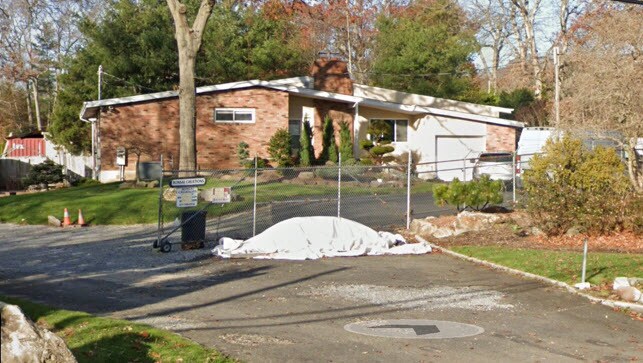
Property Record
539 Deer Park Rd, Dix Hills, NY 11746
NEARBY LISTINGS FOR SALE OR LEASE
Property Detail
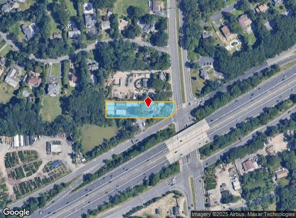
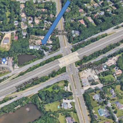
539 Deer Park Rd
Nassau County-Suffolk County, NY
Landview
0400-262-00-01-00-122-000
REFEREES DEED
Horticulturegrowinghousesagricultural
Suffolk
X
New York
36103C0640H
122
2024
0.82 AC
2024
Western Suffolk
112212
Long Island (New York)
DEMOGRAPHICS near 539 Deer Park Rd
1 Mile
3 Mile
5 Mile
2024 Total Population
4,715
57,953
223,526
2029 Population
4,709
57,102
218,448
Pop Growth 2024-2029
(0.13%)
(1.47%)
(2.27%)
Average Age
41
42
41
2024 Total Households
1,387
18,326
67,844
HH Growth 2024-2029
(0.22%)
(1.66%)
(2.44%)
Median Household Inc
$209,986
$146,338
$128,662
Avg Household Size
3.20
3.00
3.10
2024 Avg HH Vehicles
3.00
2.00
2.00
Median Home Value
$811,336
$701,840
$540,259
Median Year Built
1970
1968
1964
Nearby Places
- Restaurants
- Banks
- Shops
- Fitness
- Groceries
PUBLIC TRANSPORTATION
COMMUTER RAIL
Wyandanch Station (Ronkonkoma Branch - Long Island Rail Road)
DRIVE
WALK
Distance
Wyandanch Station (Ronkonkoma Branch - Long Island Rail Road)
7 min
4.7 mi
Deer Park Station (Ronkonkoma Branch - Long Island Rail Road)
DRIVE
WALK
Distance
Deer Park Station (Ronkonkoma Branch - Long Island Rail Road)
11 min
6.2 mi
AIRPORT
Long Island MacArthur
DRIVE
WALK
Distance
Long Island MacArthur
23 min
15.2 mi
John F Kennedy International
DRIVE
WALK
Distance
John F Kennedy International
46 min
32.6 mi
Freight Ports
NY - Red Hook Container Terminal
DRIVE
WALK
Distance
NY - Red Hook Container Terminal
57 min
39.6 mi
SALE & LEASE HISTORY
LISTING DATE
SALE/LEASE

Sep 30, 2021
For Sale
Nearby Properties
Address
Land Use
TOTAL SIZE
Lot Size
Zoning
Address
Land Use
TOTAL SIZE
Lot Size
Zoning
4.81 AC
AAA
Address
Land Use
TOTAL SIZE
Lot Size
Zoning
4.39 AC
AAA
Address
Land Use
TOTAL SIZE
Lot Size
Zoning
117.66 AC
AAA
Address
Land Use
TOTAL SIZE
Lot Size
Zoning
109.45 AC
AAA
Address
Land Use
TOTAL SIZE
Lot Size
Zoning
756 SF
0.36 AC
B1
Address
Land Use
TOTAL SIZE
Lot Size
Zoning
9.20 AC
IND1
Address
Land Use
TOTAL SIZE
Lot Size
Zoning
3.31 AC
R40
Address
Land Use
TOTAL SIZE
Lot Size
Zoning
1.88 AC
AAA
Address
Land Use
TOTAL SIZE
Lot Size
Zoning
9.30 AC
Address
Land Use
TOTAL SIZE
Lot Size
Zoning
10.16 AC
Address
Land Use
TOTAL SIZE
Lot Size
Zoning
7.50 AC
Address
Land Use
TOTAL SIZE
Lot Size
Zoning
7.04 AC
IND1
Address
Land Use
TOTAL SIZE
Lot Size
Zoning
3.63 AC
IND2
Address
Land Use
TOTAL SIZE
Lot Size
Zoning
2,388 SF
0.36 AC
B1
Address
Land Use
TOTAL SIZE
Lot Size
Zoning
82 AC
R40
Address
Land Use
TOTAL SIZE
Lot Size
Zoning
1,680 SF
0.15 AC
B1
Address
Land Use
TOTAL SIZE
Lot Size
Zoning
11.95 AC
AAA
Address
Land Use
TOTAL SIZE
Lot Size
Zoning
0.55 AC
VILLA
Address
Land Use
TOTAL SIZE
Lot Size
Zoning
52.20 AC
R40
Address
Land Use
TOTAL SIZE
Lot Size
Zoning
88,200 SF
11.20 AC
Address
Land Use
TOTAL SIZE
Lot Size
Zoning
1.90 AC
IND2
Address
Land Use
TOTAL SIZE
Lot Size
Zoning
148.70 AC
R40
Address
Land Use
TOTAL SIZE
Lot Size
Zoning
30.30 AC
R40
Address
Land Use
TOTAL SIZE
Lot Size
Zoning
15.20 AC
Address
Land Use
TOTAL SIZE
Lot Size
Zoning
19.77 AC
Address
Land Use
TOTAL SIZE
Lot Size
Zoning
94,566 SF
9.90 AC
E
Address
Land Use
TOTAL SIZE
Lot Size
Zoning
5.77 AC
R40
Address
Land Use
TOTAL SIZE
Lot Size
Zoning
4.80 AC
AAA
Address
Land Use
TOTAL SIZE
Lot Size
Zoning
160 AC
R40
Address
Land Use
TOTAL SIZE
Lot Size
Zoning
117,621 SF
10.10 AC
GA
The World's #1 Commercial Real Estate Marketplace
Connect with us
© 2025 CoStar Group
The information above has been obtained from sources believed reliable. While we do not doubt its accuracy we have not verified it and make no guarantee, warranty or representation about it. It is your responsibility to independently confirm its accuracy and completeness. Any projections, opinions, assumptions, or estimates used are for example only and do not represent the current or future performance of the property. The value of this transaction to you depends on tax and other factors which should be evaluated by your tax, financial, and legal advisors. You and your advisors should conduct a careful, independent investigation of the property to determine to your satisfaction the suitability of the property for your needs.