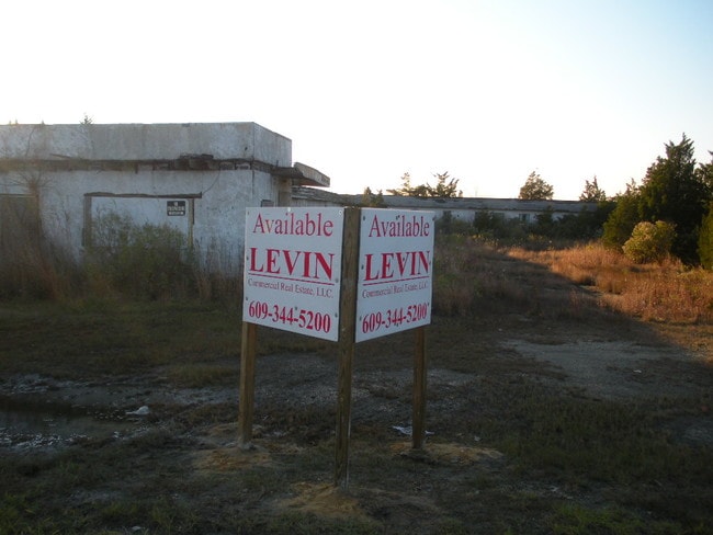
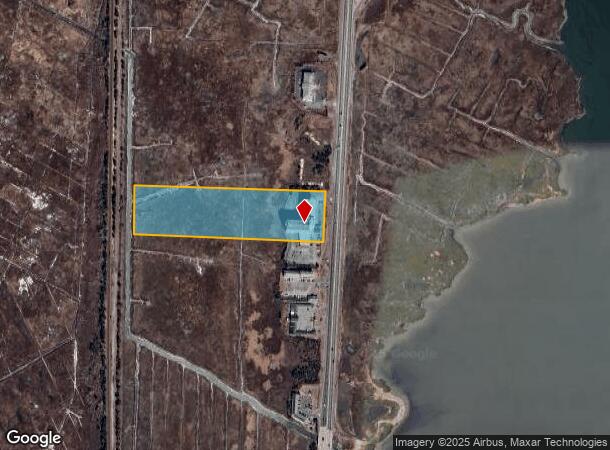
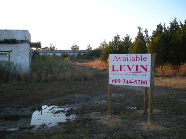
Property Record
539 E Absecon Blvd, Absecon, NJ 08201

NEARBY LISTINGS FOR SALE OR LEASE
Property Detail
539 E Absecon Blvd
Atlantic City-Hammonton, NJ
+ 10
01-00225-0000-00009
Atlantic
Motel
New Jersey
AE
9
34001C0338F
12.90 AC
2024
Atlantic City/Hammonton
2025
Philadelphia
010300
DEMOGRAPHICS near 539 E Absecon Blvd
1 Mile
3 Mile
5 Mile
2024 Total Population
3,288
29,694
109,024
2029 Population
3,176
28,898
108,912
Pop Growth 2024-2029
(3.41%)
(2.68%)
(0.10%)
Average Age
39
39
41
2024 Total Households
1,236
10,424
42,292
HH Growth 2024-2029
(4.13%)
(3.50%)
(0.22%)
Median Household Inc
$44,661
$54,960
$52,645
Avg Household Size
2.60
2.70
2.40
2024 Avg HH Vehicles
2.00
2.00
1.00
Median Home Value
$169,370
$191,962
$229,751
Median Year Built
1965
1968
1966
Nearby Places
Map Layers
Map Styles
 Street
 Aerial
- Restaurants
- Banks
- Shops
- Fitness
- Groceries
PUBLIC TRANSPORTATION
COMMUTER RAIL
Absecon (Atlantic City Line - NJ Transit Commuter Rail (NJ Transit))
DRIVE
WALK
Distance
Absecon (Atlantic City Line - NJ Transit Commuter Rail (NJ Transit))
5 min
2.5 mi
Atlantic City (Atlantic City Line - NJ Transit Commuter Rail (NJ Transit))
DRIVE
WALK
Distance
Atlantic City (Atlantic City Line - NJ Transit Commuter Rail (NJ Transit))
11 min
5.3 mi
AIRPORT
Atlantic City International
DRIVE
WALK
Distance
Atlantic City International
37 min
13.6 mi
Freight Ports
Broadway Terminal - Pier 5
DRIVE
WALK
Distance
Broadway Terminal - Pier 5
69 min
52.9 mi
Nearby Properties
Address
Land Use
TOTAL SIZE
Lot Size
Zoning
Address
Land Use
TOTAL SIZE
Lot Size
Zoning
387,249 SF
49.56 AC
HW-C
Address
Land Use
TOTAL SIZE
Lot Size
Zoning
40.29 AC
IND
Address
Land Use
TOTAL SIZE
Lot Size
Zoning
4,320 SF
0.84 AC
UEZC
Address
Land Use
TOTAL SIZE
Lot Size
Zoning
9,318 SF
1.38 AC
UEZC
Address
Land Use
TOTAL SIZE
Lot Size
Zoning
17,312 SF
14.95 AC
MF
Address
Land Use
TOTAL SIZE
Lot Size
Zoning
5.56 AC
R-50
Address
Land Use
TOTAL SIZE
Lot Size
Zoning
16.27 AC
Address
Land Use
TOTAL SIZE
Lot Size
Zoning
1.95 AC
UEZC
Address
Land Use
TOTAL SIZE
Lot Size
Zoning
7.86 AC
UEZR
Address
Land Use
TOTAL SIZE
Lot Size
Zoning
20.90 AC
RCD
Address
Land Use
TOTAL SIZE
Lot Size
Zoning
Address
Land Use
TOTAL SIZE
Lot Size
Zoning
10,000 SF
1.57 AC
UEZC
Address
Land Use
TOTAL SIZE
Lot Size
Zoning
1.44 AC
UEZR
Address
Land Use
TOTAL SIZE
Lot Size
Zoning
14.09 AC
DC
Address
Land Use
TOTAL SIZE
Lot Size
Zoning
2,541 SF
19.88 AC
UEZC
Address
Land Use
TOTAL SIZE
Lot Size
Zoning
2,740 SF
0.89 AC
UEZC
Address
Land Use
TOTAL SIZE
Lot Size
Zoning
2.85 AC
R-50
Address
Land Use
TOTAL SIZE
Lot Size
Zoning
1,796 SF
11.10 AC
MF
Address
Land Use
TOTAL SIZE
Lot Size
Zoning
Address
Land Use
TOTAL SIZE
Lot Size
Zoning
1.64 AC
UEZC
Address
Land Use
TOTAL SIZE
Lot Size
Zoning
29.20 AC
Address
Land Use
TOTAL SIZE
Lot Size
Zoning
7.16 AC
Address
Land Use
TOTAL SIZE
Lot Size
Zoning
13.43 AC
UEZC
Address
Land Use
TOTAL SIZE
Lot Size
Zoning
136,378 SF
17.41 AC
HW-C
Address
Land Use
TOTAL SIZE
Lot Size
Zoning
1,530 SF
316.44 AC
HW-C
Address
Land Use
TOTAL SIZE
Lot Size
Zoning
16,960 SF
9.15 AC
MF
Address
Land Use
TOTAL SIZE
Lot Size
Zoning
5,991 SF
2.31 AC
UEZC
Address
Land Use
TOTAL SIZE
Lot Size
Zoning
Address
Land Use
TOTAL SIZE
Lot Size
Zoning
2.80 AC
UEZW
Address
Land Use
TOTAL SIZE
Lot Size
Zoning
7.01 AC
RCD
The World's #1 Commercial Real Estate Marketplace
Connect with us
© 2025 CoStar Group
The information above has been obtained from sources believed reliable. While we do not doubt its accuracy we have not verified it and make no guarantee, warranty or representation about it. It is your responsibility to independently confirm its accuracy and completeness. Any projections, opinions, assumptions, or estimates used are for example only and do not represent the current or future performance of the property. The value of this transaction to you depends on tax and other factors which should be evaluated by your tax, financial, and legal advisors. You and your advisors should conduct a careful, independent investigation of the property to determine to your satisfaction the suitability of the property for your needs.