Property Record
539 E Main St, Cartersville, GA 30121
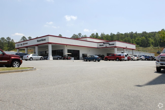
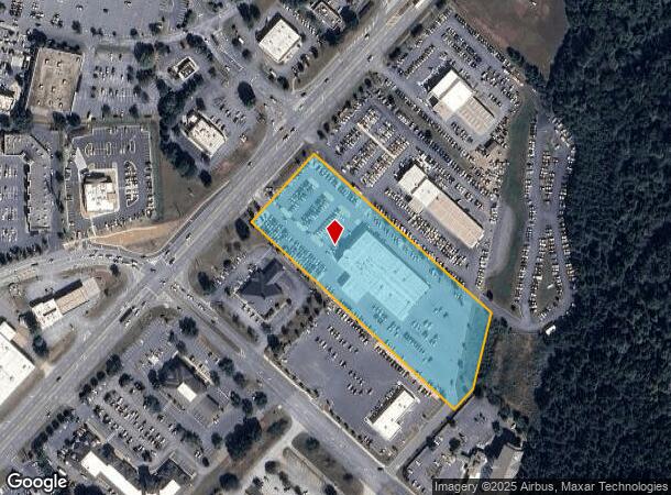
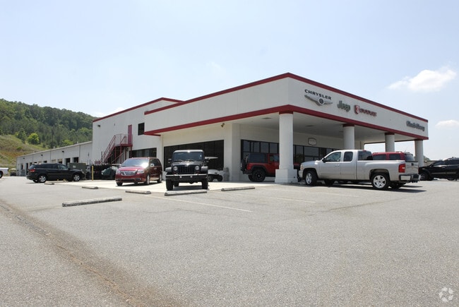
Property Detail
539 E Main St
C005-0004-001
LL407 458 LD4 PLAT 62-207
Commercialnec
BARTOW
IN
Georgia
B and X Area of moderate flood hazard, usually the area between the limits of the 100-year and 500-year floods.
407
2025
4.89 AC
2025
Bartow/Cartersville
960702
Atlanta
35,484 SF
Atlanta-Sandy Springs-Roswell, GA
NEARBY LISTINGS FOR SALE OR LEASE
DEMOGRAPHICS near 539 E Main St
1 mile
3 mile
5 mile
2024 Total Population
4,714
28,320
50,218
2029 Population
5,041
30,186
53,667
Pop Growth 2024-2029
+ 6.94%
+ 6.59%
+ 6.87%
Average Age
38
40
40
2024 Total Households
1,765
10,762
19,208
HH Growth 2024-2029
+ 6.86%
+ 6.62%
+ 6.91%
Median Household Inc
$69,973
$80,151
$80,335
Avg Household Size
2.50
2.50
2.50
2024 Avg HH Vehicles
2.00
2.00
2.00
Median Home Value
$329,136
$311,079
$316,403
Median Year Built
1976
1991
1993
Nearby Places
Map Layers
Map Styles
 Street
 Aerial
Transit
 Traffic
 Biking
Places
Listings with unknown addresses are not visible on the map
- Restaurants
- Banks
- Shops
- Fitness
- Groceries
Nearby Properties
Address
Land Use
TOTAL SIZE
Lot Size
Zoning
Address
Land Use
TOTAL SIZE
Lot Size
Zoning
1,200 SF
25.69 AC
IN
Address
Land Use
TOTAL SIZE
Lot Size
Zoning
141,651 SF
181.89 AC
I1
Address
Land Use
TOTAL SIZE
Lot Size
Zoning
175,810 SF
53.35 AC
Address
Land Use
TOTAL SIZE
Lot Size
Zoning
67,428 SF
36.96 AC
Address
Land Use
TOTAL SIZE
Lot Size
Zoning
127,175 SF
55.52 AC
Address
Land Use
TOTAL SIZE
Lot Size
Zoning
7,488 SF
38.49 AC
IN
Address
Land Use
TOTAL SIZE
Lot Size
Zoning
194,306 SF
126.40 AC
A1
Address
Land Use
TOTAL SIZE
Lot Size
Zoning
90,497 SF
24.36 AC
Address
Land Use
TOTAL SIZE
Lot Size
Zoning
104,757 SF
45 AC
IN
Address
Land Use
TOTAL SIZE
Lot Size
Zoning
Address
Land Use
TOTAL SIZE
Lot Size
Zoning
134,528 SF
4.71 AC
IN
Address
Land Use
TOTAL SIZE
Lot Size
Zoning
250,701 SF
15.17 AC
C1
Address
Land Use
TOTAL SIZE
Lot Size
Zoning
Address
Land Use
TOTAL SIZE
Lot Size
Zoning
342,088 SF
49.67 AC
Address
Land Use
TOTAL SIZE
Lot Size
Zoning
33,096 SF
15.80 AC
Address
Land Use
TOTAL SIZE
Lot Size
Zoning
Address
Land Use
TOTAL SIZE
Lot Size
Zoning
51,681 SF
16 AC
Address
Land Use
TOTAL SIZE
Lot Size
Zoning
122,352 SF
26.48 AC
IN
Address
Land Use
TOTAL SIZE
Lot Size
Zoning
313,245 SF
30.15 AC
Address
Land Use
TOTAL SIZE
Lot Size
Zoning
194,368 SF
25.02 AC
IN
Address
Land Use
TOTAL SIZE
Lot Size
Zoning
84,852 SF
6.78 AC
A1
Address
Land Use
TOTAL SIZE
Lot Size
Zoning
91,110 SF
17.09 AC
Address
Land Use
TOTAL SIZE
Lot Size
Zoning
21,465 SF
17.30 AC
IN
Address
Land Use
TOTAL SIZE
Lot Size
Zoning
151,571 SF
25.82 AC
Address
Land Use
TOTAL SIZE
Lot Size
Zoning
13.86 AC
IN
Address
Land Use
TOTAL SIZE
Lot Size
Zoning
88,974 SF
5.42 AC
IN
Address
Land Use
TOTAL SIZE
Lot Size
Zoning
211,821 SF
20.32 AC
Address
Land Use
TOTAL SIZE
Lot Size
Zoning
8,064 SF
36.63 AC
IN
Address
Land Use
TOTAL SIZE
Lot Size
Zoning
123,522 SF
12.52 AC
Address
Land Use
TOTAL SIZE
Lot Size
Zoning
20.79 AC
RESIDENTIA
The World's #1 Commercial Real Estate Marketplace
Connect with us
© 2026 CoStar Group
The information above has been obtained from sources believed reliable. While we do not doubt its accuracy we have not verified it and make no guarantee, warranty or representation about it. It is your responsibility to independently confirm its accuracy and completeness. Any projections, opinions, assumptions, or estimates used are for example only and do not represent the current or future performance of the property. The value of this transaction to you depends on tax and other factors which should be evaluated by your tax, financial, and legal advisors. You and your advisors should conduct a careful, independent investigation of the property to determine to your satisfaction the suitability of the property for your needs.