Property Record
539 Gentry Memorial Hwy, Easley, SC 29640
NEARBY LISTINGS FOR SALE OR LEASE
-
-
View all Easley listings for sale on LoopNet.com
Property Detail
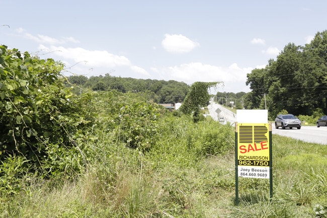
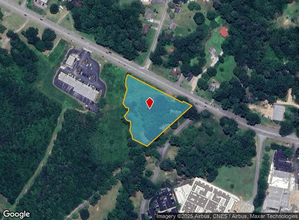
539 Gentry Memorial Hwy
Greenville-Anderson-Mauldin, SC
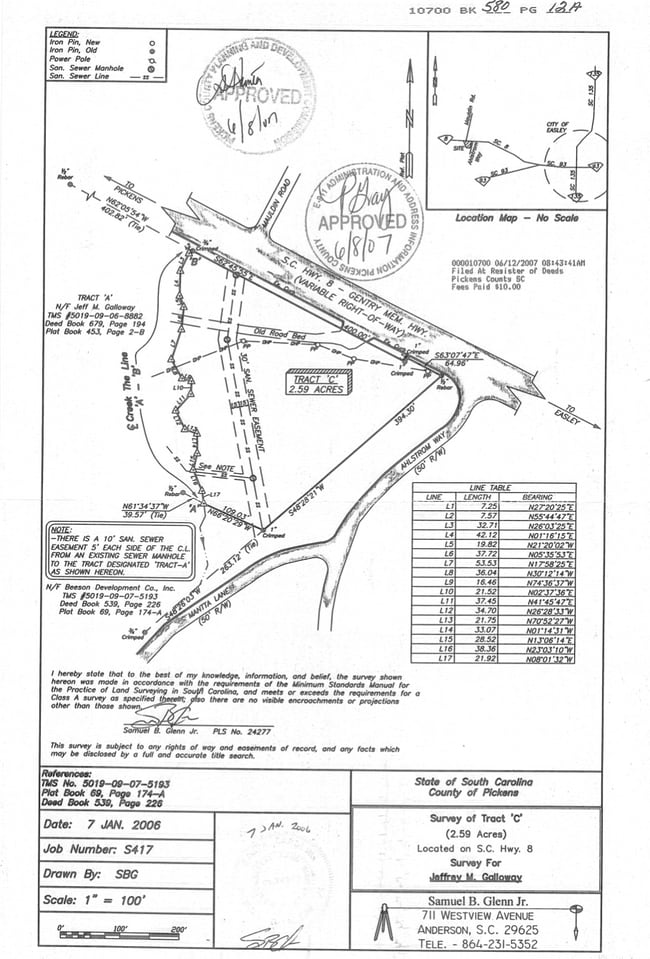
Survey For Jeffrey M Galloway
5019-09-16-2695
S/SIDE GENTRY MEM HWY TR-C PLAT 543/14B PLAT 580/12A PLAT 620/25
Vacantlandnec
Pickens
X
South Carolina
45007C0025E
2.57 AC
2025
Outlying Pickens County
2024
Greenville/Spartanburg
010806
DEMOGRAPHICS near 539 Gentry Memorial Hwy
1 Mile
3 Mile
5 Mile
2024 Total Population
3,299
23,913
47,356
2029 Population
3,476
25,178
49,676
Pop Growth 2024-2029
+ 5.37%
+ 5.29%
+ 4.90%
Average Age
40
40
41
2024 Total Households
1,327
9,878
19,261
HH Growth 2024-2029
+ 5.50%
+ 5.44%
+ 4.99%
Median Household Inc
$44,898
$44,322
$51,560
Avg Household Size
2.40
2.40
2.40
2024 Avg HH Vehicles
2.00
2.00
2.00
Median Home Value
$127,763
$153,169
$170,206
Median Year Built
1972
1981
1985
Nearby Places
Map Layers
Map Styles
 Street
 Aerial
- Restaurants
- Banks
- Shops
- Fitness
- Groceries
PUBLIC TRANSPORTATION
AIRPORT
Greenville Spartanburg International
DRIVE
WALK
Distance
Greenville Spartanburg International
45 min
30.0 mi
SALE & LEASE HISTORY
LISTING DATE
SALE/LEASE

Oct 28, 2022
For Sale
Jan 27, 2017
For Sale
Aug 17, 2018
For Sale
Nearby Properties
Address
Land Use
TOTAL SIZE
Lot Size
Zoning
Address
Land Use
TOTAL SIZE
Lot Size
Zoning
2,291 SF
6.44 AC
GR2
Address
Land Use
TOTAL SIZE
Lot Size
Zoning
81,245 SF
8.49 AC
GC
Address
Land Use
TOTAL SIZE
Lot Size
Zoning
44,601 SF
3 AC
Address
Land Use
TOTAL SIZE
Lot Size
Zoning
10,906 SF
2.59 AC
CORE COMME
Address
Land Use
TOTAL SIZE
Lot Size
Zoning
21.71 AC
GR2
Address
Land Use
TOTAL SIZE
Lot Size
Zoning
3,344 SF
3.04 AC
GR2
Address
Land Use
TOTAL SIZE
Lot Size
Zoning
9,800 SF
5.94 AC
R10
Address
Land Use
TOTAL SIZE
Lot Size
Zoning
3.60 AC
CORE COMME
Address
Land Use
TOTAL SIZE
Lot Size
Zoning
30,000 SF
3.30 AC
Address
Land Use
TOTAL SIZE
Lot Size
Zoning
220,956 SF
16.80 AC
GENERAL CO
Address
Land Use
TOTAL SIZE
Lot Size
Zoning
20,406 SF
1.26 AC
CORE COMME
Address
Land Use
TOTAL SIZE
Lot Size
Zoning
27,700 SF
12.91 AC
Address
Land Use
TOTAL SIZE
Lot Size
Zoning
39,480 SF
3.26 AC
Address
Land Use
TOTAL SIZE
Lot Size
Zoning
4,829 SF
2 AC
Address
Land Use
TOTAL SIZE
Lot Size
Zoning
180.03 AC
Address
Land Use
TOTAL SIZE
Lot Size
Zoning
4,450 SF
1.28 AC
MED MEDICA
Address
Land Use
TOTAL SIZE
Lot Size
Zoning
27.43 AC
R 10 ONE F
Address
Land Use
TOTAL SIZE
Lot Size
Zoning
7.09 AC
GC
Address
Land Use
TOTAL SIZE
Lot Size
Zoning
2,679 SF
0.58 AC
Address
Land Use
TOTAL SIZE
Lot Size
Zoning
19.43 AC
Address
Land Use
TOTAL SIZE
Lot Size
Zoning
922 SF
14.30 AC
Address
Land Use
TOTAL SIZE
Lot Size
Zoning
104,889 SF
10.68 AC
GC
Address
Land Use
TOTAL SIZE
Lot Size
Zoning
5,508 SF
4.78 AC
Address
Land Use
TOTAL SIZE
Lot Size
Zoning
3,299 SF
0.32 AC
GENERAL CO
Address
Land Use
TOTAL SIZE
Lot Size
Zoning
1,436 SF
1.62 AC
OC OFFICE
Address
Land Use
TOTAL SIZE
Lot Size
Zoning
4,267 SF
0.77 AC
R 10 ONE F
Address
Land Use
TOTAL SIZE
Lot Size
Zoning
9.07 AC
R 10 ONE F
Address
Land Use
TOTAL SIZE
Lot Size
Zoning
3,250 SF
0.07 AC
GENERAL RE
Address
Land Use
TOTAL SIZE
Lot Size
Zoning
114.97 AC
Address
Land Use
TOTAL SIZE
Lot Size
Zoning
5,000 SF
0.12 AC
CORE COMME
The World's #1 Commercial Real Estate Marketplace
Connect with us
© 2025 CoStar Group
The information above has been obtained from sources believed reliable. While we do not doubt its accuracy we have not verified it and make no guarantee, warranty or representation about it. It is your responsibility to independently confirm its accuracy and completeness. Any projections, opinions, assumptions, or estimates used are for example only and do not represent the current or future performance of the property. The value of this transaction to you depends on tax and other factors which should be evaluated by your tax, financial, and legal advisors. You and your advisors should conduct a careful, independent investigation of the property to determine to your satisfaction the suitability of the property for your needs.