Property Record
539 N Main St, Rocky Top, TN 37769
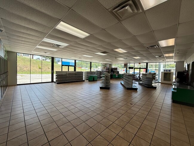
This Property Is For Sale
NEARBY LISTINGS FOR SALE OR LEASE
-
-
View all Rocky Top listings for sale on LoopNet.com
Property Detail
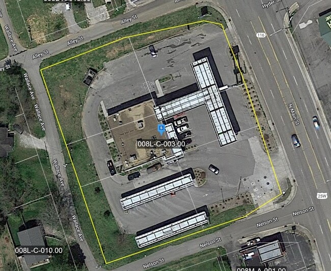
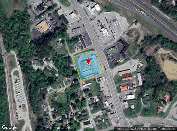
539 N Main St
Knoxville, TN
North Coal Creek
008L-C-003.00
NORTH COAL CREEK PB: 1&2 PG: 13 LOT: 22 107X125 IRR.
Commercialnec
Anderson
X
Tennessee
47013C0400C
22
2024
1.53 AC
2025
Anderson County
020800
Knoxville
5,182 SF
DEMOGRAPHICS near 539 N Main St
1 Mile
3 Mile
5 Mile
2024 Total Population
1,366
5,753
10,346
2029 Population
1,427
5,984
10,747
Pop Growth 2024-2029
+ 4.47%
+ 4.02%
+ 3.88%
Average Age
42
42
42
2024 Total Households
575
2,390
4,243
HH Growth 2024-2029
+ 4.52%
+ 4.02%
+ 3.89%
Median Household Inc
$50,072
$48,097
$52,689
Avg Household Size
2.40
2.40
2.40
2024 Avg HH Vehicles
2.00
2.00
2.00
Median Home Value
$278,378
$198,999
$196,614
Median Year Built
1973
1979
1983
Nearby Places
- Restaurants
- Banks
- Shops
- Fitness
- Groceries
PUBLIC TRANSPORTATION
AIRPORT
McGhee Tyson
DRIVE
WALK
Distance
McGhee Tyson
61 min
40.1 mi
Nearby Properties
Address
Land Use
TOTAL SIZE
Lot Size
Zoning
Address
Land Use
TOTAL SIZE
Lot Size
Zoning
82,336 SF
7.20 AC
Address
Land Use
TOTAL SIZE
Lot Size
Zoning
63,879 SF
23.20 AC
Address
Land Use
TOTAL SIZE
Lot Size
Zoning
39,426 SF
2.93 AC
Address
Land Use
TOTAL SIZE
Lot Size
Zoning
62,476 SF
15.85 AC
Address
Land Use
TOTAL SIZE
Lot Size
Zoning
200,618 SF
13.30 AC
Address
Land Use
TOTAL SIZE
Lot Size
Zoning
11,680 SF
2.06 AC
Address
Land Use
TOTAL SIZE
Lot Size
Zoning
33,819 SF
7.22 AC
Address
Land Use
TOTAL SIZE
Lot Size
Zoning
Address
Land Use
TOTAL SIZE
Lot Size
Zoning
20,720 SF
2.20 AC
Address
Land Use
TOTAL SIZE
Lot Size
Zoning
5,184 SF
2.45 AC
Address
Land Use
TOTAL SIZE
Lot Size
Zoning
11,464 SF
3 AC
Address
Land Use
TOTAL SIZE
Lot Size
Zoning
9,660 SF
3.33 AC
Address
Land Use
TOTAL SIZE
Lot Size
Zoning
15,230 SF
0.55 AC
Address
Land Use
TOTAL SIZE
Lot Size
Zoning
21,620 SF
1.87 AC
Address
Land Use
TOTAL SIZE
Lot Size
Zoning
4,502 SF
6.10 AC
Address
Land Use
TOTAL SIZE
Lot Size
Zoning
4,386 SF
1.30 AC
Address
Land Use
TOTAL SIZE
Lot Size
Zoning
4,978 SF
1.36 AC
Address
Land Use
TOTAL SIZE
Lot Size
Zoning
4,326 SF
1.90 AC
Address
Land Use
TOTAL SIZE
Lot Size
Zoning
4,608 SF
0.98 AC
Address
Land Use
TOTAL SIZE
Lot Size
Zoning
3,726 SF
0.71 AC
Address
Land Use
TOTAL SIZE
Lot Size
Zoning
8,618 SF
0.76 AC
Address
Land Use
TOTAL SIZE
Lot Size
Zoning
13,276 SF
0.92 AC
Address
Land Use
TOTAL SIZE
Lot Size
Zoning
9,020 SF
0.93 AC
Address
Land Use
TOTAL SIZE
Lot Size
Zoning
Address
Land Use
TOTAL SIZE
Lot Size
Zoning
6,867 SF
4.22 AC
Address
Land Use
TOTAL SIZE
Lot Size
Zoning
2,237 SF
4 AC
Address
Land Use
TOTAL SIZE
Lot Size
Zoning
4,576 SF
0.63 AC
Address
Land Use
TOTAL SIZE
Lot Size
Zoning
3,668 SF
0.85 AC
Address
Land Use
TOTAL SIZE
Lot Size
Zoning
9,000 SF
0.33 AC
The World's #1 Commercial Real Estate Marketplace
Connect with us
© 2025 CoStar Group
The information above has been obtained from sources believed reliable. While we do not doubt its accuracy we have not verified it and make no guarantee, warranty or representation about it. It is your responsibility to independently confirm its accuracy and completeness. Any projections, opinions, assumptions, or estimates used are for example only and do not represent the current or future performance of the property. The value of this transaction to you depends on tax and other factors which should be evaluated by your tax, financial, and legal advisors. You and your advisors should conduct a careful, independent investigation of the property to determine to your satisfaction the suitability of the property for your needs.