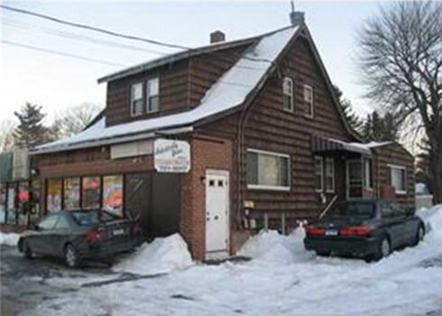
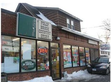
Property Record
539 Nott St, Wethersfield, CT 06109

Property Detail
539 Nott St
Commercialofficeresidentialmixeduse
HARTFORD
B
Connecticut
B and X Area of moderate flood hazard, usually the area between the limits of the 100-year and 500-year floods.
0.35 AC
2025
Wethersfield
2025
Hartford
492400
Hartford-West Hartford-East Hartford, CT
2,633 SF
H02720
NEARBY LISTINGS FOR SALE OR LEASE
DEMOGRAPHICS near 539 Nott St
1 mile
3 mile
5 mile
2025 Total Population
10,208
94,438
259,548
2030 Population
10,349
95,389
263,967
Pop Growth 2025-2030
+ 1.38%
+ 1.01%
+ 1.70%
Average Age
42
40
40
2025 Total Households
4,290
36,567
107,538
HH Growth 2025-2030
+ 1.33%
+ 1.06%
+ 1.85%
Median Household Inc
$103,888
$75,141
$74,363
Avg Household Size
2.30
2.40
2.30
2025 Avg HH Vehicles
2.00
2.00
1.00
Median Home Value
$280,013
$285,810
$304,633
Median Year Built
1956
1954
1958
Nearby Places
Map Layers
Map Styles
 Street
 Aerial
Transit
 Traffic
 Biking
Places
Listings with unknown addresses are not visible on the map
- Restaurants
- Banks
- Shops
- Fitness
- Groceries
PUBLIC TRANSPORTATION
COMMUTER RAIL
Drive
Walk
Distance
10 min
4.6 mi
Drive
Walk
Distance
10 min
4.6 mi
AIRPORT
Bradley International
Drive
Walk
Distance
Bradley International
39 min
21.6 mi
Tweed/New Haven
Drive
Walk
Distance
Tweed/New Haven
51 min
36.4 mi
Freight Ports
Port of New Haven
Drive
Walk
Distance
Port of New Haven
46 min
34.1 mi
Nearby Properties
Address
Land Use
TOTAL SIZE
Lot Size
Zoning
Address
Land Use
TOTAL SIZE
Lot Size
Zoning
147,644 SF
0.19 AC
CAMP
Address
Land Use
TOTAL SIZE
Lot Size
Zoning
516,804 SF
32.98 AC
CAMP
Address
Land Use
TOTAL SIZE
Lot Size
Zoning
15.73 AC
CAMP
Address
Land Use
TOTAL SIZE
Lot Size
Zoning
69.42 AC
CT R
Address
Land Use
TOTAL SIZE
Lot Size
Zoning
261,072 SF
44.47 AC
PL
Address
Land Use
TOTAL SIZE
Lot Size
Zoning
20.41 AC
MX-2
Address
Land Use
TOTAL SIZE
Lot Size
Zoning
235,476 SF
198.32 AC
CT R
Address
Land Use
TOTAL SIZE
Lot Size
Zoning
254,786 SF
36 AC
A
Address
Land Use
TOTAL SIZE
Lot Size
Zoning
223,885 SF
43.33 AC
CAMP
Address
Land Use
TOTAL SIZE
Lot Size
Zoning
3,416 SF
19.31 AC
SRD
Address
Land Use
TOTAL SIZE
Lot Size
Zoning
86,600 SF
20.05 AC
R-6
Address
Land Use
TOTAL SIZE
Lot Size
Zoning
3.46 AC
CAMP
Address
Land Use
TOTAL SIZE
Lot Size
Zoning
225,477 SF
1.36 AC
CAMP
Address
Land Use
TOTAL SIZE
Lot Size
Zoning
126.75 AC
OS
Address
Land Use
TOTAL SIZE
Lot Size
Zoning
29.48 AC
MX-2
Address
Land Use
TOTAL SIZE
Lot Size
Zoning
171,729 SF
80.59 AC
R-12/
Address
Land Use
TOTAL SIZE
Lot Size
Zoning
116,979 SF
17 AC
B
Address
Land Use
TOTAL SIZE
Lot Size
Zoning
128,043 SF
1.15 AC
CAMP
Address
Land Use
TOTAL SIZE
Lot Size
Zoning
3.21 AC
MX-2
Address
Land Use
TOTAL SIZE
Lot Size
Zoning
111,532 SF
12.50 AC
R-12
Address
Land Use
TOTAL SIZE
Lot Size
Zoning
188,427 SF
8.55 AC
SRD
Address
Land Use
TOTAL SIZE
Lot Size
Zoning
141,200 SF
5.56 AC
MX-2
Address
Land Use
TOTAL SIZE
Lot Size
Zoning
129,065 SF
4.63 AC
MX-2
Address
Land Use
TOTAL SIZE
Lot Size
Zoning
68,967 SF
11.25 AC
O
Address
Land Use
TOTAL SIZE
Lot Size
Zoning
2.98 AC
CAMP
Address
Land Use
TOTAL SIZE
Lot Size
Zoning
Address
Land Use
TOTAL SIZE
Lot Size
Zoning
53.52 AC
PL
Address
Land Use
TOTAL SIZE
Lot Size
Zoning
622,262 SF
47.95 AC
I
Address
Land Use
TOTAL SIZE
Lot Size
Zoning
33.19 AC
ID-1
Address
Land Use
TOTAL SIZE
Lot Size
Zoning
13.61 AC
RC
The World's #1 Commercial Real Estate Marketplace
Connect with us
© 2026 CoStar Group
The information above has been obtained from sources believed reliable. While we do not doubt its accuracy we have not verified it and make no guarantee, warranty or representation about it. It is your responsibility to independently confirm its accuracy and completeness. Any projections, opinions, assumptions, or estimates used are for example only and do not represent the current or future performance of the property. The value of this transaction to you depends on tax and other factors which should be evaluated by your tax, financial, and legal advisors. You and your advisors should conduct a careful, independent investigation of the property to determine to your satisfaction the suitability of the property for your needs.