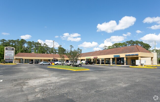
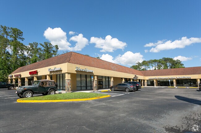
Property Record
5393 Roosevelt Blvd, Jacksonville, FL 32210


NEARBY LISTINGS FOR SALE OR LEASE
Property Detail
5393 Roosevelt Blvd
102725-0020
Ortega Cos R/P Pt Ortega
Regionalshoppingcenterormallwithanchorstore
15-63 42-3S-26E 2.081 ORTEGA COS R/P PT TRACT 1 RECD O/R 17402-2175
X
Duval
12031C0364J
Florida
2024
1.79 AC
2025
Riverside
013100
Jacksonville (Florida)
28,517 SF
Jacksonville, FL
DEMOGRAPHICS near 5393 Roosevelt Blvd
1 Mile
3 Mile
5 Mile
2024 Total Population
4,843
34,440
165,239
2029 Population
5,066
36,116
174,337
Pop Growth 2024-2029
+ 4.60%
+ 4.87%
+ 5.51%
Average Age
41
40
39
2024 Total Households
2,002
14,501
69,403
HH Growth 2024-2029
+ 4.80%
+ 5.03%
+ 5.71%
Median Household Inc
$96,894
$61,045
$52,282
Avg Household Size
2.40
2.30
2.30
2024 Avg HH Vehicles
2.00
2.00
2.00
Median Home Value
$419,427
$260,201
$220,060
Median Year Built
1959
1966
1971
Nearby Places
Map Layers
Map Styles
 Street
 Aerial
- Restaurants
- Banks
- Shops
- Fitness
- Groceries
PUBLIC TRANSPORTATION
AIRPORT
Jacksonville International
DRIVE
WALK
Distance
Jacksonville International
35 min
22.2 mi
Freight Ports
Jacksonville Port
DRIVE
WALK
Distance
Jacksonville Port
22 min
12.6 mi
SALE & LEASE HISTORY
LISTING DATE
SALE/LEASE

Feb 06, 2020
For Lease
Nearby Properties
Address
Land Use
TOTAL SIZE
Lot Size
Zoning
Address
Land Use
TOTAL SIZE
Lot Size
Zoning
810,000 SF
3,511.12 AC
PBF-1
Address
Land Use
TOTAL SIZE
Lot Size
Zoning
184,092 SF
21.69 AC
CCG-1
Address
Land Use
TOTAL SIZE
Lot Size
Zoning
147,066 SF
3.30 AC
PUD
Address
Land Use
TOTAL SIZE
Lot Size
Zoning
416,674 SF
18.38 AC
RMD-D
Address
Land Use
TOTAL SIZE
Lot Size
Zoning
309,461 SF
20.09 AC
RMD-D
Address
Land Use
TOTAL SIZE
Lot Size
Zoning
203,724 SF
14.71 AC
RMD-D
Address
Land Use
TOTAL SIZE
Lot Size
Zoning
220,288 SF
13.51 AC
RMD-D
Address
Land Use
TOTAL SIZE
Lot Size
Zoning
277,225 SF
11.72 AC
RMD-D
Address
Land Use
TOTAL SIZE
Lot Size
Zoning
32,663 SF
2.56 AC
PUD
Address
Land Use
TOTAL SIZE
Lot Size
Zoning
230,837 SF
10.94 AC
RMD-D
Address
Land Use
TOTAL SIZE
Lot Size
Zoning
152,768 SF
9.66 AC
RMD-D
Address
Land Use
TOTAL SIZE
Lot Size
Zoning
159,337 SF
11.09 AC
RMD-D
Address
Land Use
TOTAL SIZE
Lot Size
Zoning
169,084 SF
13 AC
CCG-1
Address
Land Use
TOTAL SIZE
Lot Size
Zoning
187,612 SF
20.16 AC
PUD
Address
Land Use
TOTAL SIZE
Lot Size
Zoning
57,762 SF
11.90 AC
CCG-2
Address
Land Use
TOTAL SIZE
Lot Size
Zoning
85,238 SF
3.90 AC
CCG-2
Address
Land Use
TOTAL SIZE
Lot Size
Zoning
107,045 SF
9 AC
RMD-D
Address
Land Use
TOTAL SIZE
Lot Size
Zoning
29,263 SF
1.94 AC
CCG-1
Address
Land Use
TOTAL SIZE
Lot Size
Zoning
141,403 SF
11.36 AC
PUD
Address
Land Use
TOTAL SIZE
Lot Size
Zoning
112,361 SF
11.23 AC
CCG-1
Address
Land Use
TOTAL SIZE
Lot Size
Zoning
4,890 SF
0.66 AC
PUD
Address
Land Use
TOTAL SIZE
Lot Size
Zoning
70,460 SF
1.66 AC
CCG-2
Address
Land Use
TOTAL SIZE
Lot Size
Zoning
69,274 SF
3.74 AC
CCG-1
Address
Land Use
TOTAL SIZE
Lot Size
Zoning
119,755 SF
14.77 AC
PUD
Address
Land Use
TOTAL SIZE
Lot Size
Zoning
135,421 SF
9.35 AC
CCG-1
Address
Land Use
TOTAL SIZE
Lot Size
Zoning
12.05 AC
RLD-90
Address
Land Use
TOTAL SIZE
Lot Size
Zoning
100,238 SF
9.68 AC
RMD-D
Address
Land Use
TOTAL SIZE
Lot Size
Zoning
76,110 SF
5.22 AC
PUD
Address
Land Use
TOTAL SIZE
Lot Size
Zoning
78,415 SF
5.65 AC
RMD-D
Address
Land Use
TOTAL SIZE
Lot Size
Zoning
72,134 SF
286.79 AC
RLD-100A
The World's #1 Commercial Real Estate Marketplace
Connect with us
© 2025 CoStar Group
The information above has been obtained from sources believed reliable. While we do not doubt its accuracy we have not verified it and make no guarantee, warranty or representation about it. It is your responsibility to independently confirm its accuracy and completeness. Any projections, opinions, assumptions, or estimates used are for example only and do not represent the current or future performance of the property. The value of this transaction to you depends on tax and other factors which should be evaluated by your tax, financial, and legal advisors. You and your advisors should conduct a careful, independent investigation of the property to determine to your satisfaction the suitability of the property for your needs.