Property Record
540 7Th Ave, Longview, WA 98632
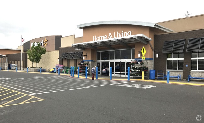


Property Detail
540 7Th Ave
1-0086
819 (LONGVIEW OUTLOT) -LVOL -12A-2, 47A, 4 -7N -2W BSP01059 FKA LVOL 12A-2,47A,70D,70E-1,70F-2,72A INCL LVOL 70F-2 FEE 3373115EXC LVOL 70D-1,70E-1A,72A-1 FEE 3379521EXC LOT 3 FEE 3431071.
Storebuilding
Cowlitz
M01
Washington
A Areas with a 1% annual chance of flooding and a 26% chance of flooding over the life of a 30-year mortgage.
12a-2
2025
20.68 AC
2024
Cowlitz County
980000
Portland
160,069 SF
Longview-Kelso, WA
NEARBY LISTINGS FOR SALE OR LEASE
DEMOGRAPHICS near 540 7Th Ave
1 mile
3 mile
5 mile
2025 Total Population
3,794
42,189
67,172
2030 Population
3,903
42,896
68,419
Pop Growth 2025-2030
+ 2.87%
+ 1.68%
+ 1.86%
Average Age
39
41
41
2025 Total Households
1,558
17,193
26,671
HH Growth 2025-2030
+ 3.15%
+ 1.83%
+ 1.95%
Median Household Inc
$42,880
$59,932
$67,041
Avg Household Size
2.30
2.40
2.40
2025 Avg HH Vehicles
2.00
2.00
2.00
Median Home Value
$217,063
$348,260
$375,488
Median Year Built
1966
1960
1967
Nearby Places
Map Layers
Map Styles
 Street
 Aerial
Layers
 Traffic
 Biking
Places
Listings with unknown addresses are not visible on the map
- Restaurants
- Banks
- Shops
- Fitness
- Groceries
PUBLIC TRANSPORTATION
COMMUTER RAIL
Drive
Walk
Distance
8 min
2.8 mi
Freight Ports
Port of Long View, WA
Drive
Walk
Distance
Port of Long View, WA
6 min
2.1 mi
Nearby Properties
Address
Land Use
TOTAL SIZE
Lot Size
Zoning
Address
Land Use
TOTAL SIZE
Lot Size
Zoning
93.25 AC
MH0
Address
Land Use
TOTAL SIZE
Lot Size
Zoning
285.30 AC
MH0
Address
Land Use
TOTAL SIZE
Lot Size
Zoning
84.34 AC
MH0
Address
Land Use
TOTAL SIZE
Lot Size
Zoning
128.42 AC
Address
Land Use
TOTAL SIZE
Lot Size
Zoning
83,033 SF
27.78 AC
R01
Address
Land Use
TOTAL SIZE
Lot Size
Zoning
40.70 AC
MH0
Address
Land Use
TOTAL SIZE
Lot Size
Zoning
13.29 AC
Address
Land Use
TOTAL SIZE
Lot Size
Zoning
Address
Land Use
TOTAL SIZE
Lot Size
Zoning
23.75 AC
M02
Address
Land Use
TOTAL SIZE
Lot Size
Zoning
9,600 SF
26.83 AC
MH0
Address
Land Use
TOTAL SIZE
Lot Size
Zoning
92.77 AC
I02
Address
Land Use
TOTAL SIZE
Lot Size
Zoning
40.41 AC
R02
Address
Land Use
TOTAL SIZE
Lot Size
Zoning
179.05 AC
Address
Land Use
TOTAL SIZE
Lot Size
Zoning
81.40 AC
RN:M-1
Address
Land Use
TOTAL SIZE
Lot Size
Zoning
10.12 AC
I01
Address
Land Use
TOTAL SIZE
Lot Size
Zoning
139,660 SF
2.76 AC
Address
Land Use
TOTAL SIZE
Lot Size
Zoning
206,926 SF
4.80 AC
C02
Address
Land Use
TOTAL SIZE
Lot Size
Zoning
1 SF
76.14 AC
MH0
Address
Land Use
TOTAL SIZE
Lot Size
Zoning
28.39 AC
M02
Address
Land Use
TOTAL SIZE
Lot Size
Zoning
1 SF
88.15 AC
M01
Address
Land Use
TOTAL SIZE
Lot Size
Zoning
25.82 AC
Address
Land Use
TOTAL SIZE
Lot Size
Zoning
106.19 AC
M01
Address
Land Use
TOTAL SIZE
Lot Size
Zoning
48,368 SF
6.32 AC
RF1
Address
Land Use
TOTAL SIZE
Lot Size
Zoning
8.20 AC
C03
Address
Land Use
TOTAL SIZE
Lot Size
Zoning
1 SF
34.61 AC
Address
Land Use
TOTAL SIZE
Lot Size
Zoning
138,715 SF
7.43 AC
C04
Address
Land Use
TOTAL SIZE
Lot Size
Zoning
157,970 SF
12.36 AC
R01
Address
Land Use
TOTAL SIZE
Lot Size
Zoning
1 SF
43.48 AC
MH0
The World's #1 Commercial Real Estate Marketplace
Connect with us
© 2026 CoStar Group
The information above has been obtained from sources believed reliable. While we do not doubt its accuracy we have not verified it and make no guarantee, warranty or representation about it. It is your responsibility to independently confirm its accuracy and completeness. Any projections, opinions, assumptions, or estimates used are for example only and do not represent the current or future performance of the property. The value of this transaction to you depends on tax and other factors which should be evaluated by your tax, financial, and legal advisors. You and your advisors should conduct a careful, independent investigation of the property to determine to your satisfaction the suitability of the property for your needs.