Property Record
540 Dune Rd, Southampton, NY 11968

NEARBY LISTINGS FOR SALE OR LEASE
Property Detail
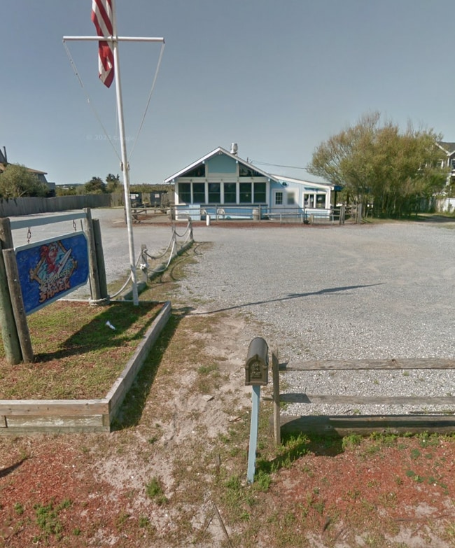
540 Dune Rd
Nassau County-Suffolk County, NY
Map Of Villages At Eastport Section #3
0900-392-00-01-00-014-000
1988 LD EQ + 3790
Restaurantbuilding
Suffolk
AE
New York
36103C0766H
14
0
4.20 AC
2024
Eastern Suffolk
190706
Long Island (New York)
1,632 SF
DEMOGRAPHICS near 540 Dune Rd
1 Mile
3 Mile
5 Mile
2024 Total Population
663
9,564
23,332
2029 Population
807
10,509
24,689
Pop Growth 2024-2029
+ 21.72%
+ 9.88%
+ 5.82%
Average Age
50
46
45
2024 Total Households
267
3,730
8,806
HH Growth 2024-2029
+ 21.72%
+ 10.19%
+ 5.97%
Median Household Inc
$222,667
$167,131
$127,291
Avg Household Size
2.50
2.50
2.60
2024 Avg HH Vehicles
2.00
2.00
2.00
Median Home Value
$1,117,073
$1,063,207
$900,874
Median Year Built
1985
1980
1979
Nearby Places
Map Layers
Map Styles
 Street
 Aerial
- Restaurants
- Banks
- Shops
- Fitness
- Groceries
PUBLIC TRANSPORTATION
COMMUTER RAIL
Westhampton Station (Montauk Branch - Long Island Rail Road)
DRIVE
WALK
Distance
Westhampton Station (Montauk Branch - Long Island Rail Road)
10 min
4.8 mi
Speonk Station (Montauk Branch - Long Island Rail Road)
DRIVE
WALK
Distance
Speonk Station (Montauk Branch - Long Island Rail Road)
13 min
7.2 mi
AIRPORT
Long Island MacArthur
DRIVE
WALK
Distance
Long Island MacArthur
48 min
30.1 mi
Freight Ports
Port of New Haven
DRIVE
WALK
Distance
Port of New Haven
165 min
70.8 mi
Nearby Properties
Address
Land Use
TOTAL SIZE
Lot Size
Zoning
Address
Land Use
TOTAL SIZE
Lot Size
Zoning
53,067 SF
6.20 AC
R2
Address
Land Use
TOTAL SIZE
Lot Size
Zoning
55,202 SF
18.50 AC
R2
Address
Land Use
TOTAL SIZE
Lot Size
Zoning
68,676 SF
9.70 AC
CR200
Address
Land Use
TOTAL SIZE
Lot Size
Zoning
18.28 AC
CR200
Address
Land Use
TOTAL SIZE
Lot Size
Zoning
15,084 SF
10.25 AC
R40
Address
Land Use
TOTAL SIZE
Lot Size
Zoning
31,393 SF
4.90 AC
R3
Address
Land Use
TOTAL SIZE
Lot Size
Zoning
28.62 AC
R40
Address
Land Use
TOTAL SIZE
Lot Size
Zoning
16.50 AC
VILLA
Address
Land Use
TOTAL SIZE
Lot Size
Zoning
19.50 AC
PC
Address
Land Use
TOTAL SIZE
Lot Size
Zoning
20,697 SF
1.91 AC
B1
Address
Land Use
TOTAL SIZE
Lot Size
Zoning
36,918 SF
6.27 AC
R40
Address
Land Use
TOTAL SIZE
Lot Size
Zoning
13.90 AC
PC
Address
Land Use
TOTAL SIZE
Lot Size
Zoning
7,270 SF
4.20 AC
R2
Address
Land Use
TOTAL SIZE
Lot Size
Zoning
30,512 SF
4.28 AC
VB
Address
Land Use
TOTAL SIZE
Lot Size
Zoning
28,544 SF
4.70 AC
R1
Address
Land Use
TOTAL SIZE
Lot Size
Zoning
16,854 SF
11.95 AC
OD
Address
Land Use
TOTAL SIZE
Lot Size
Zoning
20,822 SF
2.60 AC
B1
Address
Land Use
TOTAL SIZE
Lot Size
Zoning
2,427 SF
3.80 AC
R3
Address
Land Use
TOTAL SIZE
Lot Size
Zoning
8,636 SF
1.55 AC
R40
Address
Land Use
TOTAL SIZE
Lot Size
Zoning
10.64 AC
PC
Address
Land Use
TOTAL SIZE
Lot Size
Zoning
9,069 SF
4.19 AC
R60
Address
Land Use
TOTAL SIZE
Lot Size
Zoning
7,032 SF
1.96 AC
R1
Address
Land Use
TOTAL SIZE
Lot Size
Zoning
10,770 SF
1.50 AC
B1
Address
Land Use
TOTAL SIZE
Lot Size
Zoning
7.40 AC
R40
Address
Land Use
TOTAL SIZE
Lot Size
Zoning
7,271 SF
2.05 AC
R1
Address
Land Use
TOTAL SIZE
Lot Size
Zoning
6,875 SF
2.90 AC
R80
Address
Land Use
TOTAL SIZE
Lot Size
Zoning
6,230 SF
0.51 AC
R3
Address
Land Use
TOTAL SIZE
Lot Size
Zoning
7,384 SF
0.91 AC
R3
Address
Land Use
TOTAL SIZE
Lot Size
Zoning
5,122 SF
0.55 AC
VILLA
Address
Land Use
TOTAL SIZE
Lot Size
Zoning
7,396 SF
0.43 AC
B1
The World's #1 Commercial Real Estate Marketplace
Connect with us
© 2026 CoStar Group
The information above has been obtained from sources believed reliable. While we do not doubt its accuracy we have not verified it and make no guarantee, warranty or representation about it. It is your responsibility to independently confirm its accuracy and completeness. Any projections, opinions, assumptions, or estimates used are for example only and do not represent the current or future performance of the property. The value of this transaction to you depends on tax and other factors which should be evaluated by your tax, financial, and legal advisors. You and your advisors should conduct a careful, independent investigation of the property to determine to your satisfaction the suitability of the property for your needs.