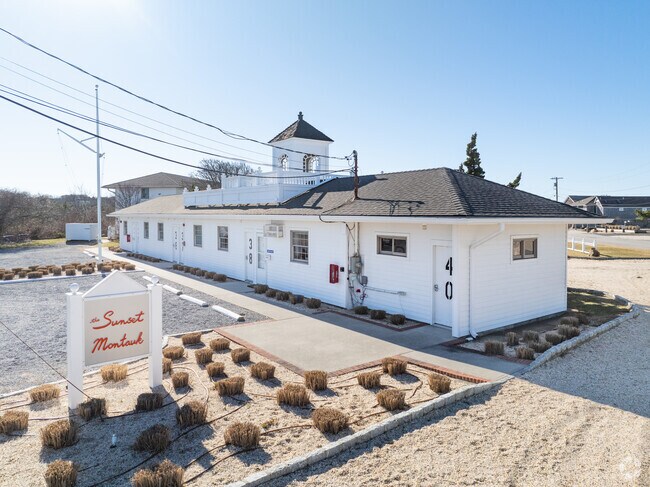
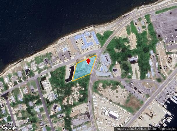
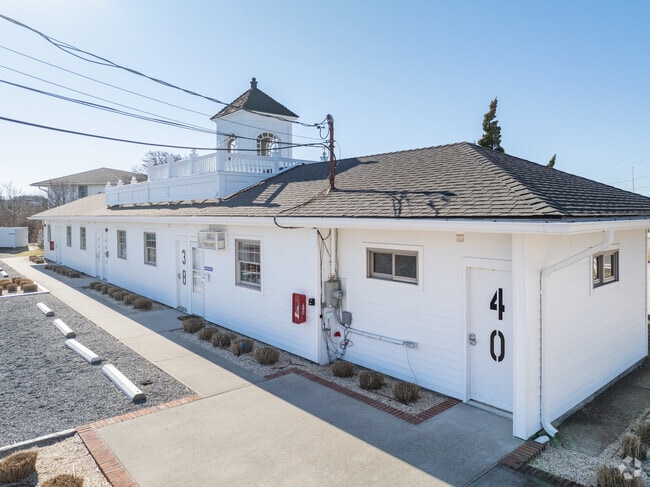
Property Record
540 W Lake Dr, Montauk, NY 11954
NEARBY LISTINGS FOR SALE OR LEASE
Property Detail
540 W Lake Dr
Nassau County-Suffolk County, NY
SOUND VIEW DR W LAKE DR J GOSMAN/ORS MAP 1929 TC-230
0300-005-00-04-00-003-000
Suffolk
Transientlodging
New York
X
3
36103C0254H
0.72 AC
2024
Suffolk
2024
Long Island (New York)
201008
DEMOGRAPHICS near 540 W Lake Dr
1 Mile
3 Mile
5 Mile
2024 Total Population
1,197
6,025
7,388
2029 Population
1,298
6,441
7,912
Pop Growth 2024-2029
+ 8.44%
+ 6.90%
+ 7.09%
Average Age
45
46
46
2024 Total Households
490
2,484
3,064
HH Growth 2024-2029
+ 8.37%
+ 6.84%
+ 7.08%
Median Household Inc
$132,143
$126,023
$134,303
Avg Household Size
2.40
2.40
2.40
2024 Avg HH Vehicles
2.00
2.00
2.00
Median Home Value
$1,000,838
$961,559
$1,012,562
Median Year Built
1979
1978
1979
Nearby Places
- Restaurants
- Banks
- Shops
- Fitness
- Groceries
PUBLIC TRANSPORTATION
COMMUTER RAIL
Montauk Station (Montauk Branch - Long Island Rail Road)
DRIVE
WALK
Distance
Montauk Station (Montauk Branch - Long Island Rail Road)
4 min
2.1 mi
Freight Ports
Port of Davisville, RI
DRIVE
WALK
Distance
Port of Davisville, RI
265 min
111.6 mi
Nearby Properties
Address
Land Use
TOTAL SIZE
Lot Size
Zoning
Address
Land Use
TOTAL SIZE
Lot Size
Zoning
232.10 AC
Address
Land Use
TOTAL SIZE
Lot Size
Zoning
11.18 AC
CR120
Address
Land Use
TOTAL SIZE
Lot Size
Zoning
960.83 AC
Address
Land Use
TOTAL SIZE
Lot Size
Zoning
776.30 AC
Address
Land Use
TOTAL SIZE
Lot Size
Zoning
0.95 AC
Address
Land Use
TOTAL SIZE
Lot Size
Zoning
10.30 AC
Address
Land Use
TOTAL SIZE
Lot Size
Zoning
17.99 AC
CR120
Address
Land Use
TOTAL SIZE
Lot Size
Zoning
0.41 AC
Address
Land Use
TOTAL SIZE
Lot Size
Zoning
2.32 AC
Address
Land Use
TOTAL SIZE
Lot Size
Zoning
1.90 AC
Address
Land Use
TOTAL SIZE
Lot Size
Zoning
76.90 AC
Address
Land Use
TOTAL SIZE
Lot Size
Zoning
2.20 AC
Address
Land Use
TOTAL SIZE
Lot Size
Zoning
121.90 AC
Address
Land Use
TOTAL SIZE
Lot Size
Zoning
1.41 AC
Address
Land Use
TOTAL SIZE
Lot Size
Zoning
1.90 AC
Address
Land Use
TOTAL SIZE
Lot Size
Zoning
138.50 AC
Address
Land Use
TOTAL SIZE
Lot Size
Zoning
10.50 AC
Address
Land Use
TOTAL SIZE
Lot Size
Zoning
Address
Land Use
TOTAL SIZE
Lot Size
Zoning
Address
Land Use
TOTAL SIZE
Lot Size
Zoning
Address
Land Use
TOTAL SIZE
Lot Size
Zoning
1.18 AC
Address
Land Use
TOTAL SIZE
Lot Size
Zoning
22.32 AC
Address
Land Use
TOTAL SIZE
Lot Size
Zoning
Address
Land Use
TOTAL SIZE
Lot Size
Zoning
26.40 AC
Address
Land Use
TOTAL SIZE
Lot Size
Zoning
2.70 AC
Address
Land Use
TOTAL SIZE
Lot Size
Zoning
6.10 AC
Address
Land Use
TOTAL SIZE
Lot Size
Zoning
Address
Land Use
TOTAL SIZE
Lot Size
Zoning
430.75 AC
Address
Land Use
TOTAL SIZE
Lot Size
Zoning
2.20 AC
Address
Land Use
TOTAL SIZE
Lot Size
Zoning
1.30 AC
The World's #1 Commercial Real Estate Marketplace
Connect with us
© 2025 CoStar Group
The information above has been obtained from sources believed reliable. While we do not doubt its accuracy we have not verified it and make no guarantee, warranty or representation about it. It is your responsibility to independently confirm its accuracy and completeness. Any projections, opinions, assumptions, or estimates used are for example only and do not represent the current or future performance of the property. The value of this transaction to you depends on tax and other factors which should be evaluated by your tax, financial, and legal advisors. You and your advisors should conduct a careful, independent investigation of the property to determine to your satisfaction the suitability of the property for your needs.