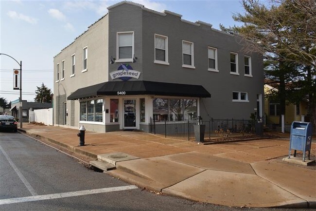
Property Record
5400 Nottingham Ave, Saint Louis, MO 63109


NEARBY LISTINGS FOR SALE OR LEASE
Property Detail
5400 Nottingham Ave
St. Louis, MO-IL
Muths Morningside Pk Addn
5584-00-0230-7
C B 5584 NOTTINGHAM 55 X 125 MUTHS MORNINGSIDE PK ADDN BLOCK 15 LOT E-1
Commercialnec
St. Louis City
X
Missouri
29189C0333K
e-1
2024
0.08 AC
2025
St Louis City South
114300
St. Louis
4,840 SF
DEMOGRAPHICS near 5400 Nottingham Ave
1 Mile
3 Mile
5 Mile
2024 Total Population
21,877
150,663
326,374
2029 Population
19,898
140,941
310,419
Pop Growth 2024-2029
(9.05%)
(6.45%)
(4.89%)
Average Age
41
40
39
2024 Total Households
11,292
72,323
152,836
HH Growth 2024-2029
(8.87%)
(6.46%)
(5.06%)
Median Household Inc
$63,924
$58,978
$62,837
Avg Household Size
1.90
2.00
2.00
2024 Avg HH Vehicles
2.00
1.00
2.00
Median Home Value
$193,056
$184,171
$215,025
Median Year Built
1946
1947
1948
Nearby Places
Map Layers
Map Styles
 Street
 Aerial
- Restaurants
- Banks
- Shops
- Fitness
- Groceries
PUBLIC TRANSPORTATION
COMMUTER RAIL
Shrewsbury-Lansdowne (Shrewsbury-Lansdowne I-44 Emerson Park - St. Louis MetroLink (MetroLink))
DRIVE
WALK
Distance
Shrewsbury-Lansdowne (Shrewsbury-Lansdowne I-44 Emerson Park - St. Louis MetroLink (MetroLink))
5 min
2.3 mi
Sunnen (Shrewsbury-Lansdowne I-44 Emerson Park - St. Louis MetroLink (MetroLink))
DRIVE
WALK
Distance
Sunnen (Shrewsbury-Lansdowne I-44 Emerson Park - St. Louis MetroLink (MetroLink))
9 min
3.9 mi
AIRPORT
St Louis Lambert International
DRIVE
WALK
Distance
St Louis Lambert International
26 min
17.0 mi
Scott AFB/Midamerica St Louis
DRIVE
WALK
Distance
Scott AFB/Midamerica St Louis
50 min
33.4 mi
Freight Ports
Port Milwaukee
DRIVE
WALK
Distance
Port Milwaukee
429 min
377.7 mi
SALE & LEASE HISTORY
LISTING DATE
SALE/LEASE

Feb 28, 2017
For Sale
Nearby Properties
Address
Land Use
TOTAL SIZE
Lot Size
Zoning
Address
Land Use
TOTAL SIZE
Lot Size
Zoning
0.92 AC
A
Address
Land Use
TOTAL SIZE
Lot Size
Zoning
5.61 AC
A
Address
Land Use
TOTAL SIZE
Lot Size
Zoning
229.57 AC
B
Address
Land Use
TOTAL SIZE
Lot Size
Zoning
177.77 AC
A
Address
Land Use
TOTAL SIZE
Lot Size
Zoning
57.77 AC
A
Address
Land Use
TOTAL SIZE
Lot Size
Zoning
6.05 AC
J
Address
Land Use
TOTAL SIZE
Lot Size
Zoning
306,459 SF
4.79 AC
H
Address
Land Use
TOTAL SIZE
Lot Size
Zoning
358,243 SF
3.02 AC
H
Address
Land Use
TOTAL SIZE
Lot Size
Zoning
559,752 SF
24.37 AC
53R-3
Address
Land Use
TOTAL SIZE
Lot Size
Zoning
212,406 SF
21.42 AC
AB
Address
Land Use
TOTAL SIZE
Lot Size
Zoning
44.38 AC
R1
Address
Land Use
TOTAL SIZE
Lot Size
Zoning
39,712 SF
30.49 AC
R1
Address
Land Use
TOTAL SIZE
Lot Size
Zoning
22.44 AC
A
Address
Land Use
TOTAL SIZE
Lot Size
Zoning
432,844 SF
5.08 AC
JK
Address
Land Use
TOTAL SIZE
Lot Size
Zoning
39,863 SF
5.83 AC
H
Address
Land Use
TOTAL SIZE
Lot Size
Zoning
23.21 AC
A
Address
Land Use
TOTAL SIZE
Lot Size
Zoning
106,148 SF
13.01 AC
53C-2
Address
Land Use
TOTAL SIZE
Lot Size
Zoning
261,362 SF
17.19 AC
R6
Address
Land Use
TOTAL SIZE
Lot Size
Zoning
86,230 SF
4.01 AC
H
Address
Land Use
TOTAL SIZE
Lot Size
Zoning
7.03 AC
PA
Address
Land Use
TOTAL SIZE
Lot Size
Zoning
20.27 AC
R5
Address
Land Use
TOTAL SIZE
Lot Size
Zoning
217,910 SF
12.41 AC
53C-2
Address
Land Use
TOTAL SIZE
Lot Size
Zoning
394,790 SF
19.32 AC
K
Address
Land Use
TOTAL SIZE
Lot Size
Zoning
187,145 SF
4.96 AC
A
Address
Land Use
TOTAL SIZE
Lot Size
Zoning
50.67 AC
A
Address
Land Use
TOTAL SIZE
Lot Size
Zoning
137,147 SF
12.11 AC
35PUD
Address
Land Use
TOTAL SIZE
Lot Size
Zoning
220,632 SF
15.60 AC
M1
Address
Land Use
TOTAL SIZE
Lot Size
Zoning
433,028 SF
32.35 AC
A
Address
Land Use
TOTAL SIZE
Lot Size
Zoning
118,491 SF
0.42 AC
F
Address
Land Use
TOTAL SIZE
Lot Size
Zoning
133,832 SF
12.18 AC
53C-2
The World's #1 Commercial Real Estate Marketplace
Connect with us
© 2026 CoStar Group
The information above has been obtained from sources believed reliable. While we do not doubt its accuracy we have not verified it and make no guarantee, warranty or representation about it. It is your responsibility to independently confirm its accuracy and completeness. Any projections, opinions, assumptions, or estimates used are for example only and do not represent the current or future performance of the property. The value of this transaction to you depends on tax and other factors which should be evaluated by your tax, financial, and legal advisors. You and your advisors should conduct a careful, independent investigation of the property to determine to your satisfaction the suitability of the property for your needs.