Property Record
5400 Cypress St, Monroe, LA 71201
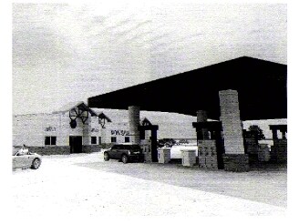


Property Detail
5400 Cypress St
Monroe, LA
1.327 ACS M/L IN NE4 OF SE4 SEC 30-18-3 COMMENCE AT NE COR NE4/SE4 SEC 30-18-3 THENCE N89.5140W 25.69 FT TO W LINE OF R/W WAL
106109
OUACHITA
Commercialnec
Louisiana
B and X Area of moderate flood hazard, usually the area between the limits of the 100-year and 500-year floods.
1.43 AC
2025
Louisiana North Area
2025
Other Market Areas
001700
NEARBY LISTINGS FOR SALE OR LEASE
DEMOGRAPHICS near 5400 Cypress St
1 mile
3 mile
5 mile
2025 Total Population
4,909
30,161
57,299
2030 Population
4,849
29,907
56,874
Pop Growth 2025-2030
(1.22%)
(0.84%)
(0.74%)
Average Age
39
40
40
2025 Total Households
2,108
12,432
23,768
HH Growth 2025-2030
(1.23%)
(0.88%)
(0.79%)
Median Household Inc
$74,434
$63,062
$61,206
Avg Household Size
2.30
2.40
2.30
2025 Avg HH Vehicles
2.00
2.00
2.00
Median Home Value
$233,197
$210,826
$216,534
Median Year Built
1992
1987
1983
Nearby Places
Map Layers
Map Styles
 Street
 Aerial
Transit
 Traffic
 Biking
Places
Listings with unknown addresses are not visible on the map
- Restaurants
- Banks
- Shops
- Fitness
- Groceries
PUBLIC TRANSPORTATION
AIRPORT
Monroe Regional
Drive
Walk
Distance
Monroe Regional
15 min
11.3 mi
Freight Ports
Port of Shreveport
Drive
Walk
Distance
Port of Shreveport
124 min
106.2 mi
Nearby Properties
Address
Land Use
TOTAL SIZE
Lot Size
Zoning
Address
Land Use
TOTAL SIZE
Lot Size
Zoning
38.56 AC
Address
Land Use
TOTAL SIZE
Lot Size
Zoning
Address
Land Use
TOTAL SIZE
Lot Size
Zoning
15.74 AC
Address
Land Use
TOTAL SIZE
Lot Size
Zoning
23.29 AC
Address
Land Use
TOTAL SIZE
Lot Size
Zoning
3.66 AC
Address
Land Use
TOTAL SIZE
Lot Size
Zoning
6.10 AC
Address
Land Use
TOTAL SIZE
Lot Size
Zoning
18.85 AC
Address
Land Use
TOTAL SIZE
Lot Size
Zoning
14.09 AC
Address
Land Use
TOTAL SIZE
Lot Size
Zoning
10.67 AC
Address
Land Use
TOTAL SIZE
Lot Size
Zoning
20.17 AC
Address
Land Use
TOTAL SIZE
Lot Size
Zoning
Address
Land Use
TOTAL SIZE
Lot Size
Zoning
Address
Land Use
TOTAL SIZE
Lot Size
Zoning
2.09 AC
Address
Land Use
TOTAL SIZE
Lot Size
Zoning
Address
Land Use
TOTAL SIZE
Lot Size
Zoning
8.05 AC
Address
Land Use
TOTAL SIZE
Lot Size
Zoning
Address
Land Use
TOTAL SIZE
Lot Size
Zoning
5.19 AC
Address
Land Use
TOTAL SIZE
Lot Size
Zoning
Address
Land Use
TOTAL SIZE
Lot Size
Zoning
4.43 AC
Address
Land Use
TOTAL SIZE
Lot Size
Zoning
5.86 AC
Address
Land Use
TOTAL SIZE
Lot Size
Zoning
Address
Land Use
TOTAL SIZE
Lot Size
Zoning
Address
Land Use
TOTAL SIZE
Lot Size
Zoning
Address
Land Use
TOTAL SIZE
Lot Size
Zoning
1.84 AC
Address
Land Use
TOTAL SIZE
Lot Size
Zoning
Address
Land Use
TOTAL SIZE
Lot Size
Zoning
Address
Land Use
TOTAL SIZE
Lot Size
Zoning
38.96 AC
Address
Land Use
TOTAL SIZE
Lot Size
Zoning
Address
Land Use
TOTAL SIZE
Lot Size
Zoning
1.89 AC
Address
Land Use
TOTAL SIZE
Lot Size
Zoning
The World's #1 Commercial Real Estate Marketplace
Connect with us
© 2026 CoStar Group
The information above has been obtained from sources believed reliable. While we do not doubt its accuracy we have not verified it and make no guarantee, warranty or representation about it. It is your responsibility to independently confirm its accuracy and completeness. Any projections, opinions, assumptions, or estimates used are for example only and do not represent the current or future performance of the property. The value of this transaction to you depends on tax and other factors which should be evaluated by your tax, financial, and legal advisors. You and your advisors should conduct a careful, independent investigation of the property to determine to your satisfaction the suitability of the property for your needs.