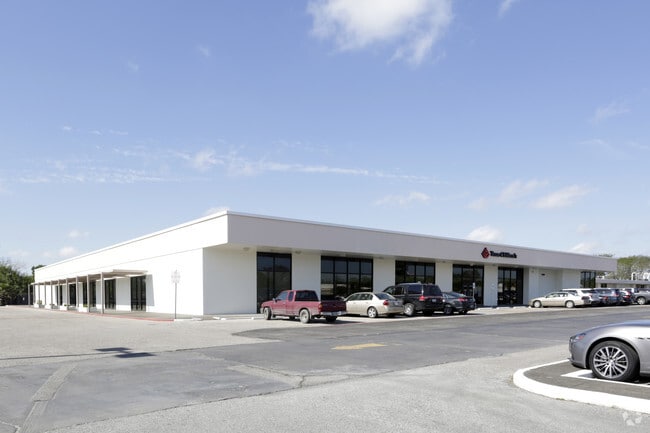
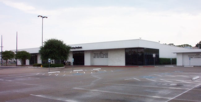
Property Record
5400 Griggs Rd, Houston, TX 77021

Current Lease Availabilities
Property Detail
5400 Griggs Rd
1167750010003
RES B3 & C BLK 1 & TR 4 ABST 936 WCRR CO SEC 1 PALM CENTER
Regionalshoppingcenterormallwithanchorstore
HARRIS
B and X Area of moderate flood hazard, usually the area between the limits of the 100-year and 500-year floods.
Texas
0
5.51 AC
2025
Inner Loop East End
313400
Houston
94,702 SF
Houston-Pasadena-The Woodlands, TX
NEARBY LISTINGS FOR SALE OR LEASE
DEMOGRAPHICS near 5400 Griggs Rd
1 mile
3 mile
5 mile
2025 Total Population
15,648
164,153
397,448
2030 Population
17,023
176,391
428,646
Pop Growth 2025-2030
+ 8.79%
+ 7.46%
+ 7.85%
Average Age
37
37
37
2025 Total Households
5,876
56,778
157,629
HH Growth 2025-2030
+ 9.55%
+ 8.15%
+ 8.51%
Median Household Inc
$38,891
$46,734
$59,805
Avg Household Size
2.50
2.60
2.30
2025 Avg HH Vehicles
2.00
2.00
1.00
Median Home Value
$194,824
$216,490
$257,782
Median Year Built
1966
1961
1975
Nearby Places
Map Layers
Map Styles
 Street
 Aerial
Layers
 Traffic
 Biking
Places
Listings with unknown addresses are not visible on the map
- Restaurants
- Banks
- Shops
- Fitness
- Groceries
PUBLIC TRANSPORTATION
TRANSIT/SUBWAY
Palm Center Transit Center Sb (METRORAIL PURPLE LINE - Metropolitan Transit Authority of Harris County)
Drive
Walk
Distance
Palm Center Transit Center Sb (METRORAIL PURPLE LINE - Metropolitan Transit Authority of Harris County)
1 min
4 min
0.2 mi
COMMUTER RAIL
Houston (Sunset Limited - Amtrak)
Drive
Walk
Distance
Houston (Sunset Limited - Amtrak)
13 min
7.1 mi
AIRPORT
William P Hobby
Drive
Walk
Distance
William P Hobby
17 min
7.3 mi
George Bush Intcntl/Houston
Drive
Walk
Distance
George Bush Intcntl/Houston
36 min
24.3 mi
Freight Ports
Port of Houston
Drive
Walk
Distance
Port of Houston
14 min
7.6 mi
Nearby Properties
Address
Land Use
TOTAL SIZE
Lot Size
Zoning
Address
Land Use
TOTAL SIZE
Lot Size
Zoning
486,076 SF
3.79 AC
Address
Land Use
TOTAL SIZE
Lot Size
Zoning
453,987 SF
4.33 AC
Address
Land Use
TOTAL SIZE
Lot Size
Zoning
403,242 SF
46.18 AC
Address
Land Use
TOTAL SIZE
Lot Size
Zoning
1,171,276 SF
44.19 AC
Address
Land Use
TOTAL SIZE
Lot Size
Zoning
372,028 SF
26.56 AC
Address
Land Use
TOTAL SIZE
Lot Size
Zoning
643,698 SF
6.57 AC
Address
Land Use
TOTAL SIZE
Lot Size
Zoning
257,963 SF
6.39 AC
Address
Land Use
TOTAL SIZE
Lot Size
Zoning
476,754 SF
4.14 AC
Address
Land Use
TOTAL SIZE
Lot Size
Zoning
278,362 SF
1.70 AC
Address
Land Use
TOTAL SIZE
Lot Size
Zoning
159,235 SF
1.49 AC
Address
Land Use
TOTAL SIZE
Lot Size
Zoning
242,936 SF
Address
Land Use
TOTAL SIZE
Lot Size
Zoning
310,171 SF
2.35 AC
Address
Land Use
TOTAL SIZE
Lot Size
Zoning
757,830 SF
31.03 AC
Address
Land Use
TOTAL SIZE
Lot Size
Zoning
245,307 SF
1.67 AC
Address
Land Use
TOTAL SIZE
Lot Size
Zoning
358,709 SF
2.66 AC
Address
Land Use
TOTAL SIZE
Lot Size
Zoning
389,108 SF
37.39 AC
Address
Land Use
TOTAL SIZE
Lot Size
Zoning
198,023 SF
17.87 AC
Address
Land Use
TOTAL SIZE
Lot Size
Zoning
92,539 SF
12.12 AC
Address
Land Use
TOTAL SIZE
Lot Size
Zoning
504,018 SF
37.16 AC
Address
Land Use
TOTAL SIZE
Lot Size
Zoning
419,760 SF
15.27 AC
Address
Land Use
TOTAL SIZE
Lot Size
Zoning
785,097 SF
27.77 AC
Address
Land Use
TOTAL SIZE
Lot Size
Zoning
232,915 SF
7.89 AC
Address
Land Use
TOTAL SIZE
Lot Size
Zoning
228,886 SF
1.85 AC
Address
Land Use
TOTAL SIZE
Lot Size
Zoning
267,844 SF
10.98 AC
Address
Land Use
TOTAL SIZE
Lot Size
Zoning
194,296 SF
15.13 AC
Address
Land Use
TOTAL SIZE
Lot Size
Zoning
153,240 SF
5.98 AC
Address
Land Use
TOTAL SIZE
Lot Size
Zoning
210,476 SF
9.60 AC
Address
Land Use
TOTAL SIZE
Lot Size
Zoning
143,440 SF
1.06 AC
Address
Land Use
TOTAL SIZE
Lot Size
Zoning
215,960 SF
0.98 AC
Address
Land Use
TOTAL SIZE
Lot Size
Zoning
595,069 SF
17.77 AC
The World's #1 Commercial Real Estate Marketplace
Connect with us
© 2026 CoStar Group
The information above has been obtained from sources believed reliable. While we do not doubt its accuracy we have not verified it and make no guarantee, warranty or representation about it. It is your responsibility to independently confirm its accuracy and completeness. Any projections, opinions, assumptions, or estimates used are for example only and do not represent the current or future performance of the property. The value of this transaction to you depends on tax and other factors which should be evaluated by your tax, financial, and legal advisors. You and your advisors should conduct a careful, independent investigation of the property to determine to your satisfaction the suitability of the property for your needs.