Property Record
5401 Burning Tree Rd, Duluth, MN 55811
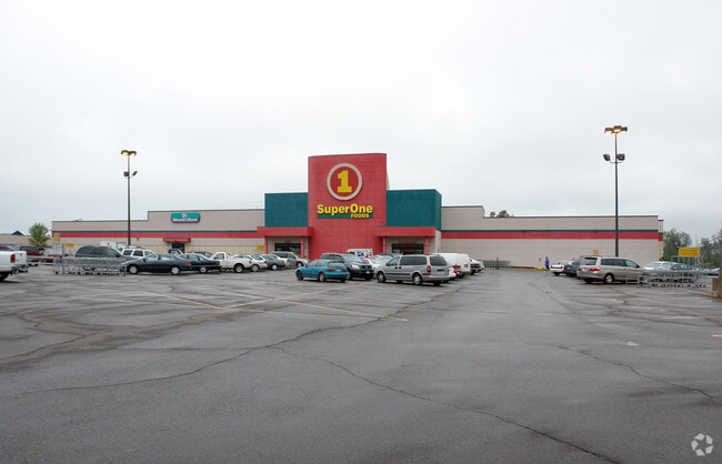

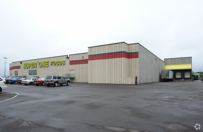
Property Detail
5401 Burning Tree Rd
Duluth, MN-WI
LOT: 0001 BLOCK:001 SERIAL #
010035500010
Saint Louis
Commercialnec
Minnesota
AE The base floodplain where base flood elevations are provided. AE Zones are now used on new format FIRMs instead of A1-A30 Zones.
1
2024
7.16 AC
2024
Miller Hill/Airpark
000302
Duluth
73,622 SF
NEARBY LISTINGS FOR SALE OR LEASE
DEMOGRAPHICS near 5401 Burning Tree Rd
1 mile
3 mile
5 mile
2025 Total Population
2,618
19,215
68,144
2030 Population
2,619
19,053
67,362
Pop Growth 2025-2030
+ 0.04%
(0.84%)
(1.15%)
Average Age
44
42
39
2025 Total Households
1,122
7,726
28,331
HH Growth 2025-2030
(0.09%)
(1.42%)
(1.39%)
Median Household Inc
$59,656
$77,191
$61,068
Avg Household Size
2.10
2.20
2.10
2025 Avg HH Vehicles
2.00
2.00
2.00
Median Home Value
$301,892
$315,104
$273,711
Median Year Built
1992
1977
1956
Nearby Places
Map Layers
Map Styles
 Street
 Aerial
Transit
 Traffic
 Biking
Places
Listings with unknown addresses are not visible on the map
- Restaurants
- Banks
- Shops
- Fitness
- Groceries
PUBLIC TRANSPORTATION
AIRPORT
Duluth International
Drive
Walk
Distance
Duluth International
13 min
4.5 mi
Freight Ports
Port Milwaukee
Drive
Walk
Distance
Port Milwaukee
457 min
402.1 mi
Nearby Properties
Address
Land Use
TOTAL SIZE
Lot Size
Zoning
Address
Land Use
TOTAL SIZE
Lot Size
Zoning
524,275 SF
38.23 AC
Address
Land Use
TOTAL SIZE
Lot Size
Zoning
195,455 SF
54.06 AC
Address
Land Use
TOTAL SIZE
Lot Size
Zoning
32,824 SF
117.72 AC
Address
Land Use
TOTAL SIZE
Lot Size
Zoning
178,184 SF
20 AC
Address
Land Use
TOTAL SIZE
Lot Size
Zoning
20,388 SF
20 AC
Address
Land Use
TOTAL SIZE
Lot Size
Zoning
100,246 SF
12.24 AC
Address
Land Use
TOTAL SIZE
Lot Size
Zoning
118,418 SF
13.62 AC
Address
Land Use
TOTAL SIZE
Lot Size
Zoning
7,300 SF
19.85 AC
Address
Land Use
TOTAL SIZE
Lot Size
Zoning
113,448 SF
10 AC
Address
Land Use
TOTAL SIZE
Lot Size
Zoning
62,634 SF
4.32 AC
Address
Land Use
TOTAL SIZE
Lot Size
Zoning
72,980 SF
2.85 AC
R1B
Address
Land Use
TOTAL SIZE
Lot Size
Zoning
109,021 SF
10.01 AC
Address
Land Use
TOTAL SIZE
Lot Size
Zoning
98,994 SF
185.96 AC
Address
Land Use
TOTAL SIZE
Lot Size
Zoning
158,240 SF
0.13 AC
Address
Land Use
TOTAL SIZE
Lot Size
Zoning
183,097 SF
27.58 AC
Address
Land Use
TOTAL SIZE
Lot Size
Zoning
174,964 SF
41.97 AC
Address
Land Use
TOTAL SIZE
Lot Size
Zoning
81,316 SF
1.89 AC
Address
Land Use
TOTAL SIZE
Lot Size
Zoning
176,840 SF
27.50 AC
Address
Land Use
TOTAL SIZE
Lot Size
Zoning
161,568 SF
20.87 AC
Address
Land Use
TOTAL SIZE
Lot Size
Zoning
15,246 SF
10.98 AC
R3
Address
Land Use
TOTAL SIZE
Lot Size
Zoning
153,866 SF
13.83 AC
Address
Land Use
TOTAL SIZE
Lot Size
Zoning
172,700 SF
33.34 AC
Address
Land Use
TOTAL SIZE
Lot Size
Zoning
164,720 SF
19.81 AC
Address
Land Use
TOTAL SIZE
Lot Size
Zoning
123,720 SF
2.65 AC
Address
Land Use
TOTAL SIZE
Lot Size
Zoning
108,788 SF
2.86 AC
Address
Land Use
TOTAL SIZE
Lot Size
Zoning
21,204 SF
26.34 AC
Address
Land Use
TOTAL SIZE
Lot Size
Zoning
158,388 SF
6.21 AC
Address
Land Use
TOTAL SIZE
Lot Size
Zoning
38,952 SF
20.99 AC
Address
Land Use
TOTAL SIZE
Lot Size
Zoning
112,838 SF
40 AC
Address
Land Use
TOTAL SIZE
Lot Size
Zoning
90,980 SF
13.11 AC
R3
The World's #1 Commercial Real Estate Marketplace
Connect with us
© 2026 CoStar Group
The information above has been obtained from sources believed reliable. While we do not doubt its accuracy we have not verified it and make no guarantee, warranty or representation about it. It is your responsibility to independently confirm its accuracy and completeness. Any projections, opinions, assumptions, or estimates used are for example only and do not represent the current or future performance of the property. The value of this transaction to you depends on tax and other factors which should be evaluated by your tax, financial, and legal advisors. You and your advisors should conduct a careful, independent investigation of the property to determine to your satisfaction the suitability of the property for your needs.