Property Record
501 N Ann Arbor Ave, Oklahoma City, OK 73127


Current Lease Availabilities
NEARBY LISTINGS FOR SALE OR LEASE
Property Detail
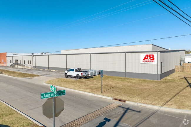
501 N Ann Arbor Ave
Oklahoma City, OK
Cain & Rock Island Inds Pk
148071000
CAIN & ROCK ISLAND INDS PK 001 001
Warehouse
Oklahoma
A
Oklahoma
40109C0280H
1
2023
4.04 AC
2024
West
106913
Oklahoma City
98,466 SF
DEMOGRAPHICS near 501 N Ann Arbor Ave
1 Mile
3 Mile
5 Mile
2024 Total Population
4,810
72,111
201,092
2029 Population
5,010
74,363
209,712
Pop Growth 2024-2029
+ 4.16%
+ 3.12%
+ 4.29%
Average Age
33
36
36
2024 Total Households
1,880
28,419
78,843
HH Growth 2024-2029
+ 4.31%
+ 3.23%
+ 4.20%
Median Household Inc
$27,547
$45,072
$47,474
Avg Household Size
2.40
2.40
2.40
2024 Avg HH Vehicles
1.00
2.00
2.00
Median Home Value
$80,877
$132,785
$139,959
Median Year Built
1971
1965
1964
Nearby Places
Map Layers
Map Styles
 Street
 Aerial
- Restaurants
- Banks
- Shops
- Fitness
- Groceries
PUBLIC TRANSPORTATION
COMMUTER RAIL
Oklahoma City (Heartland Flyer - Amtrak)
DRIVE
WALK
Distance
Oklahoma City (Heartland Flyer - Amtrak)
12 min
6.1 mi
AIRPORT
Will Rogers World
DRIVE
WALK
Distance
Will Rogers World
17 min
6.6 mi
Freight Ports
Tulsa Port Of Catoosa
DRIVE
WALK
Distance
Tulsa Port Of Catoosa
142 min
128.3 mi
Nearby Properties
Address
Land Use
TOTAL SIZE
Lot Size
Zoning
Address
Land Use
TOTAL SIZE
Lot Size
Zoning
1,976,300 SF
217.95 AC
I-2
Address
Land Use
TOTAL SIZE
Lot Size
Zoning
388,082 SF
34.03 AC
I-2
Address
Land Use
TOTAL SIZE
Lot Size
Zoning
44,519 SF
3.39 AC
SPUD
Address
Land Use
TOTAL SIZE
Lot Size
Zoning
246,774 SF
55.60 AC
PUD
Address
Land Use
TOTAL SIZE
Lot Size
Zoning
195,412 SF
4.42 AC
I-1
Address
Land Use
TOTAL SIZE
Lot Size
Zoning
1,194,497 SF
89.98 AC
I-2
Address
Land Use
TOTAL SIZE
Lot Size
Zoning
300,000 SF
123.06 AC
R-1
Address
Land Use
TOTAL SIZE
Lot Size
Zoning
259,726 SF
19.94 AC
PUD
Address
Land Use
TOTAL SIZE
Lot Size
Zoning
211,626 SF
12.67 AC
PUD
Address
Land Use
TOTAL SIZE
Lot Size
Zoning
279,224 SF
18.75 AC
PUD
Address
Land Use
TOTAL SIZE
Lot Size
Zoning
181,946 SF
4.42 AC
C-4
Address
Land Use
TOTAL SIZE
Lot Size
Zoning
192,771 SF
11.20 AC
I-3
Address
Land Use
TOTAL SIZE
Lot Size
Zoning
213,085 SF
3.64 AC
Address
Land Use
TOTAL SIZE
Lot Size
Zoning
371,946 SF
31.38 AC
I-2
Address
Land Use
TOTAL SIZE
Lot Size
Zoning
336,750 SF
15.53 AC
I-3
Address
Land Use
TOTAL SIZE
Lot Size
Zoning
141,204 SF
6.10 AC
I-2
Address
Land Use
TOTAL SIZE
Lot Size
Zoning
294,820 SF
12.17 AC
Address
Land Use
TOTAL SIZE
Lot Size
Zoning
246,884 SF
11.64 AC
I-2
Address
Land Use
TOTAL SIZE
Lot Size
Zoning
256,500 SF
19.46 AC
I-3
Address
Land Use
TOTAL SIZE
Lot Size
Zoning
182,590 SF
11.35 AC
R-4
Address
Land Use
TOTAL SIZE
Lot Size
Zoning
166,850 SF
9.97 AC
I-2
Address
Land Use
TOTAL SIZE
Lot Size
Zoning
110,391 SF
28.91 AC
I-2
Address
Land Use
TOTAL SIZE
Lot Size
Zoning
223,679 SF
40.52 AC
PUD
Address
Land Use
TOTAL SIZE
Lot Size
Zoning
258,262 SF
15.17 AC
Address
Land Use
TOTAL SIZE
Lot Size
Zoning
1,291,806 SF
53.08 AC
I-3
Address
Land Use
TOTAL SIZE
Lot Size
Zoning
217,512 SF
8.79 AC
Address
Land Use
TOTAL SIZE
Lot Size
Zoning
83,055 SF
6.25 AC
PUD
Address
Land Use
TOTAL SIZE
Lot Size
Zoning
182,948 SF
10 AC
Address
Land Use
TOTAL SIZE
Lot Size
Zoning
81,491 SF
15 AC
C-3
Address
Land Use
TOTAL SIZE
Lot Size
Zoning
239,654 SF
24.50 AC
PUD
The World's #1 Commercial Real Estate Marketplace
Connect with us
© 2026 CoStar Group
The information above has been obtained from sources believed reliable. While we do not doubt its accuracy we have not verified it and make no guarantee, warranty or representation about it. It is your responsibility to independently confirm its accuracy and completeness. Any projections, opinions, assumptions, or estimates used are for example only and do not represent the current or future performance of the property. The value of this transaction to you depends on tax and other factors which should be evaluated by your tax, financial, and legal advisors. You and your advisors should conduct a careful, independent investigation of the property to determine to your satisfaction the suitability of the property for your needs.