Property Record
5401 W Grand River Ave, Lansing, MI 48906


NEARBY LISTINGS FOR SALE OR LEASE
Property Detail
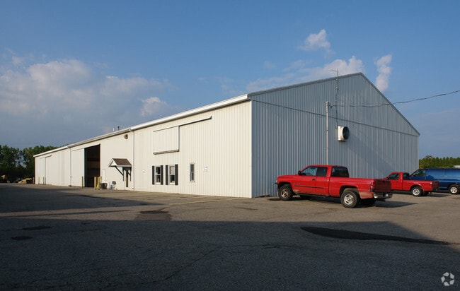
5401 W Grand River Ave
150-035-400-065-00
COM CTR LN GRAND RIVER AVE & E LINE SEC 35 T5N R3W, TH N 74D 57M 50S W 2727.5FT ALG SD CTR LN, TH S 414.18 FT TO BEG, TH S
Officebuilding
Clinton
X
Michigan
26037C0294D
8 AC
2024
Outlying Clinton County
2025
West Michigan
010300
Lansing-East Lansing, MI
3,600 SF
DEMOGRAPHICS near 5401 W Grand River Ave
1 Mile
3 Mile
5 Mile
2024 Total Population
389
25,729
80,589
2029 Population
393
25,639
80,880
Pop Growth 2024-2029
+ 1.03%
(0.35%)
+ 0.36%
Average Age
44
41
41
2024 Total Households
151
11,552
35,003
HH Growth 2024-2029
+ 1.32%
(0.41%)
+ 0.29%
Median Household Inc
$99,721
$67,857
$64,254
Avg Household Size
2.50
2.20
2.20
2024 Avg HH Vehicles
2.00
2.00
2.00
Median Home Value
$282,407
$188,324
$179,660
Median Year Built
1979
1974
1970
Nearby Places
Map Layers
Map Styles
 Street
 Aerial
- Restaurants
- Banks
- Shops
- Fitness
- Groceries
PUBLIC TRANSPORTATION
AIRPORT
Capital Region International
DRIVE
WALK
Distance
Capital Region International
6 min
2.8 mi
Nearby Properties
Address
Land Use
TOTAL SIZE
Lot Size
Zoning
Address
Land Use
TOTAL SIZE
Lot Size
Zoning
170,860 SF
16.35 AC
NONE
Address
Land Use
TOTAL SIZE
Lot Size
Zoning
336,591 SF
37.81 AC
NONE
Address
Land Use
TOTAL SIZE
Lot Size
Zoning
294,044 SF
30.86 AC
NONE
Address
Land Use
TOTAL SIZE
Lot Size
Zoning
436,698 SF
48.16 AC
NONE
Address
Land Use
TOTAL SIZE
Lot Size
Zoning
113.83 AC
NONE
Address
Land Use
TOTAL SIZE
Lot Size
Zoning
10,440 SF
18.30 AC
LI
Address
Land Use
TOTAL SIZE
Lot Size
Zoning
235,893 SF
18.69 AC
NONE
Address
Land Use
TOTAL SIZE
Lot Size
Zoning
73,485 SF
7.86 AC
LI
Address
Land Use
TOTAL SIZE
Lot Size
Zoning
189,157 SF
15.55 AC
NONE
Address
Land Use
TOTAL SIZE
Lot Size
Zoning
179,316 SF
16.68 AC
NONE
Address
Land Use
TOTAL SIZE
Lot Size
Zoning
155,772 SF
12.71 AC
NONE
Address
Land Use
TOTAL SIZE
Lot Size
Zoning
218,000 SF
15.60 AC
LI
Address
Land Use
TOTAL SIZE
Lot Size
Zoning
189,878 SF
27.62 AC
NONE
Address
Land Use
TOTAL SIZE
Lot Size
Zoning
125,060 SF
36.10 AC
LI
Address
Land Use
TOTAL SIZE
Lot Size
Zoning
200,072 SF
23.85 AC
NONE
Address
Land Use
TOTAL SIZE
Lot Size
Zoning
215,785 SF
14 AC
NONE
Address
Land Use
TOTAL SIZE
Lot Size
Zoning
131,649 SF
17.57 AC
NONE
Address
Land Use
TOTAL SIZE
Lot Size
Zoning
6,090 SF
12.96 AC
A RESID
Address
Land Use
TOTAL SIZE
Lot Size
Zoning
149,456 SF
14.49 AC
NONE
Address
Land Use
TOTAL SIZE
Lot Size
Zoning
130,671 SF
11.34 AC
NONE
Address
Land Use
TOTAL SIZE
Lot Size
Zoning
112,011 SF
12.12 AC
NONE
Address
Land Use
TOTAL SIZE
Lot Size
Zoning
142,400 SF
16.75 AC
LI
Address
Land Use
TOTAL SIZE
Lot Size
Zoning
88,550 SF
8.23 AC
NONE
Address
Land Use
TOTAL SIZE
Lot Size
Zoning
558,999 SF
41.65 AC
NONE
Address
Land Use
TOTAL SIZE
Lot Size
Zoning
149,770 SF
10.33 AC
NONE
Address
Land Use
TOTAL SIZE
Lot Size
Zoning
97,812 SF
12.16 AC
F COMME
Address
Land Use
TOTAL SIZE
Lot Size
Zoning
72,484 SF
9.53 AC
NONE
Address
Land Use
TOTAL SIZE
Lot Size
Zoning
13,593 SF
20.95 AC
B-2
Address
Land Use
TOTAL SIZE
Lot Size
Zoning
55,759 SF
2.02 AC
NONE
Address
Land Use
TOTAL SIZE
Lot Size
Zoning
210,000 SF
14.33 AC
LI
The World's #1 Commercial Real Estate Marketplace
Connect with us
© 2026 CoStar Group
The information above has been obtained from sources believed reliable. While we do not doubt its accuracy we have not verified it and make no guarantee, warranty or representation about it. It is your responsibility to independently confirm its accuracy and completeness. Any projections, opinions, assumptions, or estimates used are for example only and do not represent the current or future performance of the property. The value of this transaction to you depends on tax and other factors which should be evaluated by your tax, financial, and legal advisors. You and your advisors should conduct a careful, independent investigation of the property to determine to your satisfaction the suitability of the property for your needs.