Property Record
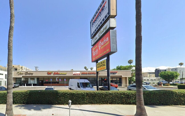
5401 W Sunset Blvd, Los Angeles, CA 90027


NEARBY LISTINGS FOR SALE OR LEASE
Property Detail
5401 W Sunset Blvd
Los Angeles-Long Beach-Glendale, CA
Nason Tract
5544-022-054
*TR=NASON TR*LOT COM S 0 12'30 E 30.53 FT FROM NW COR OF LOT 1 TH S 0 12'30 ETO N LINE OF SUNSET BLVD TH E THEREON AND N ON W LINE OF SERRANO AVE TO A PT S89 55'07 E FROM BEG TH N 89 55'07 W TO BEG POR OF LOT 1
Storemultistory
Los Angeles
X
California
06037C1610F
1
2024
0.68 AC
2025
East Hollywood/Silver Lake
190510
Los Angeles
12,870 SF
DEMOGRAPHICS near 5401 W Sunset Blvd
1 Mile
3 Mile
5 Mile
2024 Total Population
69,792
409,054
1,029,655
2029 Population
68,627
401,554
1,006,435
Pop Growth 2024-2029
(1.67%)
(1.83%)
(2.26%)
Average Age
40
40
40
2024 Total Households
31,559
189,587
456,317
HH Growth 2024-2029
(1.79%)
(1.99%)
(2.31%)
Median Household Inc
$49,634
$61,928
$64,217
Avg Household Size
2.10
2.10
2.20
2024 Avg HH Vehicles
1.00
1.00
1.00
Median Home Value
$1,050,475
$1,071,906
$1,028,772
Median Year Built
1960
1962
1962
Nearby Places
Map Layers
Map Styles
 Street
 Aerial
- Restaurants
- Banks
- Shops
- Fitness
- Groceries
PUBLIC TRANSPORTATION
TRANSIT/SUBWAY
Hollywood/Western Station (Red Line - Los Angeles County Metropolitan Transportation Authority (Metro))
DRIVE
WALK
Distance
Hollywood/Western Station (Red Line - Los Angeles County Metropolitan Transportation Authority (Metro))
1 min
7 min
0.4 mi
Vermont/Sunset Station (Red Line - Los Angeles County Metropolitan Transportation Authority (Metro))
DRIVE
WALK
Distance
Vermont/Sunset Station (Red Line - Los Angeles County Metropolitan Transportation Authority (Metro))
2 min
19 min
0.9 mi
COMMUTER RAIL
Glendale (Antelope Valley Line - Southern California Regional Rail Authority (Metrolink), Ventura County Line - Southern California Regional Rail Authority (Metrolink))
DRIVE
WALK
Distance
Glendale (Antelope Valley Line - Southern California Regional Rail Authority (Metrolink), Ventura County Line - Southern California Regional Rail Authority (Metrolink))
10 min
4.6 mi
DRIVE
WALK
Distance
10 min
5.7 mi
AIRPORT
Bob Hope
DRIVE
WALK
Distance
Bob Hope
17 min
9.8 mi
Los Angeles International
DRIVE
WALK
Distance
Los Angeles International
27 min
14.5 mi
Long Beach (Daugherty Field)
DRIVE
WALK
Distance
Long Beach (Daugherty Field)
39 min
28.2 mi
SALE & LEASE HISTORY
LISTING DATE
SALE/LEASE

Oct 11, 2024
For Sale
Oct 01, 2025
For Lease
Nov 08, 2018
For Lease
Mar 13, 2020
For Lease
Nearby Properties
Address
Land Use
TOTAL SIZE
Lot Size
Zoning
Address
Land Use
TOTAL SIZE
Lot Size
Zoning
930,249 SF
7.39 AC
LAC2
Address
Land Use
TOTAL SIZE
Lot Size
Zoning
709,584 SF
1.80 AC
LAPB
Address
Land Use
TOTAL SIZE
Lot Size
Zoning
161,046 SF
6.88 AC
LAM1
Address
Land Use
TOTAL SIZE
Lot Size
Zoning
67,126 SF
48.09 AC
LAM1
Address
Land Use
TOTAL SIZE
Lot Size
Zoning
641,453 SF
2.93 AC
LAC4
Address
Land Use
TOTAL SIZE
Lot Size
Zoning
497,377 SF
3.29 AC
LAC4
Address
Land Use
TOTAL SIZE
Lot Size
Zoning
724,958 SF
5.88 AC
LAC2
Address
Land Use
TOTAL SIZE
Lot Size
Zoning
520,825 SF
2.13 AC
LAC2
Address
Land Use
TOTAL SIZE
Lot Size
Zoning
289,633 SF
1.55 AC
LAP
Address
Land Use
TOTAL SIZE
Lot Size
Zoning
255,868 SF
9.58 AC
WDC2C*
Address
Land Use
TOTAL SIZE
Lot Size
Zoning
556,235 SF
4.22 AC
LAC4
Address
Land Use
TOTAL SIZE
Lot Size
Zoning
406,948 SF
8.04 AC
LAC2
Address
Land Use
TOTAL SIZE
Lot Size
Zoning
341,221 SF
1.84 AC
LAC4
Address
Land Use
TOTAL SIZE
Lot Size
Zoning
490,689 SF
3.60 AC
LAM1
Address
Land Use
TOTAL SIZE
Lot Size
Zoning
256,032 SF
4.69 AC
LAC4
Address
Land Use
TOTAL SIZE
Lot Size
Zoning
366,349 SF
2.98 AC
WDC2C*
Address
Land Use
TOTAL SIZE
Lot Size
Zoning
216,433 SF
1.38 AC
LAR5
Address
Land Use
TOTAL SIZE
Lot Size
Zoning
320,944 SF
1.97 AC
LAC4
Address
Land Use
TOTAL SIZE
Lot Size
Zoning
264,720 SF
4.69 AC
LAC4
Address
Land Use
TOTAL SIZE
Lot Size
Zoning
310,063 SF
2.22 AC
LAC2
Address
Land Use
TOTAL SIZE
Lot Size
Zoning
93,785 SF
3.95 AC
LAR5
Address
Land Use
TOTAL SIZE
Lot Size
Zoning
347,880 SF
0.41 AC
LAC4
Address
Land Use
TOTAL SIZE
Lot Size
Zoning
292,714 SF
1.90 AC
LAR5
Address
Land Use
TOTAL SIZE
Lot Size
Zoning
347,123 SF
1.66 AC
Address
Land Use
TOTAL SIZE
Lot Size
Zoning
306,924 SF
2.11 AC
LAC4
Address
Land Use
TOTAL SIZE
Lot Size
Zoning
261,945 SF
1.24 AC
LAC4
Address
Land Use
TOTAL SIZE
Lot Size
Zoning
251,159 SF
2.84 AC
LAPB
Address
Land Use
TOTAL SIZE
Lot Size
Zoning
529,791 SF
8.43 AC
LAR4
Address
Land Use
TOTAL SIZE
Lot Size
Zoning
247,587 SF
2.10 AC
LAC4
The World's #1 Commercial Real Estate Marketplace
Connect with us
© 2026 CoStar Group
The information above has been obtained from sources believed reliable. While we do not doubt its accuracy we have not verified it and make no guarantee, warranty or representation about it. It is your responsibility to independently confirm its accuracy and completeness. Any projections, opinions, assumptions, or estimates used are for example only and do not represent the current or future performance of the property. The value of this transaction to you depends on tax and other factors which should be evaluated by your tax, financial, and legal advisors. You and your advisors should conduct a careful, independent investigation of the property to determine to your satisfaction the suitability of the property for your needs.