Property Record
5402 Paulson Rd, Mcfarland, WI 53558
NEARBY LISTINGS FOR SALE OR LEASE
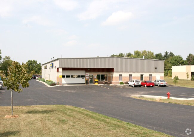
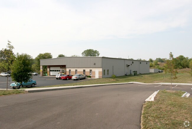
Property Detail
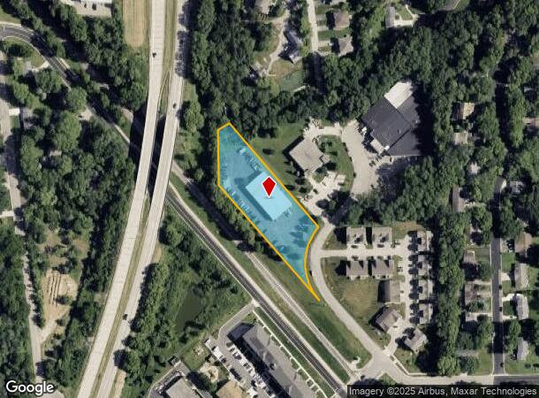
5402 Paulson Rd
Madison, WI
LOT 1 CSM 9597 CS55/100&103-2/4/2000 DESCR AS SEC 34-7-10 PRT SE1/4SW1/4 (1.58 A CRES) SUBJ TO ACCESS ESMT IN DOC #3191720
0710-343-9885-1
Dane
Commercialnec
Wisconsin
X
1
55025C0443J
1.58 AC
2024
Southeast Madison
2024
Milwaukee/Madison
010504
DEMOGRAPHICS near 5402 Paulson Rd
1 Mile
3 Mile
5 Mile
2024 Total Population
7,542
21,000
60,914
2029 Population
7,838
21,829
63,258
Pop Growth 2024-2029
+ 3.92%
+ 3.95%
+ 3.85%
Average Age
39
40
41
2024 Total Households
3,082
8,813
26,601
HH Growth 2024-2029
+ 4.06%
+ 4.07%
+ 3.97%
Median Household Inc
$85,303
$84,326
$79,217
Avg Household Size
2.40
2.30
2.20
2024 Avg HH Vehicles
2.00
2.00
2.00
Median Home Value
$326,654
$325,139
$302,373
Median Year Built
1991
1986
1978
Nearby Places
Map Layers
Map Styles
 Street
 Aerial
- Restaurants
- Banks
- Shops
- Fitness
- Groceries
PUBLIC TRANSPORTATION
AIRPORT
Dane County Regional/Truax Field
DRIVE
WALK
Distance
Dane County Regional/Truax Field
19 min
10.7 mi
Nearby Properties
Address
Land Use
TOTAL SIZE
Lot Size
Zoning
Address
Land Use
TOTAL SIZE
Lot Size
Zoning
168,685 SF
14.05 AC
IL
Address
Land Use
TOTAL SIZE
Lot Size
Zoning
2.03 AC
Address
Land Use
TOTAL SIZE
Lot Size
Zoning
3.59 AC
Address
Land Use
TOTAL SIZE
Lot Size
Zoning
2.38 AC
Address
Land Use
TOTAL SIZE
Lot Size
Zoning
19.81 AC
Address
Land Use
TOTAL SIZE
Lot Size
Zoning
5.53 AC
Address
Land Use
TOTAL SIZE
Lot Size
Zoning
3.49 AC
Address
Land Use
TOTAL SIZE
Lot Size
Zoning
6,868 SF
18.35 AC
IL
Address
Land Use
TOTAL SIZE
Lot Size
Zoning
202,800 SF
13.05 AC
IL
Address
Land Use
TOTAL SIZE
Lot Size
Zoning
16.40 AC
IL
Address
Land Use
TOTAL SIZE
Lot Size
Zoning
10.45 AC
IL
Address
Land Use
TOTAL SIZE
Lot Size
Zoning
49,562 SF
4.42 AC
SE
Address
Land Use
TOTAL SIZE
Lot Size
Zoning
17,980 SF
6.25 AC
SR-V2
Address
Land Use
TOTAL SIZE
Lot Size
Zoning
9,030 SF
6.59 AC
SR-V2
Address
Land Use
TOTAL SIZE
Lot Size
Zoning
42,967 SF
5.25 AC
SR-V2
Address
Land Use
TOTAL SIZE
Lot Size
Zoning
113,341 SF
11.66 AC
IL
Address
Land Use
TOTAL SIZE
Lot Size
Zoning
131,874 SF
8.98 AC
IL
Address
Land Use
TOTAL SIZE
Lot Size
Zoning
105,480 SF
3.20 AC
SR-V2
Address
Land Use
TOTAL SIZE
Lot Size
Zoning
14.34 AC
IL
Address
Land Use
TOTAL SIZE
Lot Size
Zoning
11.76 AC
Address
Land Use
TOTAL SIZE
Lot Size
Zoning
9.89 AC
Address
Land Use
TOTAL SIZE
Lot Size
Zoning
1.23 AC
Address
Land Use
TOTAL SIZE
Lot Size
Zoning
7.98 AC
Address
Land Use
TOTAL SIZE
Lot Size
Zoning
221,410 SF
19.70 AC
IL
Address
Land Use
TOTAL SIZE
Lot Size
Zoning
54,160 SF
6.06 AC
SR-V2
Address
Land Use
TOTAL SIZE
Lot Size
Zoning
7.24 AC
C-2
Address
Land Use
TOTAL SIZE
Lot Size
Zoning
14,946 SF
13.29 AC
IG
Address
Land Use
TOTAL SIZE
Lot Size
Zoning
3,600 SF
50.85 AC
PMHP
The World's #1 Commercial Real Estate Marketplace
Connect with us
© 2025 CoStar Group
The information above has been obtained from sources believed reliable. While we do not doubt its accuracy we have not verified it and make no guarantee, warranty or representation about it. It is your responsibility to independently confirm its accuracy and completeness. Any projections, opinions, assumptions, or estimates used are for example only and do not represent the current or future performance of the property. The value of this transaction to you depends on tax and other factors which should be evaluated by your tax, financial, and legal advisors. You and your advisors should conduct a careful, independent investigation of the property to determine to your satisfaction the suitability of the property for your needs.