Property Record
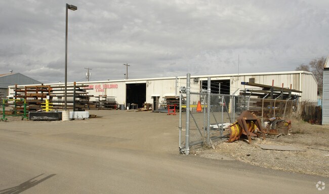
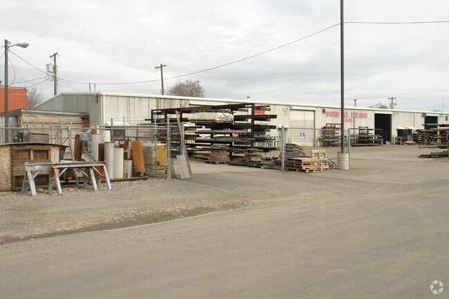
5403 E Boone Ave, Spokane, WA 99212

Property Detail
5403 E Boone Ave
35141.0922
TOWN OF YARDLEY LTS 4 THRU 7 & THE E1/2 LT 8 BLK 20, TOGETHER WITH THE S1/2 OF VAC ALLEY LYG NLY & ADJ TO SD LTS & INC N1/2 VAC BOONE AVE LYG S OF & ADJ
Industrialgeneral
SPOKANE
I-2
Washington
B and X Area of moderate flood hazard, usually the area between the limits of the 100-year and 500-year floods.
4-7,8
2025
0.84 AC
2025
Valley
012200
Spokane
13,456 SF
Spokane-Spokane Valley, WA
NEARBY LISTINGS FOR SALE OR LEASE
DEMOGRAPHICS near 5403 E Boone Ave
1 mile
3 mile
5 mile
2025 Total Population
2,205
66,567
227,145
2030 Population
2,246
67,670
231,119
Pop Growth 2025-2030
+ 1.86%
+ 1.66%
+ 1.75%
Average Age
36
40
40
2025 Total Households
999
26,326
94,218
HH Growth 2025-2030
+ 1.80%
+ 1.64%
+ 1.88%
Median Household Inc
$60,239
$66,177
$64,523
Avg Household Size
2.20
2.40
2.30
2025 Avg HH Vehicles
2.00
2.00
2.00
Median Home Value
$271,276
$348,148
$372,271
Median Year Built
1995
1969
1971
Nearby Places
Map Layers
Map Styles
 Street
 Aerial
Layers
 Traffic
 Biking
Places
Listings with unknown addresses are not visible on the map
- Restaurants
- Banks
- Shops
- Fitness
- Groceries
PUBLIC TRANSPORTATION
COMMUTER RAIL
Drive
Walk
Distance
11 min
5.8 mi
AIRPORT
Spokane International
Drive
Walk
Distance
Spokane International
18 min
11.6 mi
Nearby Properties
Address
Land Use
TOTAL SIZE
Lot Size
Zoning
Address
Land Use
TOTAL SIZE
Lot Size
Zoning
917,113 SF
100.67 AC
LI
Address
Land Use
TOTAL SIZE
Lot Size
Zoning
365,804 SF
16.13 AC
RSF
Address
Land Use
TOTAL SIZE
Lot Size
Zoning
427,054 SF
16.60 AC
LI
Address
Land Use
TOTAL SIZE
Lot Size
Zoning
251,542 SF
5.78 AC
DTG
Address
Land Use
TOTAL SIZE
Lot Size
Zoning
310,606 SF
27.56 AC
RMF
Address
Land Use
TOTAL SIZE
Lot Size
Zoning
180,822 SF
16.11 AC
CC1
Address
Land Use
TOTAL SIZE
Lot Size
Zoning
355,192 SF
35.83 AC
I-2
Address
Land Use
TOTAL SIZE
Lot Size
Zoning
379,678 SF
20.64 AC
LI
Address
Land Use
TOTAL SIZE
Lot Size
Zoning
378,750 SF
17.38 AC
R-2
Address
Land Use
TOTAL SIZE
Lot Size
Zoning
91,310 SF
2.34 AC
Address
Land Use
TOTAL SIZE
Lot Size
Zoning
108,237 SF
3.48 AC
LI
Address
Land Use
TOTAL SIZE
Lot Size
Zoning
58,522 SF
19.91 AC
HI
Address
Land Use
TOTAL SIZE
Lot Size
Zoning
134,806 SF
7.79 AC
RMF
Address
Land Use
TOTAL SIZE
Lot Size
Zoning
96,424 SF
9.04 AC
I-1
Address
Land Use
TOTAL SIZE
Lot Size
Zoning
75,680 SF
3.93 AC
RSF
Address
Land Use
TOTAL SIZE
Lot Size
Zoning
107,442 SF
5.57 AC
MF-2
Address
Land Use
TOTAL SIZE
Lot Size
Zoning
133,043 SF
1.85 AC
CC1
Address
Land Use
TOTAL SIZE
Lot Size
Zoning
134,104 SF
5.89 AC
HDR
Address
Land Use
TOTAL SIZE
Lot Size
Zoning
150,812 SF
17.49 AC
RC
Address
Land Use
TOTAL SIZE
Lot Size
Zoning
107,539 SF
7.54 AC
RMF
Address
Land Use
TOTAL SIZE
Lot Size
Zoning
50,179 SF
5.54 AC
RSF
Address
Land Use
TOTAL SIZE
Lot Size
Zoning
102,441 SF
8.38 AC
Address
Land Use
TOTAL SIZE
Lot Size
Zoning
118,818 SF
7.96 AC
HDR
Address
Land Use
TOTAL SIZE
Lot Size
Zoning
138,078 SF
8.44 AC
HI
Address
Land Use
TOTAL SIZE
Lot Size
Zoning
60,484 SF
2.38 AC
LI
Address
Land Use
TOTAL SIZE
Lot Size
Zoning
91,811 SF
6.02 AC
LI
Address
Land Use
TOTAL SIZE
Lot Size
Zoning
71,803 SF
2.34 AC
RMF
Address
Land Use
TOTAL SIZE
Lot Size
Zoning
104,760 SF
6.96 AC
HDR
Address
Land Use
TOTAL SIZE
Lot Size
Zoning
38,889 SF
114.18 AC
LI
Address
Land Use
TOTAL SIZE
Lot Size
Zoning
200 SF
159.15 AC
LI
The World's #1 Commercial Real Estate Marketplace
Connect with us
© 2026 CoStar Group
The information above has been obtained from sources believed reliable. While we do not doubt its accuracy we have not verified it and make no guarantee, warranty or representation about it. It is your responsibility to independently confirm its accuracy and completeness. Any projections, opinions, assumptions, or estimates used are for example only and do not represent the current or future performance of the property. The value of this transaction to you depends on tax and other factors which should be evaluated by your tax, financial, and legal advisors. You and your advisors should conduct a careful, independent investigation of the property to determine to your satisfaction the suitability of the property for your needs.