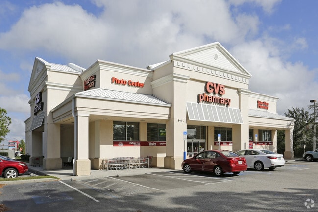
Property Record
5403 University Pkwy, University Park, FL 34201

NEARBY LISTINGS FOR SALE OR LEASE
-
-
View all University Park listings for sale on LoopNet.com
Property Detail
5403 University Pkwy
20541-0040-9
A PARCEL OF LAND LOCATED IN THE SW 1/4 OF SEC 36, TWN 35, RNG 18, DESC AS FOLLOWS: COM AT THE SW COR OF SD SW 1/4 OF SEC 36, A PT ON THE N R/W LN OF UNIVERSITY PKWY (SR 610); TH
Storebuilding
Manatee
AE
Florida
12115C0064G
2.18 AC
2024
Manatee
2025
Tampa/St Petersburg
000810
North Port-Sarasota-Bradenton, FL
11,765 SF
DEMOGRAPHICS near 5403 University Pkwy
1 Mile
3 Mile
5 Mile
2024 Total Population
4,145
46,606
135,568
2029 Population
4,784
53,823
157,088
Pop Growth 2024-2029
+ 15.42%
+ 15.49%
+ 15.87%
Average Age
53
52
48
2024 Total Households
2,089
22,353
60,609
HH Growth 2024-2029
+ 15.17%
+ 15.01%
+ 15.42%
Median Household Inc
$75,987
$80,019
$78,174
Avg Household Size
1.90
2.00
2.10
2024 Avg HH Vehicles
2.00
2.00
2.00
Median Home Value
$397,499
$365,533
$341,719
Median Year Built
1999
1994
1994
Nearby Places
Map Layers
Map Styles
 Street
 Aerial
- Restaurants
- Banks
- Shops
- Fitness
- Groceries
PUBLIC TRANSPORTATION
AIRPORT
Sarasota/Bradenton International
DRIVE
WALK
Distance
Sarasota/Bradenton International
15 min
7.4 mi
Freight Ports
Port Manatee
DRIVE
WALK
Distance
Port Manatee
32 min
21.9 mi
Nearby Properties
Address
Land Use
TOTAL SIZE
Lot Size
Zoning
Address
Land Use
TOTAL SIZE
Lot Size
Zoning
668,194 SF
45.91 AC
CG
Address
Land Use
TOTAL SIZE
Lot Size
Zoning
434,419 SF
49.04 AC
CG
Address
Land Use
TOTAL SIZE
Lot Size
Zoning
617,341 SF
76.40 AC
PD-MU
Address
Land Use
TOTAL SIZE
Lot Size
Zoning
332,686 SF
37.78 AC
VPD
Address
Land Use
TOTAL SIZE
Lot Size
Zoning
486,203 SF
40.94 AC
RMF3
Address
Land Use
TOTAL SIZE
Lot Size
Zoning
228,240 SF
23.48 AC
Address
Land Use
TOTAL SIZE
Lot Size
Zoning
349,363 SF
22.58 AC
VPD
Address
Land Use
TOTAL SIZE
Lot Size
Zoning
483,594 SF
23.32 AC
PD-MU
Address
Land Use
TOTAL SIZE
Lot Size
Zoning
326,645 SF
17.96 AC
RMF3
Address
Land Use
TOTAL SIZE
Lot Size
Zoning
272,602 SF
28.35 AC
PD-R
Address
Land Use
TOTAL SIZE
Lot Size
Zoning
353,888 SF
22.83 AC
PD-MU
Address
Land Use
TOTAL SIZE
Lot Size
Zoning
358,441 SF
31.80 AC
PD-R
Address
Land Use
TOTAL SIZE
Lot Size
Zoning
303,515 SF
36.98 AC
PD-MU
Address
Land Use
TOTAL SIZE
Lot Size
Zoning
313,441 SF
26.91 AC
RSF2
Address
Land Use
TOTAL SIZE
Lot Size
Zoning
296,343 SF
26.53 AC
PD-R
Address
Land Use
TOTAL SIZE
Lot Size
Zoning
251,472 SF
11 AC
RSF2
Address
Land Use
TOTAL SIZE
Lot Size
Zoning
207,583 SF
9.48 AC
Address
Land Use
TOTAL SIZE
Lot Size
Zoning
204,843 SF
27.48 AC
PCD
Address
Land Use
TOTAL SIZE
Lot Size
Zoning
223,054 SF
21.72 AC
Address
Land Use
TOTAL SIZE
Lot Size
Zoning
235,824 SF
71.44 AC
PD-MU
Address
Land Use
TOTAL SIZE
Lot Size
Zoning
128,638 SF
59.55 AC
PCD
Address
Land Use
TOTAL SIZE
Lot Size
Zoning
76,844 SF
6.79 AC
PCD
Address
Land Use
TOTAL SIZE
Lot Size
Zoning
11,248 SF
541.47 AC
GU
Address
Land Use
TOTAL SIZE
Lot Size
Zoning
126,111 SF
38.38 AC
RSF2
Address
Land Use
TOTAL SIZE
Lot Size
Zoning
63,064 SF
33.29 AC
GU
Address
Land Use
TOTAL SIZE
Lot Size
Zoning
75,197 SF
6.46 AC
PCD
Address
Land Use
TOTAL SIZE
Lot Size
Zoning
160,328 SF
11.75 AC
RMF-6 MULT
Address
Land Use
TOTAL SIZE
Lot Size
Zoning
190,299 SF
4.43 AC
PD-MU
Address
Land Use
TOTAL SIZE
Lot Size
Zoning
155,000 SF
23.72 AC
PD-C
Address
Land Use
TOTAL SIZE
Lot Size
Zoning
143,277 SF
21.39 AC
PCD
The World's #1 Commercial Real Estate Marketplace
Connect with us
© 2025 CoStar Group
The information above has been obtained from sources believed reliable. While we do not doubt its accuracy we have not verified it and make no guarantee, warranty or representation about it. It is your responsibility to independently confirm its accuracy and completeness. Any projections, opinions, assumptions, or estimates used are for example only and do not represent the current or future performance of the property. The value of this transaction to you depends on tax and other factors which should be evaluated by your tax, financial, and legal advisors. You and your advisors should conduct a careful, independent investigation of the property to determine to your satisfaction the suitability of the property for your needs.