Property Record
5408 Martindale Rd, Shawnee, KS 66218


This Property Is For Sale
NEARBY LISTINGS FOR SALE OR LEASE
-
-
-
-
-
-
-
No Photo
-
View all Shawnee listings for sale on LoopNet.com
Property Detail
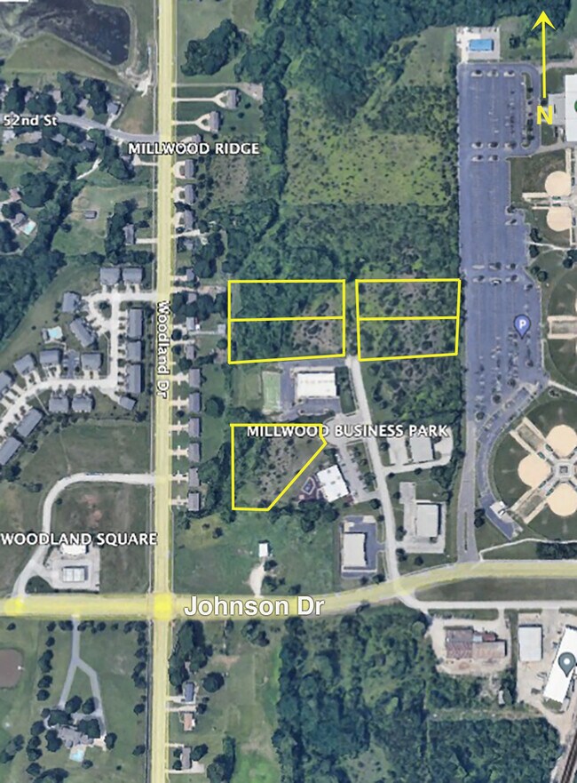
5408 Martindale Rd
Kansas City, MO-KS
Millwood Business Park Second
QP44550001-0003
MILLWOOD BUSINESS PARK SECOND PLAT LT 3 BLK 1 SHC 122 1 1 3
Industrialgeneral
Johnson
X
Kansas
20209C0140E
3
2024
2.44 AC
2024
Northwest Johnson County
052610
Kansas City
DEMOGRAPHICS near 5408 Martindale Rd
1 Mile
3 Mile
5 Mile
2024 Total Population
7,065
30,880
73,162
2029 Population
7,281
31,787
75,318
Pop Growth 2024-2029
+ 3.06%
+ 2.94%
+ 2.95%
Average Age
35
37
39
2024 Total Households
2,206
10,503
27,032
HH Growth 2024-2029
+ 3.13%
+ 3.04%
+ 2.97%
Median Household Inc
$144,423
$120,579
$108,044
Avg Household Size
3.20
2.90
2.70
2024 Avg HH Vehicles
2.00
2.00
2.00
Median Home Value
$327,764
$340,231
$345,003
Median Year Built
2001
1998
1994
Nearby Places
Map Layers
Map Styles
 Street
 Aerial
- Restaurants
- Banks
- Shops
- Fitness
- Groceries
PUBLIC TRANSPORTATION
AIRPORT
Kansas City International
DRIVE
WALK
Distance
Kansas City International
40 min
32.1 mi
Freight Ports
Tulsa Port Of Catoosa
DRIVE
WALK
Distance
Tulsa Port Of Catoosa
264 min
234.7 mi
Nearby Properties
Address
Land Use
TOTAL SIZE
Lot Size
Zoning
Address
Land Use
TOTAL SIZE
Lot Size
Zoning
202,945 SF
30.29 AC
AG
Address
Land Use
TOTAL SIZE
Lot Size
Zoning
83,537 SF
27.65 AC
AG
Address
Land Use
TOTAL SIZE
Lot Size
Zoning
108,062 SF
14.76 AC
AG
Address
Land Use
TOTAL SIZE
Lot Size
Zoning
276,310 SF
23.27 AC
PI
Address
Land Use
TOTAL SIZE
Lot Size
Zoning
274,379 SF
17.32 AC
Address
Land Use
TOTAL SIZE
Lot Size
Zoning
32,186 SF
2.80 AC
CH
Address
Land Use
TOTAL SIZE
Lot Size
Zoning
50,750 SF
42.95 AC
I-1
Address
Land Use
TOTAL SIZE
Lot Size
Zoning
100,591 SF
33.88 AC
AG
Address
Land Use
TOTAL SIZE
Lot Size
Zoning
67,336 SF
26.85 AC
AG
Address
Land Use
TOTAL SIZE
Lot Size
Zoning
75,626 SF
17.48 AC
AG
Address
Land Use
TOTAL SIZE
Lot Size
Zoning
79,697 SF
11.36 AC
PSF
Address
Land Use
TOTAL SIZE
Lot Size
Zoning
66,916 SF
14.72 AC
AG
Address
Land Use
TOTAL SIZE
Lot Size
Zoning
80,190 SF
16.86 AC
R-1
Address
Land Use
TOTAL SIZE
Lot Size
Zoning
69,923 SF
11.99 AC
AG
Address
Land Use
TOTAL SIZE
Lot Size
Zoning
170,000 SF
12.71 AC
PI
Address
Land Use
TOTAL SIZE
Lot Size
Zoning
170,000 SF
12.71 AC
PI
Address
Land Use
TOTAL SIZE
Lot Size
Zoning
170,000 SF
14.87 AC
PI
Address
Land Use
TOTAL SIZE
Lot Size
Zoning
170,000 SF
12.72 AC
PI
Address
Land Use
TOTAL SIZE
Lot Size
Zoning
34,641 SF
14.33 AC
AG
Address
Land Use
TOTAL SIZE
Lot Size
Zoning
658,206 SF
56.76 AC
ER1
Address
Land Use
TOTAL SIZE
Lot Size
Zoning
285,041 SF
109.90 AC
EI1
Address
Land Use
TOTAL SIZE
Lot Size
Zoning
52,710 SF
29.55 AC
AG
Address
Land Use
TOTAL SIZE
Lot Size
Zoning
376,094 SF
22.93 AC
Address
Land Use
TOTAL SIZE
Lot Size
Zoning
22,616 SF
31.78 AC
AG
Address
Land Use
TOTAL SIZE
Lot Size
Zoning
59,640 SF
12.92 AC
PI
Address
Land Use
TOTAL SIZE
Lot Size
Zoning
12,746 SF
8.99 AC
AG
Address
Land Use
TOTAL SIZE
Lot Size
Zoning
19,003 SF
4.47 AC
CH
Address
Land Use
TOTAL SIZE
Lot Size
Zoning
280,000 SF
24.54 AC
Address
Land Use
TOTAL SIZE
Lot Size
Zoning
5,940 SF
77.81 AC
PI
Address
Land Use
TOTAL SIZE
Lot Size
Zoning
28,390 SF
9.85 AC
AG
The World's #1 Commercial Real Estate Marketplace
Connect with us
© 2025 CoStar Group
The information above has been obtained from sources believed reliable. While we do not doubt its accuracy we have not verified it and make no guarantee, warranty or representation about it. It is your responsibility to independently confirm its accuracy and completeness. Any projections, opinions, assumptions, or estimates used are for example only and do not represent the current or future performance of the property. The value of this transaction to you depends on tax and other factors which should be evaluated by your tax, financial, and legal advisors. You and your advisors should conduct a careful, independent investigation of the property to determine to your satisfaction the suitability of the property for your needs.