Property Record
5409 Nehi Rd, Panama City, FL 32404


NEARBY LISTINGS FOR SALE OR LEASE
-
-
View all Panama City listings for sale on LoopNet.com
Property Detail
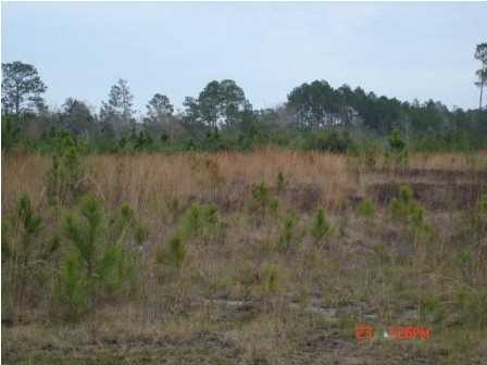
5409 Nehi Rd
05906-020-000
Cherokee Heights
Agriculturalland
17 3S 13W -1.2- 129 ST AND BAY DEV CO PLAT COM AT NE COR OF SEC TH W 1640 FOR POB TH CONT W 1626.20 TO E R/W LN OF CHEROKEE HEIGHTS RD TH S 1292.17 E 1574.07 TH N 1280.99 TO POB ORB 3861 P 351
A
Bay
12005C0352J
Florida
2024
47.64 AC
2025
Panama City
000500
Other Market Areas
6,320 SF
Panama City-Panama City Beach, FL
DEMOGRAPHICS near 5409 Nehi Rd
1 Mile
3 Mile
5 Mile
2024 Total Population
1,538
10,239
30,661
2029 Population
1,684
11,071
32,579
Pop Growth 2024-2029
+ 9.49%
+ 8.13%
+ 6.26%
Average Age
37
39
39
2024 Total Households
443
3,284
10,633
HH Growth 2024-2029
+ 10.38%
+ 8.71%
+ 6.67%
Median Household Inc
$80,819
$80,201
$71,877
Avg Household Size
2.80
2.80
2.70
2024 Avg HH Vehicles
2.00
2.00
2.00
Median Home Value
$260,263
$256,942
$230,846
Median Year Built
2006
1999
1995
Nearby Places
Map Layers
Map Styles
 Street
 Aerial
- Restaurants
- Banks
- Shops
- Fitness
- Groceries
PUBLIC TRANSPORTATION
AIRPORT
Northwest Florida Beaches International
DRIVE
WALK
Distance
Northwest Florida Beaches International
32 min
20.4 mi
Freight Ports
Port of Panama City
DRIVE
WALK
Distance
Port of Panama City
21 min
11.4 mi
Nearby Properties
Address
Land Use
TOTAL SIZE
Lot Size
Zoning
Address
Land Use
TOTAL SIZE
Lot Size
Zoning
38,588 SF
41.15 AC
BC15
Address
Land Use
TOTAL SIZE
Lot Size
Zoning
271,159 SF
24.36 AC
PC16
Address
Land Use
TOTAL SIZE
Lot Size
Zoning
277,246 SF
16 AC
BC15
Address
Land Use
TOTAL SIZE
Lot Size
Zoning
53,562 SF
14.22 AC
Address
Land Use
TOTAL SIZE
Lot Size
Zoning
185,884 SF
24 AC
BC15
Address
Land Use
TOTAL SIZE
Lot Size
Zoning
123,392 SF
15 AC
BC14
Address
Land Use
TOTAL SIZE
Lot Size
Zoning
112,836 SF
20 AC
UND
Address
Land Use
TOTAL SIZE
Lot Size
Zoning
57,807 SF
11.64 AC
UND
Address
Land Use
TOTAL SIZE
Lot Size
Zoning
75,725 SF
4.58 AC
Address
Land Use
TOTAL SIZE
Lot Size
Zoning
45,836 SF
8.99 AC
BC05
Address
Land Use
TOTAL SIZE
Lot Size
Zoning
45,503 SF
4.83 AC
BC14
Address
Land Use
TOTAL SIZE
Lot Size
Zoning
108,544 SF
35.95 AC
PI
Address
Land Use
TOTAL SIZE
Lot Size
Zoning
39,632 SF
6.45 AC
PC09
Address
Land Use
TOTAL SIZE
Lot Size
Zoning
443.25 AC
UND
Address
Land Use
TOTAL SIZE
Lot Size
Zoning
80,004 SF
10 AC
BC14
Address
Land Use
TOTAL SIZE
Lot Size
Zoning
76,921 SF
12 AC
BC06
Address
Land Use
TOTAL SIZE
Lot Size
Zoning
216.22 AC
R1
Address
Land Use
TOTAL SIZE
Lot Size
Zoning
37,225 SF
154.53 AC
BC14
Address
Land Use
TOTAL SIZE
Lot Size
Zoning
330.52 AC
Address
Land Use
TOTAL SIZE
Lot Size
Zoning
2,895 SF
97.83 AC
Address
Land Use
TOTAL SIZE
Lot Size
Zoning
40,555 SF
37.50 AC
BC14
Address
Land Use
TOTAL SIZE
Lot Size
Zoning
3,192 SF
23.53 AC
C3A
Address
Land Use
TOTAL SIZE
Lot Size
Zoning
31,236 SF
41.49 AC
UND
Address
Land Use
TOTAL SIZE
Lot Size
Zoning
169.62 AC
BC15
Address
Land Use
TOTAL SIZE
Lot Size
Zoning
12,948 SF
238.33 AC
BC14
Address
Land Use
TOTAL SIZE
Lot Size
Zoning
11,845 SF
2.32 AC
BC05
Address
Land Use
TOTAL SIZE
Lot Size
Zoning
18,125 SF
18 AC
AG2
Address
Land Use
TOTAL SIZE
Lot Size
Zoning
14,370 SF
9.30 AC
UND
Address
Land Use
TOTAL SIZE
Lot Size
Zoning
29,352 SF
5 AC
BC05
Address
Land Use
TOTAL SIZE
Lot Size
Zoning
6,812 SF
0.86 AC
R1
The World's #1 Commercial Real Estate Marketplace
Connect with us
© 2026 CoStar Group
The information above has been obtained from sources believed reliable. While we do not doubt its accuracy we have not verified it and make no guarantee, warranty or representation about it. It is your responsibility to independently confirm its accuracy and completeness. Any projections, opinions, assumptions, or estimates used are for example only and do not represent the current or future performance of the property. The value of this transaction to you depends on tax and other factors which should be evaluated by your tax, financial, and legal advisors. You and your advisors should conduct a careful, independent investigation of the property to determine to your satisfaction the suitability of the property for your needs.