Property Record
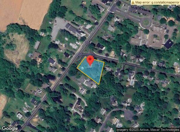
541 Main St, Portland, CT 06480


NEARBY LISTINGS FOR SALE OR LEASE
Property Detail
541 Main St
Hartford-West Hartford-East Hartford, CT
Middlesex
PORT-000048-000000-000137
Connecticut
Sfr
0.89 AC
X
NW Middlesex/Middletown
09007C0128G
Hartford
2,118 SF
DEMOGRAPHICS near 541 Main St
1 Mile
3 Mile
5 Mile
2024 Total Population
4,463
32,919
94,719
2029 Population
4,427
32,935
94,418
Pop Growth 2024-2029
(0.81%)
+ 0.05%
(0.32%)
Average Age
44
42
42
2024 Total Households
1,802
14,328
40,192
HH Growth 2024-2029
(0.94%)
+ 0.01%
(0.28%)
Median Household Inc
$118,156
$90,760
$88,647
Avg Household Size
2.40
2.20
2.20
2024 Avg HH Vehicles
2.00
2.00
2.00
Median Home Value
$297,286
$267,735
$288,357
Median Year Built
1970
1978
1974
Nearby Places
Map Layers
Map Styles
 Street
 Aerial
- Restaurants
- Banks
- Shops
- Fitness
- Groceries
PUBLIC TRANSPORTATION
AIRPORT
Tweed/New Haven
DRIVE
WALK
Distance
Tweed/New Haven
47 min
32.6 mi
Bradley International
DRIVE
WALK
Distance
Bradley International
55 min
35.4 mi
Freight Ports
Port of New Haven
DRIVE
WALK
Distance
Port of New Haven
42 min
30.3 mi
SALE & LEASE HISTORY
LISTING DATE
SALE/LEASE

Sep 25, 2020
For Sale
Nearby Properties
Address
Land Use
TOTAL SIZE
Lot Size
Zoning
Address
Land Use
TOTAL SIZE
Lot Size
Zoning
32 AC
R-45
Address
Land Use
TOTAL SIZE
Lot Size
Zoning
65.89 AC
R-45
Address
Land Use
TOTAL SIZE
Lot Size
Zoning
105 AC
R-45
Address
Land Use
TOTAL SIZE
Lot Size
Zoning
33,524 SF
37.71 AC
ID
Address
Land Use
TOTAL SIZE
Lot Size
Zoning
0.56 AC
B-1
Address
Land Use
TOTAL SIZE
Lot Size
Zoning
2.33 AC
ID
Address
Land Use
TOTAL SIZE
Lot Size
Zoning
27.21 AC
M
Address
Land Use
TOTAL SIZE
Lot Size
Zoning
4.90 AC
ID
Address
Land Use
TOTAL SIZE
Lot Size
Zoning
7.79 AC
ID
Address
Land Use
TOTAL SIZE
Lot Size
Zoning
1.62 AC
ID
Address
Land Use
TOTAL SIZE
Lot Size
Zoning
65,615 SF
1.46 AC
ID
Address
Land Use
TOTAL SIZE
Lot Size
Zoning
10.10 AC
IND
Address
Land Use
TOTAL SIZE
Lot Size
Zoning
3.58 AC
DVD
Address
Land Use
TOTAL SIZE
Lot Size
Zoning
24.45 AC
HB
Address
Land Use
TOTAL SIZE
Lot Size
Zoning
102,239 SF
1.02 AC
B-1
Address
Land Use
TOTAL SIZE
Lot Size
Zoning
83,241 SF
52.65 AC
R-15
Address
Land Use
TOTAL SIZE
Lot Size
Zoning
161,959 SF
45.61 AC
R-25
Address
Land Use
TOTAL SIZE
Lot Size
Zoning
15,395 SF
158.10 AC
R-25
Address
Land Use
TOTAL SIZE
Lot Size
Zoning
88,369 SF
26 AC
R-15
Address
Land Use
TOTAL SIZE
Lot Size
Zoning
80,627 SF
10.54 AC
HB
Address
Land Use
TOTAL SIZE
Lot Size
Zoning
146.96 AC
IND
Address
Land Use
TOTAL SIZE
Lot Size
Zoning
37.25 AC
R-25
Address
Land Use
TOTAL SIZE
Lot Size
Zoning
177,765 SF
1.10 AC
B-1
Address
Land Use
TOTAL SIZE
Lot Size
Zoning
2.98 AC
ID
Address
Land Use
TOTAL SIZE
Lot Size
Zoning
58,398 SF
4.80 AC
R-15
Address
Land Use
TOTAL SIZE
Lot Size
Zoning
19,161 SF
0.82 AC
DVD
Address
Land Use
TOTAL SIZE
Lot Size
Zoning
110,708 SF
2.99 AC
MXC
Address
Land Use
TOTAL SIZE
Lot Size
Zoning
32,640 SF
1.80 AC
B-1
Address
Land Use
TOTAL SIZE
Lot Size
Zoning
19,258 SF
1.11 AC
IRA
Address
Land Use
TOTAL SIZE
Lot Size
Zoning
26,736 SF
0.46 AC
MXC
The World's #1 Commercial Real Estate Marketplace
Connect with us
© 2025 CoStar Group
The information above has been obtained from sources believed reliable. While we do not doubt its accuracy we have not verified it and make no guarantee, warranty or representation about it. It is your responsibility to independently confirm its accuracy and completeness. Any projections, opinions, assumptions, or estimates used are for example only and do not represent the current or future performance of the property. The value of this transaction to you depends on tax and other factors which should be evaluated by your tax, financial, and legal advisors. You and your advisors should conduct a careful, independent investigation of the property to determine to your satisfaction the suitability of the property for your needs.