Property Record
541 Locklear St, Lumberton, NC 28358
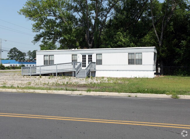


Property Detail
541 Locklear St
3225-02-007
A LOCKLEAR ST LARRY S
Autorepair
ROBESON
B4
North Carolina
AH Areas with a 1% annual chance of shallow flooding, usually in the form of a pond, withan average depth ranging from 1 to 3 feet. These areas have a 26% chance of flooding over the life of a 30-year mortgage.
1.84 AC
2025
North Carolina Southeast Area
2025
Other Market Areas
960801
Lumberton, NC
2,560 SF
NEARBY LISTINGS FOR SALE OR LEASE
-
-
View all Lumberton listings for sale on LoopNet.com
DEMOGRAPHICS near 541 Locklear St
1 mile
3 mile
5 mile
2025 Total Population
3,658
21,012
32,215
2030 Population
3,859
21,876
33,408
Pop Growth 2025-2030
+ 5.49%
+ 4.11%
+ 3.70%
Average Age
38
39
39
2025 Total Households
1,551
8,133
12,349
HH Growth 2025-2030
+ 5.29%
+ 4.30%
+ 3.85%
Median Household Inc
$33,614
$42,368
$45,947
Avg Household Size
2.30
2.40
2.40
2025 Avg HH Vehicles
1.00
2.00
2.00
Median Home Value
$101,082
$125,288
$124,954
Median Year Built
1969
1975
1980
Nearby Places
Map Layers
Map Styles
 Street
 Aerial
Layers
 Traffic
 Biking
Places
Listings with unknown addresses are not visible on the map
- Restaurants
- Banks
- Shops
- Fitness
- Groceries
PUBLIC TRANSPORTATION
AIRPORT
Fayetteville Regional/Grannis Field
Drive
Walk
Distance
Fayetteville Regional/Grannis Field
39 min
30.2 mi
Freight Ports
Port of Wilmington
Drive
Walk
Distance
Port of Wilmington
106 min
81.0 mi
Nearby Properties
Address
Land Use
TOTAL SIZE
Lot Size
Zoning
Address
Land Use
TOTAL SIZE
Lot Size
Zoning
59,810 SF
7.69 AC
R7
Address
Land Use
TOTAL SIZE
Lot Size
Zoning
116,616 SF
10.18 AC
B6
Address
Land Use
TOTAL SIZE
Lot Size
Zoning
82,115 SF
39.22 AC
R15
Address
Land Use
TOTAL SIZE
Lot Size
Zoning
24,173 SF
44.32 AC
B3
Address
Land Use
TOTAL SIZE
Lot Size
Zoning
234,074 SF
63.48 AC
M2
Address
Land Use
TOTAL SIZE
Lot Size
Zoning
204,470 SF
18.21 AC
B4
Address
Land Use
TOTAL SIZE
Lot Size
Zoning
10,197 SF
417.66 AC
M1
Address
Land Use
TOTAL SIZE
Lot Size
Zoning
134,160 SF
0.26 AC
B6
Address
Land Use
TOTAL SIZE
Lot Size
Zoning
39,628 SF
34.85 AC
M2
Address
Land Use
TOTAL SIZE
Lot Size
Zoning
128,531 SF
22.20 AC
B4
Address
Land Use
TOTAL SIZE
Lot Size
Zoning
418,000 SF
31.52 AC
M2
Address
Land Use
TOTAL SIZE
Lot Size
Zoning
139,629 SF
19.05 AC
B4
Address
Land Use
TOTAL SIZE
Lot Size
Zoning
120,000 SF
17.10 AC
M2
Address
Land Use
TOTAL SIZE
Lot Size
Zoning
36,329 SF
16.87 AC
R6
Address
Land Use
TOTAL SIZE
Lot Size
Zoning
60,906 SF
26.55 AC
Address
Land Use
TOTAL SIZE
Lot Size
Zoning
297,300 SF
128.80 AC
M2
Address
Land Use
TOTAL SIZE
Lot Size
Zoning
24,984 SF
41.13 AC
R11
Address
Land Use
TOTAL SIZE
Lot Size
Zoning
90,800 SF
36.65 AC
R20
Address
Land Use
TOTAL SIZE
Lot Size
Zoning
67,728 SF
1.50 AC
B1
Address
Land Use
TOTAL SIZE
Lot Size
Zoning
69,765 SF
9.51 AC
B4
Address
Land Use
TOTAL SIZE
Lot Size
Zoning
2,187 SF
18.75 AC
R3
Address
Land Use
TOTAL SIZE
Lot Size
Zoning
23,442 SF
7.22 AC
R6
Address
Land Use
TOTAL SIZE
Lot Size
Zoning
106,046 SF
31.24 AC
RA
Address
Land Use
TOTAL SIZE
Lot Size
Zoning
158,379 SF
17.47 AC
I2
Address
Land Use
TOTAL SIZE
Lot Size
Zoning
33,546 SF
4.97 AC
B4
Address
Land Use
TOTAL SIZE
Lot Size
Zoning
4,048 SF
12.73 AC
R3
Address
Land Use
TOTAL SIZE
Lot Size
Zoning
88,710 SF
1.11 AC
B1
Address
Land Use
TOTAL SIZE
Lot Size
Zoning
95,143 SF
7.55 AC
B4
Address
Land Use
TOTAL SIZE
Lot Size
Zoning
51,003 SF
8.49 AC
B3
Address
Land Use
TOTAL SIZE
Lot Size
Zoning
59,635 SF
10.24 AC
R11
The World's #1 Commercial Real Estate Marketplace
Connect with us
© 2026 CoStar Group
The information above has been obtained from sources believed reliable. While we do not doubt its accuracy we have not verified it and make no guarantee, warranty or representation about it. It is your responsibility to independently confirm its accuracy and completeness. Any projections, opinions, assumptions, or estimates used are for example only and do not represent the current or future performance of the property. The value of this transaction to you depends on tax and other factors which should be evaluated by your tax, financial, and legal advisors. You and your advisors should conduct a careful, independent investigation of the property to determine to your satisfaction the suitability of the property for your needs.