Property Record
5415 W Dardanella Rd, Sioux Falls, SD 57106


Property Detail
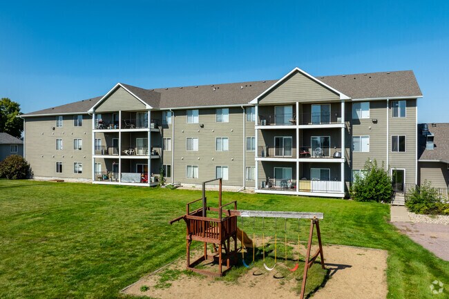
5415 W Dardanella Rd
60115
VAC JUNEAU LANE & 2 BLOCK 9 SILVER VALLEY THIRD ADDN TO CITY OF SIOUX FALLS
Apartment
MINNEHAHA
FP;FP
South Dakota
AE The base floodplain where base flood elevations are provided. AE Zones are now used on new format FIRMs instead of A1-A30 Zones.
2
2025
4.62 AC
2025
Sioux Falls
001002
Other Market Areas
41,134 SF
Sioux Falls, SD-MN
NEARBY LISTINGS FOR SALE OR LEASE
-
-
View all Sioux Falls listings for sale on LoopNet.com
DEMOGRAPHICS near 5415 W Dardanella Rd
1 mile
3 mile
5 mile
2025 Total Population
10,057
78,727
142,840
2030 Population
10,537
83,002
151,800
Pop Growth 2025-2030
+ 4.77%
+ 5.43%
+ 6.27%
Average Age
38
38
38
2025 Total Households
4,206
33,324
59,577
HH Growth 2025-2030
+ 5.30%
+ 5.91%
+ 6.69%
Median Household Inc
$72,901
$66,917
$69,447
Avg Household Size
2.30
2.30
2.30
2025 Avg HH Vehicles
2.00
2.00
2.00
Median Home Value
$253,040
$268,547
$283,695
Median Year Built
1993
1992
1992
Nearby Places
Map Layers
Map Styles
 Street
 Aerial
Layers
 Traffic
 Biking
Places
Listings with unknown addresses are not visible on the map
- Restaurants
- Banks
- Shops
- Fitness
- Groceries
PUBLIC TRANSPORTATION
AIRPORT
Joe Foss Field
Drive
Walk
Distance
Joe Foss Field
23 min
7.2 mi
Freight Ports
Port Milwaukee
Drive
Walk
Distance
Port Milwaukee
552 min
508.3 mi
Nearby Properties
Address
Land Use
TOTAL SIZE
Lot Size
Zoning
Address
Land Use
TOTAL SIZE
Lot Size
Zoning
80,415 SF
13.13 AC
Address
Land Use
TOTAL SIZE
Lot Size
Zoning
Address
Land Use
TOTAL SIZE
Lot Size
Zoning
408,018 SF
53.02 AC
FP;FP
Address
Land Use
TOTAL SIZE
Lot Size
Zoning
8.90 AC
C1;NEIGHBO
Address
Land Use
TOTAL SIZE
Lot Size
Zoning
32,169 SF
9.91 AC
Address
Land Use
TOTAL SIZE
Lot Size
Zoning
9.41 AC
Address
Land Use
TOTAL SIZE
Lot Size
Zoning
317,992 SF
27 AC
Address
Land Use
TOTAL SIZE
Lot Size
Zoning
51,004 SF
3.99 AC
Address
Land Use
TOTAL SIZE
Lot Size
Zoning
201,028 SF
5.42 AC
FP;FP
Address
Land Use
TOTAL SIZE
Lot Size
Zoning
149,610 SF
0.97 AC
Address
Land Use
TOTAL SIZE
Lot Size
Zoning
15.40 AC
MUNICIPALI
Address
Land Use
TOTAL SIZE
Lot Size
Zoning
172,212 SF
15.89 AC
Address
Land Use
TOTAL SIZE
Lot Size
Zoning
80,964 SF
23.34 AC
Address
Land Use
TOTAL SIZE
Lot Size
Zoning
77,853 SF
10.42 AC
Address
Land Use
TOTAL SIZE
Lot Size
Zoning
99,834 SF
6.58 AC
Address
Land Use
TOTAL SIZE
Lot Size
Zoning
100,053 SF
8.50 AC
FP;FP
Address
Land Use
TOTAL SIZE
Lot Size
Zoning
8.57 AC
MUNICIPALI
Address
Land Use
TOTAL SIZE
Lot Size
Zoning
16.45 AC
MUNICIPALI
Address
Land Use
TOTAL SIZE
Lot Size
Zoning
1.66 AC
FP;FP
Address
Land Use
TOTAL SIZE
Lot Size
Zoning
75,786 SF
7.14 AC
Address
Land Use
TOTAL SIZE
Lot Size
Zoning
47,142 SF
6.09 AC
Address
Land Use
TOTAL SIZE
Lot Size
Zoning
7.07 AC
MUNICIPALI
Address
Land Use
TOTAL SIZE
Lot Size
Zoning
3.43 AC
MUNICIPALI
Address
Land Use
TOTAL SIZE
Lot Size
Zoning
220,834 SF
11.46 AC
Address
Land Use
TOTAL SIZE
Lot Size
Zoning
211,577 SF
11.58 AC
Address
Land Use
TOTAL SIZE
Lot Size
Zoning
137,609 SF
22.28 AC
Address
Land Use
TOTAL SIZE
Lot Size
Zoning
201,471 SF
35.38 AC
Address
Land Use
TOTAL SIZE
Lot Size
Zoning
146,719 SF
1.65 AC
Address
Land Use
TOTAL SIZE
Lot Size
Zoning
148,748 SF
17.11 AC
Address
Land Use
TOTAL SIZE
Lot Size
Zoning
26,601 SF
5.31 AC
The World's #1 Commercial Real Estate Marketplace
Connect with us
© 2026 CoStar Group
The information above has been obtained from sources believed reliable. While we do not doubt its accuracy we have not verified it and make no guarantee, warranty or representation about it. It is your responsibility to independently confirm its accuracy and completeness. Any projections, opinions, assumptions, or estimates used are for example only and do not represent the current or future performance of the property. The value of this transaction to you depends on tax and other factors which should be evaluated by your tax, financial, and legal advisors. You and your advisors should conduct a careful, independent investigation of the property to determine to your satisfaction the suitability of the property for your needs.