Property Record
5417 Robbs Ln, Louisville, KY 40219


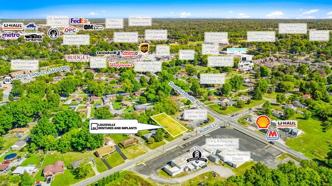
NEARBY LISTINGS FOR SALE OR LEASE
Property Detail
5417 Robbs Ln
064300780000
0.311 AC+- SHEPHERDSVILLE RD
Officebuilding
Jefferson
X
Kentucky
21111C0094F
0.33 AC
2025
South Central
2025
Louisville
011907
Louisville-Jefferson County, KY-IN
1,722 SF
DEMOGRAPHICS near 5417 Robbs Ln
1 Mile
3 Mile
5 Mile
2024 Total Population
9,630
80,514
174,440
2029 Population
9,514
79,695
173,224
Pop Growth 2024-2029
(1.20%)
(1.02%)
(0.70%)
Average Age
42
39
39
2024 Total Households
3,837
31,642
69,903
HH Growth 2024-2029
(1.25%)
(1.08%)
(0.80%)
Median Household Inc
$66,007
$61,402
$59,682
Avg Household Size
2.40
2.50
2.40
2024 Avg HH Vehicles
2.00
2.00
2.00
Median Home Value
$190,217
$174,340
$182,923
Median Year Built
1966
1974
1976
Nearby Places
Map Layers
Map Styles
 Street
 Aerial
- Restaurants
- Banks
- Shops
- Fitness
- Groceries
PUBLIC TRANSPORTATION
AIRPORT
Louisville Muhammad Ali International
DRIVE
WALK
Distance
Louisville Muhammad Ali International
14 min
7.1 mi
Freight Ports
Port of Toledo
DRIVE
WALK
Distance
Port of Toledo
363 min
310.0 mi
SALE & LEASE HISTORY
LISTING DATE
SALE/LEASE

Oct 18, 2022
For Sale
Dec 22, 2021
For Lease
Dec 22, 2021
For Sale
Aug 25, 2022
For Sale
Nearby Properties
Address
Land Use
TOTAL SIZE
Lot Size
Zoning
Address
Land Use
TOTAL SIZE
Lot Size
Zoning
109.84 AC
R5-RESIDEN
Address
Land Use
TOTAL SIZE
Lot Size
Zoning
61.37 AC
C2-COMMERC
Address
Land Use
TOTAL SIZE
Lot Size
Zoning
15 AC
C2-COMMERC
Address
Land Use
TOTAL SIZE
Lot Size
Zoning
35 AC
C2-COMMERC
Address
Land Use
TOTAL SIZE
Lot Size
Zoning
22,076 SF
9.49 AC
R6-RESIDEN
Address
Land Use
TOTAL SIZE
Lot Size
Zoning
127,824 SF
53.76 AC
M2-INDUSTR
Address
Land Use
TOTAL SIZE
Lot Size
Zoning
19.16 AC
Address
Land Use
TOTAL SIZE
Lot Size
Zoning
1,484 SF
17.11 AC
R4-RESIDEN
Address
Land Use
TOTAL SIZE
Lot Size
Zoning
32.44 AC
Address
Land Use
TOTAL SIZE
Lot Size
Zoning
14,166 SF
16.32 AC
C1-COMMERC
Address
Land Use
TOTAL SIZE
Lot Size
Zoning
407,840 SF
25.51 AC
C2-COMMERC
Address
Land Use
TOTAL SIZE
Lot Size
Zoning
4,745 SF
17.95 AC
Address
Land Use
TOTAL SIZE
Lot Size
Zoning
11.17 AC
R6-RESIDEN
Address
Land Use
TOTAL SIZE
Lot Size
Zoning
396,422 SF
23.30 AC
PEC-PLANNE
Address
Land Use
TOTAL SIZE
Lot Size
Zoning
10.22 AC
C1-COMMERC
Address
Land Use
TOTAL SIZE
Lot Size
Zoning
500,000 SF
27.89 AC
Address
Land Use
TOTAL SIZE
Lot Size
Zoning
402,560 SF
23.70 AC
PEC-PLANNE
Address
Land Use
TOTAL SIZE
Lot Size
Zoning
5,200 SF
7.55 AC
R7-RESIDEN
Address
Land Use
TOTAL SIZE
Lot Size
Zoning
1,450 SF
87.64 AC
M2-INDUSTR
Address
Land Use
TOTAL SIZE
Lot Size
Zoning
401,443 SF
28.92 AC
M2-INDUSTR
Address
Land Use
TOTAL SIZE
Lot Size
Zoning
9.44 AC
R5-RESIDEN
Address
Land Use
TOTAL SIZE
Lot Size
Zoning
27.92 AC
EZ1-ENTERP
Address
Land Use
TOTAL SIZE
Lot Size
Zoning
13.68 AC
Address
Land Use
TOTAL SIZE
Lot Size
Zoning
1,411 SF
7.65 AC
OR1-OFFICE
Address
Land Use
TOTAL SIZE
Lot Size
Zoning
15.24 AC
Address
Land Use
TOTAL SIZE
Lot Size
Zoning
370,297 SF
28.31 AC
M2-INDUSTR
Address
Land Use
TOTAL SIZE
Lot Size
Zoning
Address
Land Use
TOTAL SIZE
Lot Size
Zoning
17.17 AC
EZ1-ENTERP
Address
Land Use
TOTAL SIZE
Lot Size
Zoning
3,654 SF
11.13 AC
R5A-RESIDE
Address
Land Use
TOTAL SIZE
Lot Size
Zoning
24,290 SF
14.88 AC
C2-COMMERC
The World's #1 Commercial Real Estate Marketplace
Connect with us
© 2026 CoStar Group
The information above has been obtained from sources believed reliable. While we do not doubt its accuracy we have not verified it and make no guarantee, warranty or representation about it. It is your responsibility to independently confirm its accuracy and completeness. Any projections, opinions, assumptions, or estimates used are for example only and do not represent the current or future performance of the property. The value of this transaction to you depends on tax and other factors which should be evaluated by your tax, financial, and legal advisors. You and your advisors should conduct a careful, independent investigation of the property to determine to your satisfaction the suitability of the property for your needs.