Property Record
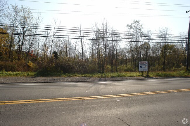
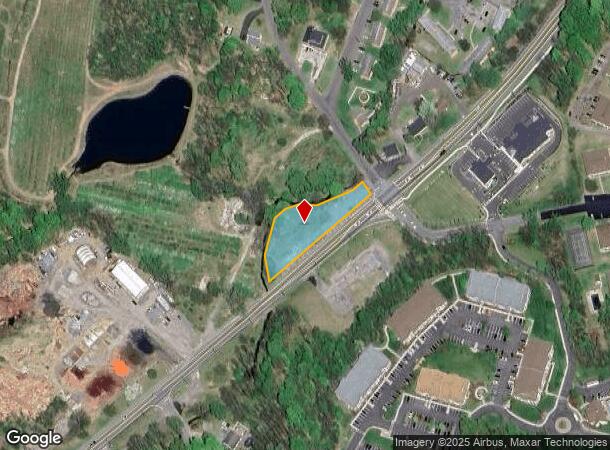
5417 Route 9W, Newburgh, NY 12550
NEARBY LISTINGS FOR SALE OR LEASE
Property Detail
5417 Route 9W
New York-Jersey City-White Plains, NY-NJ
Lyons
334600-009-000-0001-012.000-0000
PT LT 1 LYONS SUB MAP 271-02
Commercialacreage
Orange
A
New York
36027C0453E
12.00
2024
0.73 AC
2024
Newburgh
010102
Northern New Jersey
5,616 SF
DEMOGRAPHICS near 5417 Route 9W
1 Mile
3 Mile
5 Mile
2024 Total Population
2,681
18,145
82,720
2029 Population
2,718
18,263
83,307
Pop Growth 2024-2029
+ 1.38%
+ 0.65%
+ 0.71%
Average Age
40
41
40
2024 Total Households
1,073
6,936
31,354
HH Growth 2024-2029
+ 1.49%
+ 0.61%
+ 0.65%
Median Household Inc
$101,313
$106,362
$83,295
Avg Household Size
2.50
2.50
2.50
2024 Avg HH Vehicles
2.00
2.00
2.00
Median Home Value
$351,984
$377,072
$326,431
Median Year Built
1993
1983
1963
Nearby Places
- Restaurants
- Banks
- Shops
- Fitness
- Groceries
PUBLIC TRANSPORTATION
COMMUTER RAIL
Beacon Station (Hudson Line - Metro-North Commuter Railroad Company (Metro-North))
DRIVE
WALK
Distance
Beacon Station (Hudson Line - Metro-North Commuter Railroad Company (Metro-North))
11 min
7.3 mi
AIRPORT
New York Stewart International
DRIVE
WALK
Distance
New York Stewart International
17 min
10.9 mi
Freight Ports
Port of New Haven
DRIVE
WALK
Distance
Port of New Haven
103 min
77.7 mi
SALE & LEASE HISTORY
LISTING DATE
SALE/LEASE

Sep 24, 2016
For Sale
Nearby Properties
Address
Land Use
TOTAL SIZE
Lot Size
Zoning
Address
Land Use
TOTAL SIZE
Lot Size
Zoning
101,170 SF
28.71 AC
RMF5
Address
Land Use
TOTAL SIZE
Lot Size
Zoning
Address
Land Use
TOTAL SIZE
Lot Size
Zoning
114 AC
Address
Land Use
TOTAL SIZE
Lot Size
Zoning
94,340 SF
31.64 AC
RMF5
Address
Land Use
TOTAL SIZE
Lot Size
Zoning
21,996 SF
17.36 AC
RMF5
Address
Land Use
TOTAL SIZE
Lot Size
Zoning
7.65 AC
RMF-5
Address
Land Use
TOTAL SIZE
Lot Size
Zoning
466.77 AC
R40
Address
Land Use
TOTAL SIZE
Lot Size
Zoning
141,167 SF
46.50 AC
R1
Address
Land Use
TOTAL SIZE
Lot Size
Zoning
50.90 AC
Address
Land Use
TOTAL SIZE
Lot Size
Zoning
35 AC
R40
Address
Land Use
TOTAL SIZE
Lot Size
Zoning
Address
Land Use
TOTAL SIZE
Lot Size
Zoning
22 AC
R40
Address
Land Use
TOTAL SIZE
Lot Size
Zoning
138.90 AC
Address
Land Use
TOTAL SIZE
Lot Size
Zoning
54,908 SF
7.60 AC
HD
Address
Land Use
TOTAL SIZE
Lot Size
Zoning
14.30 AC
RAG1
Address
Land Use
TOTAL SIZE
Lot Size
Zoning
Address
Land Use
TOTAL SIZE
Lot Size
Zoning
32.30 AC
RMF5
Address
Land Use
TOTAL SIZE
Lot Size
Zoning
11,367 SF
14.97 AC
R80
Address
Land Use
TOTAL SIZE
Lot Size
Zoning
0.01 AC
R80
Address
Land Use
TOTAL SIZE
Lot Size
Zoning
Address
Land Use
TOTAL SIZE
Lot Size
Zoning
43,633 SF
99.63 AC
R80
Address
Land Use
TOTAL SIZE
Lot Size
Zoning
Address
Land Use
TOTAL SIZE
Lot Size
Zoning
40.30 AC
Address
Land Use
TOTAL SIZE
Lot Size
Zoning
3.50 AC
HB
Address
Land Use
TOTAL SIZE
Lot Size
Zoning
30,571 SF
3.12 AC
R40
Address
Land Use
TOTAL SIZE
Lot Size
Zoning
9,183 SF
31.43 AC
R40
Address
Land Use
TOTAL SIZE
Lot Size
Zoning
Address
Land Use
TOTAL SIZE
Lot Size
Zoning
Address
Land Use
TOTAL SIZE
Lot Size
Zoning
25,956 SF
15.30 AC
RNH
Address
Land Use
TOTAL SIZE
Lot Size
Zoning
The World's #1 Commercial Real Estate Marketplace
Connect with us
© 2025 CoStar Group
The information above has been obtained from sources believed reliable. While we do not doubt its accuracy we have not verified it and make no guarantee, warranty or representation about it. It is your responsibility to independently confirm its accuracy and completeness. Any projections, opinions, assumptions, or estimates used are for example only and do not represent the current or future performance of the property. The value of this transaction to you depends on tax and other factors which should be evaluated by your tax, financial, and legal advisors. You and your advisors should conduct a careful, independent investigation of the property to determine to your satisfaction the suitability of the property for your needs.