Property Record
5418 State Highway 28, Cooperstown, NY 13326

NEARBY LISTINGS FOR SALE OR LEASE
-
-
View all Cooperstown listings for sale on LoopNet.com
Property Detail
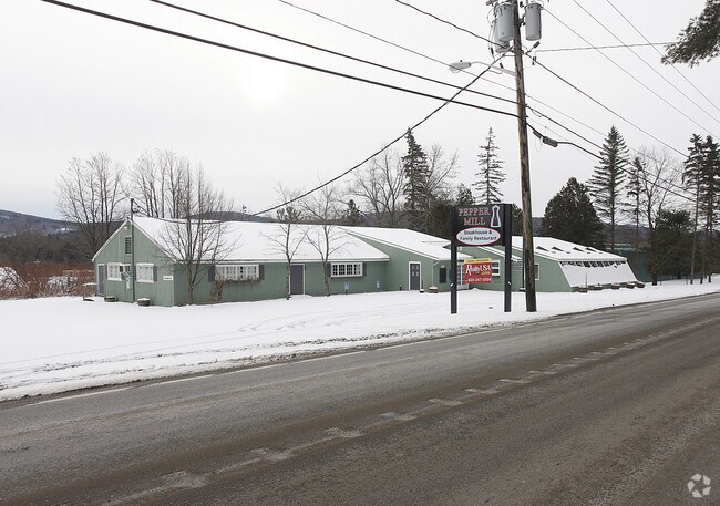
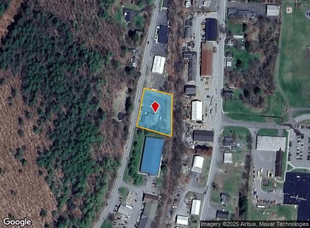
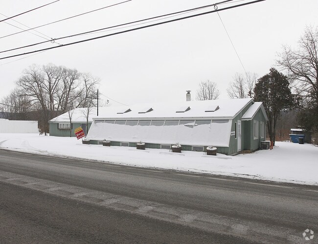
5418 State Highway 28
365089-131-000-0001-003-000-0000
FM 3253 0 0
Restaurantbuilding
Otsego
X
New York
36077C0333E
3.000
2025
0.81 AC
2024
Otsego County
590202
Albany/Schenectady/Troy
5,920 SF
Oneonta, NY
DEMOGRAPHICS near 5418 State Highway 28
1 Mile
3 Mile
5 Mile
2024 Total Population
1,955
3,685
5,425
2029 Population
1,966
3,711
5,462
Pop Growth 2024-2029
+ 0.56%
+ 0.71%
+ 0.68%
Average Age
48
48
48
2024 Total Households
898
1,653
2,423
HH Growth 2024-2029
+ 0.56%
+ 0.73%
+ 0.78%
Median Household Inc
$71,764
$71,618
$75,197
Avg Household Size
1.90
2.00
2.10
2024 Avg HH Vehicles
2.00
2.00
2.00
Median Home Value
$331,746
$304,028
$296,014
Median Year Built
1946
1948
1951
Nearby Places
- Restaurants
- Banks
- Shops
- Fitness
- Groceries
SALE & LEASE HISTORY
LISTING DATE
SALE/LEASE

Sep 24, 2016
For Sale
Nearby Properties
Address
Land Use
TOTAL SIZE
Lot Size
Zoning
Address
Land Use
TOTAL SIZE
Lot Size
Zoning
5.40 AC
Address
Land Use
TOTAL SIZE
Lot Size
Zoning
Address
Land Use
TOTAL SIZE
Lot Size
Zoning
103,576 SF
3.47 AC
R1
Address
Land Use
TOTAL SIZE
Lot Size
Zoning
8.29 AC
R1
Address
Land Use
TOTAL SIZE
Lot Size
Zoning
0.24 AC
Address
Land Use
TOTAL SIZE
Lot Size
Zoning
43,488 SF
4.63 AC
R2
Address
Land Use
TOTAL SIZE
Lot Size
Zoning
15.70 AC
01 - NOT Z
Address
Land Use
TOTAL SIZE
Lot Size
Zoning
Address
Land Use
TOTAL SIZE
Lot Size
Zoning
0.70 AC
Address
Land Use
TOTAL SIZE
Lot Size
Zoning
0.38 AC
Address
Land Use
TOTAL SIZE
Lot Size
Zoning
105,825 SF
49.02 AC
01 - NOT Z
Address
Land Use
TOTAL SIZE
Lot Size
Zoning
69,172 SF
6.44 AC
R2
Address
Land Use
TOTAL SIZE
Lot Size
Zoning
Address
Land Use
TOTAL SIZE
Lot Size
Zoning
0.15 AC
Address
Land Use
TOTAL SIZE
Lot Size
Zoning
43,110 SF
3.28 AC
R1
Address
Land Use
TOTAL SIZE
Lot Size
Zoning
3,020 SF
9.21 AC
CD
Address
Land Use
TOTAL SIZE
Lot Size
Zoning
41,620 SF
6.56 AC
Address
Land Use
TOTAL SIZE
Lot Size
Zoning
29,994 SF
1.70 AC
C
Address
Land Use
TOTAL SIZE
Lot Size
Zoning
1,531 SF
6.56 AC
01 - NOT Z
Address
Land Use
TOTAL SIZE
Lot Size
Zoning
0.46 AC
R1
Address
Land Use
TOTAL SIZE
Lot Size
Zoning
9.44 AC
01 - NOT Z
Address
Land Use
TOTAL SIZE
Lot Size
Zoning
11,962 SF
2.57 AC
R2
Address
Land Use
TOTAL SIZE
Lot Size
Zoning
Address
Land Use
TOTAL SIZE
Lot Size
Zoning
19,220 SF
0.41 AC
B
Address
Land Use
TOTAL SIZE
Lot Size
Zoning
6,890 SF
1.81 AC
01 - NOT Z
Address
Land Use
TOTAL SIZE
Lot Size
Zoning
19,368 SF
16.22 AC
Address
Land Use
TOTAL SIZE
Lot Size
Zoning
8,040 SF
0.56 AC
R2
Address
Land Use
TOTAL SIZE
Lot Size
Zoning
11,504 SF
0.78 AC
R2
Address
Land Use
TOTAL SIZE
Lot Size
Zoning
9,657 SF
1.25 AC
C
Address
Land Use
TOTAL SIZE
Lot Size
Zoning
10,697 SF
0.83 AC
C
The World's #1 Commercial Real Estate Marketplace
Connect with us
© 2025 CoStar Group
The information above has been obtained from sources believed reliable. While we do not doubt its accuracy we have not verified it and make no guarantee, warranty or representation about it. It is your responsibility to independently confirm its accuracy and completeness. Any projections, opinions, assumptions, or estimates used are for example only and do not represent the current or future performance of the property. The value of this transaction to you depends on tax and other factors which should be evaluated by your tax, financial, and legal advisors. You and your advisors should conduct a careful, independent investigation of the property to determine to your satisfaction the suitability of the property for your needs.