Property Record
542 Riverside Dr, Klamath Falls, OR 97601
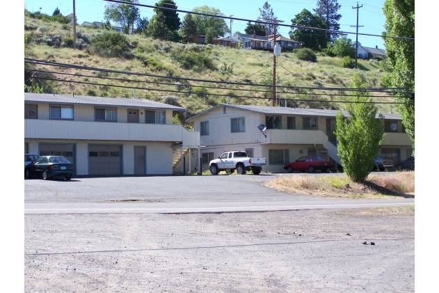

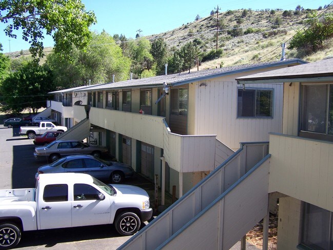

Property Detail
542 Riverside Dr
R631196
WEST KLAMATH FALLS, BLOCK 4, LOT 20 N22OF LT 21
Multifamilydwelling
Klamath
MD
Oregon
B and X Area of moderate flood hazard, usually the area between the limits of the 100-year and 500-year floods.
20
2025
0.47 AC
2025
Oregon East Area
970902
Other Market Areas
7,080 SF
Klamath Falls, OR
NEARBY LISTINGS FOR SALE OR LEASE
DEMOGRAPHICS near 542 Riverside Dr
1 mile
3 mile
5 mile
2025 Total Population
2,697
25,379
46,218
2030 Population
2,719
25,438
46,197
Pop Growth 2025-2030
+ 0.82%
+ 0.23%
(0.05%)
Average Age
40
39
40
2025 Total Households
1,230
10,544
18,628
HH Growth 2025-2030
+ 0.81%
0.00%
(0.19%)
Median Household Inc
$29,399
$40,792
$46,389
Avg Household Size
2.10
2.20
2.30
2025 Avg HH Vehicles
2.00
2.00
2.00
Median Home Value
$215,789
$229,082
$246,804
Median Year Built
1956
1962
1970
Nearby Places
Map Layers
Map Styles
 Street
 Aerial
Transit
 Traffic
 Biking
Places
Listings with unknown addresses are not visible on the map
- Restaurants
- Banks
- Shops
- Fitness
- Groceries
PUBLIC TRANSPORTATION
COMMUTER RAIL
Klamath Falls (Coast Starlight - Amtrak)
Drive
Walk
Distance
Klamath Falls (Coast Starlight - Amtrak)
3 min
1.7 mi
Freight Ports
Port of Coos Bay, OR
Drive
Walk
Distance
Port of Coos Bay, OR
306 min
237.2 mi
SALE & LEASE HISTORY
LISTING DATE
SALE/LEASE

Sep 23, 2016
For Sale
Oct 15, 2018
For Sale
Nearby Properties
Address
Land Use
TOTAL SIZE
Lot Size
Zoning
Address
Land Use
TOTAL SIZE
Lot Size
Zoning
210,396 SF
12.99 AC
PUD
Address
Land Use
TOTAL SIZE
Lot Size
Zoning
15,313 SF
1.63 AC
PUD
Address
Land Use
TOTAL SIZE
Lot Size
Zoning
530,947 SF
156.42 AC
PUD
Address
Land Use
TOTAL SIZE
Lot Size
Zoning
Address
Land Use
TOTAL SIZE
Lot Size
Zoning
784 SF
5.73 AC
I
Address
Land Use
TOTAL SIZE
Lot Size
Zoning
3.92 AC
MU
Address
Land Use
TOTAL SIZE
Lot Size
Zoning
211,167 SF
14.23 AC
GC
Address
Land Use
TOTAL SIZE
Lot Size
Zoning
179,904 SF
13.90 AC
GC
Address
Land Use
TOTAL SIZE
Lot Size
Zoning
66,904 SF
36.90 AC
PF
Address
Land Use
TOTAL SIZE
Lot Size
Zoning
145,149 SF
4.90 AC
PF
Address
Land Use
TOTAL SIZE
Lot Size
Zoning
940 SF
37.21 AC
CR
Address
Land Use
TOTAL SIZE
Lot Size
Zoning
57,008 SF
1.43 AC
PF
Address
Land Use
TOTAL SIZE
Lot Size
Zoning
30,390 SF
12.63 AC
RS
Address
Land Use
TOTAL SIZE
Lot Size
Zoning
22,500 SF
4 AC
LI
Address
Land Use
TOTAL SIZE
Lot Size
Zoning
6.29 AC
L1
Address
Land Use
TOTAL SIZE
Lot Size
Zoning
1 SF
11.75 AC
Address
Land Use
TOTAL SIZE
Lot Size
Zoning
Address
Land Use
TOTAL SIZE
Lot Size
Zoning
98,373 SF
0.69 AC
PUD
Address
Land Use
TOTAL SIZE
Lot Size
Zoning
61,045 SF
2.44 AC
A
Address
Land Use
TOTAL SIZE
Lot Size
Zoning
7,432 SF
0.16 AC
A
Address
Land Use
TOTAL SIZE
Lot Size
Zoning
2.46 AC
MU
Address
Land Use
TOTAL SIZE
Lot Size
Zoning
108,500 SF
19.90 AC
IH
Address
Land Use
TOTAL SIZE
Lot Size
Zoning
4,524 SF
0.88 AC
MD,GC
Address
Land Use
TOTAL SIZE
Lot Size
Zoning
41,938 SF
1.45 AC
PF
Address
Land Use
TOTAL SIZE
Lot Size
Zoning
26,645 SF
1.66 AC
A
Address
Land Use
TOTAL SIZE
Lot Size
Zoning
1 SF
10.06 AC
IH
Address
Land Use
TOTAL SIZE
Lot Size
Zoning
29,106 SF
8.76 AC
GC
Address
Land Use
TOTAL SIZE
Lot Size
Zoning
2,638 SF
8.17 AC
A
The World's #1 Commercial Real Estate Marketplace
Connect with us
© 2026 CoStar Group
The information above has been obtained from sources believed reliable. While we do not doubt its accuracy we have not verified it and make no guarantee, warranty or representation about it. It is your responsibility to independently confirm its accuracy and completeness. Any projections, opinions, assumptions, or estimates used are for example only and do not represent the current or future performance of the property. The value of this transaction to you depends on tax and other factors which should be evaluated by your tax, financial, and legal advisors. You and your advisors should conduct a careful, independent investigation of the property to determine to your satisfaction the suitability of the property for your needs.