Property Record
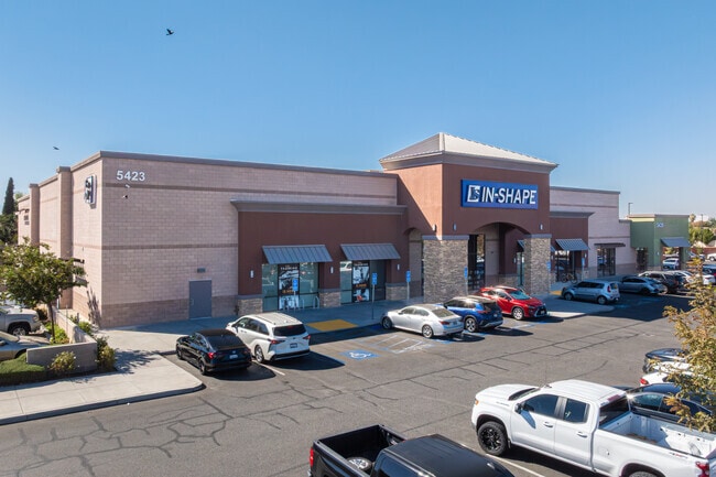
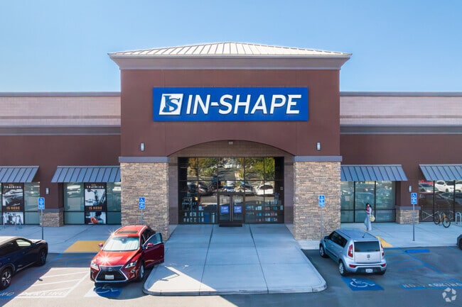
5423 Calloway Dr, Bakersfield, CA 93312

Property Detail
5423 Calloway Dr
526-560-10-00-5
PARCEL MAP 11788 , LOT 10
Regionalshoppingcenterormallwithanchorstore
KERN
C-2 PCD
California
B and X Area of moderate flood hazard, usually the area between the limits of the 100-year and 500-year floods.
10
2024
2.83 AC
2025
Northwest Bakersfield
000510
Bakersfield
25,000 SF
Bakersfield-Delano, CA
NEARBY LISTINGS FOR SALE OR LEASE
DEMOGRAPHICS near 5423 Calloway Dr
1 mile
3 mile
5 mile
2025 Total Population
14,362
73,441
150,982
2030 Population
14,362
73,974
153,494
Pop Growth 2025-2030
0.00%
+ 0.73%
+ 1.66%
Average Age
38
37
38
2025 Total Households
4,728
24,368
51,901
HH Growth 2025-2030
(0.04%)
+ 0.67%
+ 1.61%
Median Household Inc
$122,635
$112,727
$98,215
Avg Household Size
3.00
3.00
2.80
2025 Avg HH Vehicles
2.00
2.00
2.00
Median Home Value
$438,136
$435,777
$435,787
Median Year Built
2001
1998
1994
Nearby Places
Map Layers
Map Styles
 Street
 Aerial
Transit
 Traffic
 Biking
Places
Listings with unknown addresses are not visible on the map
- Restaurants
- Banks
- Shops
- Fitness
- Groceries
PUBLIC TRANSPORTATION
COMMUTER RAIL
Bakersfield (San Joaquins - Amtrak)
Drive
Walk
Distance
Bakersfield (San Joaquins - Amtrak)
13 min
7.7 mi
AIRPORT
Meadows Field
Drive
Walk
Distance
Meadows Field
15 min
5.9 mi
Freight Ports
The Port of Hueneme
Drive
Walk
Distance
The Port of Hueneme
160 min
128.0 mi
Nearby Properties
Address
Land Use
TOTAL SIZE
Lot Size
Zoning
Address
Land Use
TOTAL SIZE
Lot Size
Zoning
3,788 SF
54.09 AC
M3
Address
Land Use
TOTAL SIZE
Lot Size
Zoning
1,200 SF
5.89 AC
M-1
Address
Land Use
TOTAL SIZE
Lot Size
Zoning
1 SF
14.26 AC
R-2 PUD
Address
Land Use
TOTAL SIZE
Lot Size
Zoning
386,282 SF
14.05 AC
Address
Land Use
TOTAL SIZE
Lot Size
Zoning
10,064 SF
13.44 AC
R3
Address
Land Use
TOTAL SIZE
Lot Size
Zoning
63,428 SF
5.18 AC
C-2
Address
Land Use
TOTAL SIZE
Lot Size
Zoning
41,394 SF
14.74 AC
Address
Land Use
TOTAL SIZE
Lot Size
Zoning
134,728 SF
7.56 AC
R3
Address
Land Use
TOTAL SIZE
Lot Size
Zoning
2,129 SF
11.42 AC
M-2
Address
Land Use
TOTAL SIZE
Lot Size
Zoning
3,497 SF
31.27 AC
E
Address
Land Use
TOTAL SIZE
Lot Size
Zoning
1,949 SF
6.43 AC
R-2
Address
Land Use
TOTAL SIZE
Lot Size
Zoning
51,666 SF
6.08 AC
C2
Address
Land Use
TOTAL SIZE
Lot Size
Zoning
3,383 SF
19.40 AC
M-2
Address
Land Use
TOTAL SIZE
Lot Size
Zoning
72,726 SF
13.15 AC
M2
Address
Land Use
TOTAL SIZE
Lot Size
Zoning
92,953 SF
13.59 AC
C2
Address
Land Use
TOTAL SIZE
Lot Size
Zoning
144,414 SF
11.90 AC
PCD
Address
Land Use
TOTAL SIZE
Lot Size
Zoning
83,650 SF
2.43 AC
C-2
Address
Land Use
TOTAL SIZE
Lot Size
Zoning
50,949 SF
78.05 AC
M-2
Address
Land Use
TOTAL SIZE
Lot Size
Zoning
54,960 SF
15.83 AC
M-2
Address
Land Use
TOTAL SIZE
Lot Size
Zoning
168,559 SF
5.34 AC
M-2
Address
Land Use
TOTAL SIZE
Lot Size
Zoning
215,165 SF
9 AC
M-2
Address
Land Use
TOTAL SIZE
Lot Size
Zoning
16,991 SF
17.46 AC
R1
Address
Land Use
TOTAL SIZE
Lot Size
Zoning
55,215 SF
3.93 AC
C-2
Address
Land Use
TOTAL SIZE
Lot Size
Zoning
86,729 SF
8.59 AC
C2
Address
Land Use
TOTAL SIZE
Lot Size
Zoning
161,685 SF
12.79 AC
C2
Address
Land Use
TOTAL SIZE
Lot Size
Zoning
12,000 SF
11.90 AC
M-2 PD
Address
Land Use
TOTAL SIZE
Lot Size
Zoning
115,058 SF
10.95 AC
Address
Land Use
TOTAL SIZE
Lot Size
Zoning
357,609 SF
21.80 AC
M2
Address
Land Use
TOTAL SIZE
Lot Size
Zoning
117,352 SF
13.84 AC
M2
The World's #1 Commercial Real Estate Marketplace
Connect with us
© 2026 CoStar Group
The information above has been obtained from sources believed reliable. While we do not doubt its accuracy we have not verified it and make no guarantee, warranty or representation about it. It is your responsibility to independently confirm its accuracy and completeness. Any projections, opinions, assumptions, or estimates used are for example only and do not represent the current or future performance of the property. The value of this transaction to you depends on tax and other factors which should be evaluated by your tax, financial, and legal advisors. You and your advisors should conduct a careful, independent investigation of the property to determine to your satisfaction the suitability of the property for your needs.