Property Record
5427 39Th St E, Bradenton, FL 34203
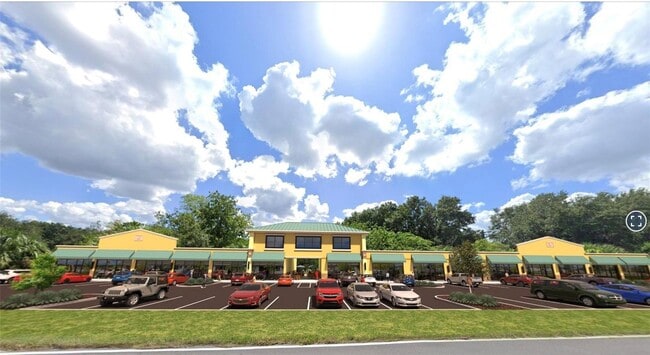

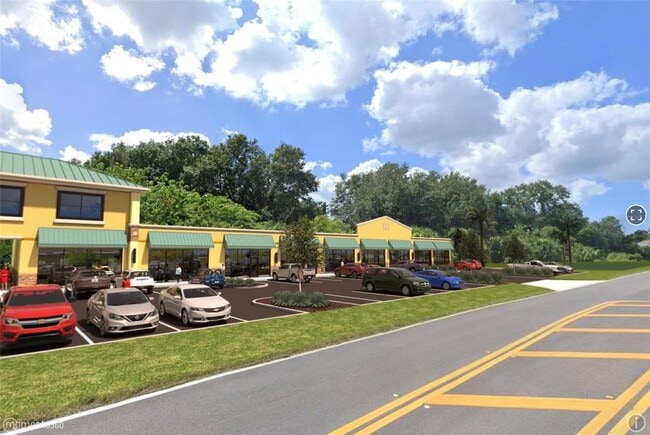
Property Detail
5427 39Th St E
17638-0000-8
BEG SW COR OF NW1/4 OF NW1/4 OF SEC 16, TWN 35 S, RNG 18 E, FOR A POB, THENCE N 89 DEG 59 MIN 49 SEC E ALG THE S LN OF THE NW1/4 OF NW1/4 OF SD SEC 16, A DIST OF 735.39 FT TO THE
Vacantlandnec
MANATEE
PD-R
Florida
AE The base floodplain where base flood elevations are provided. AE Zones are now used on new format FIRMs instead of A1-A30 Zones.
2.70 AC
2024
Manatee
2025
Tampa/St Petersburg
000813
North Port-Bradenton-Sarasota, FL
NEARBY LISTINGS FOR SALE OR LEASE
DEMOGRAPHICS near 5427 39Th St E
1 mile
3 mile
5 mile
2025 Total Population
9,552
59,806
189,289
2030 Population
10,589
66,528
210,089
Pop Growth 2025-2030
+ 10.86%
+ 11.24%
+ 10.99%
Average Age
47
47
45
2025 Total Households
3,977
24,650
80,927
HH Growth 2025-2030
+ 11.01%
+ 11.59%
+ 11.24%
Median Household Inc
$92,283
$75,985
$65,607
Avg Household Size
2.30
2.30
2.20
2025 Avg HH Vehicles
2.00
2.00
2.00
Median Home Value
$403,544
$391,689
$356,160
Median Year Built
1999
1995
1988
Nearby Places
Map Layers
Map Styles
 Street
 Aerial
Transit
 Traffic
 Biking
Places
Listings with unknown addresses are not visible on the map
- Restaurants
- Banks
- Shops
- Fitness
- Groceries
PUBLIC TRANSPORTATION
AIRPORT
Sarasota/Bradenton International
Drive
Walk
Distance
Sarasota/Bradenton International
15 min
8.1 mi
Freight Ports
Port Manatee
Drive
Walk
Distance
Port Manatee
29 min
17.2 mi
SALE & LEASE HISTORY
LISTING DATE
SALE/LEASE

Apr 21, 2023
For Sale
Nearby Properties
Address
Land Use
TOTAL SIZE
Lot Size
Zoning
Address
Land Use
TOTAL SIZE
Lot Size
Zoning
385,610 SF
32.65 AC
RMF-6 MULT
Address
Land Use
TOTAL SIZE
Lot Size
Zoning
241,504 SF
27.72 AC
A GENERAL
Address
Land Use
TOTAL SIZE
Lot Size
Zoning
375,171 SF
20 AC
PD-MU
Address
Land Use
TOTAL SIZE
Lot Size
Zoning
343,415 SF
31.02 AC
PD-C
Address
Land Use
TOTAL SIZE
Lot Size
Zoning
238,774 SF
15.56 AC
A-1 SUBURB
Address
Land Use
TOTAL SIZE
Lot Size
Zoning
115,400 SF
22.55 AC
LM LIGHT M
Address
Land Use
TOTAL SIZE
Lot Size
Zoning
187,000 SF
8.93 AC
Address
Land Use
TOTAL SIZE
Lot Size
Zoning
214,350 SF
16.07 AC
LM LIGHT M
Address
Land Use
TOTAL SIZE
Lot Size
Zoning
296,983 SF
34.84 AC
PD-MU
Address
Land Use
TOTAL SIZE
Lot Size
Zoning
163,394 SF
15.49 AC
PD-MU
Address
Land Use
TOTAL SIZE
Lot Size
Zoning
901,196 SF
48.54 AC
LM LIGHT M
Address
Land Use
TOTAL SIZE
Lot Size
Zoning
145,200 SF
8.66 AC
Address
Land Use
TOTAL SIZE
Lot Size
Zoning
126,505 SF
20 AC
RSF-2
Address
Land Use
TOTAL SIZE
Lot Size
Zoning
419,956 SF
18.46 AC
LM LIGHT M
Address
Land Use
TOTAL SIZE
Lot Size
Zoning
145,200 SF
8.99 AC
Address
Land Use
TOTAL SIZE
Lot Size
Zoning
10,389 SF
57.58 AC
PD-RV
Address
Land Use
TOTAL SIZE
Lot Size
Zoning
124,129 SF
23.29 AC
PDC
Address
Land Use
TOTAL SIZE
Lot Size
Zoning
143,582 SF
14.42 AC
LM LIGHT M
Address
Land Use
TOTAL SIZE
Lot Size
Zoning
231,364 SF
27.50 AC
PD-PI
Address
Land Use
TOTAL SIZE
Lot Size
Zoning
310,215 SF
134.06 AC
A GENERAL
Address
Land Use
TOTAL SIZE
Lot Size
Zoning
220,685 SF
27.21 AC
PD-C
Address
Land Use
TOTAL SIZE
Lot Size
Zoning
322,364 SF
32.93 AC
HM HEAVY M
Address
Land Use
TOTAL SIZE
Lot Size
Zoning
141,244 SF
18.08 AC
LM,HM
Address
Land Use
TOTAL SIZE
Lot Size
Zoning
201,632 SF
7.23 AC
A-1 SUBURB
Address
Land Use
TOTAL SIZE
Lot Size
Zoning
121,899 SF
9.88 AC
HM HEAVY M
Address
Land Use
TOTAL SIZE
Lot Size
Zoning
10,094 SF
51.90 AC
PD-RV
Address
Land Use
TOTAL SIZE
Lot Size
Zoning
45,160 SF
12.66 AC
HM HEAVY M
Address
Land Use
TOTAL SIZE
Lot Size
Zoning
313,540 SF
10.51 AC
LM LIGHT M
Address
Land Use
TOTAL SIZE
Lot Size
Zoning
92,466 SF
18.80 AC
A-1 SUBURB
Address
Land Use
TOTAL SIZE
Lot Size
Zoning
88,713 SF
8.70 AC
PD-C
The World's #1 Commercial Real Estate Marketplace
Connect with us
© 2026 CoStar Group
The information above has been obtained from sources believed reliable. While we do not doubt its accuracy we have not verified it and make no guarantee, warranty or representation about it. It is your responsibility to independently confirm its accuracy and completeness. Any projections, opinions, assumptions, or estimates used are for example only and do not represent the current or future performance of the property. The value of this transaction to you depends on tax and other factors which should be evaluated by your tax, financial, and legal advisors. You and your advisors should conduct a careful, independent investigation of the property to determine to your satisfaction the suitability of the property for your needs.