Property Record
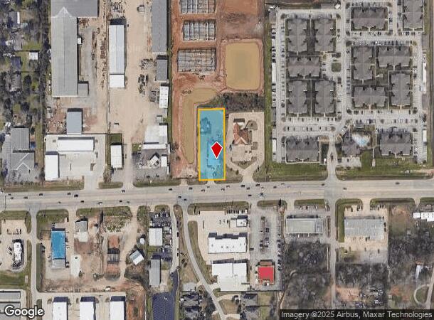
5428 Fm 1488 Rd, Magnolia, TX 77354


NEARBY LISTINGS FOR SALE OR LEASE
Property Detail
5428 Fm 1488 Rd
0546-00-01505
Taylor Thomas
Commercialnec
A0546 - TAYLOR THOMAS, TRACT 15-A, ACRES 0.9222
X
Montgomery
48339C0510G
Texas
2024
0.92 AC
2025
Montgomery County
690501
Houston
7,681 SF
Houston-Pasadena-The Woodlands, TX
DEMOGRAPHICS near 5428 Fm 1488 Rd
1 Mile
3 Mile
5 Mile
2024 Total Population
7,999
55,828
124,203
2029 Population
9,844
68,091
151,350
Pop Growth 2024-2029
+ 23.07%
+ 21.97%
+ 21.86%
Average Age
40
39
39
2024 Total Households
3,136
19,851
44,706
HH Growth 2024-2029
+ 23.44%
+ 22.20%
+ 22.06%
Median Household Inc
$115,726
$129,595
$127,703
Avg Household Size
2.50
2.80
2.70
2024 Avg HH Vehicles
2.00
2.00
2.00
Median Home Value
$340,484
$390,612
$393,380
Median Year Built
2007
2003
2004
Nearby Places
Map Layers
Map Styles
 Street
 Aerial
- Restaurants
- Banks
- Shops
- Fitness
- Groceries
PUBLIC TRANSPORTATION
AIRPORT
George Bush Intcntl/Houston
DRIVE
WALK
Distance
George Bush Intcntl/Houston
40 min
31.4 mi
Freight Ports
Port of Houston
DRIVE
WALK
Distance
Port of Houston
63 min
47.2 mi
SALE & LEASE HISTORY
LISTING DATE
SALE/LEASE

Jul 31, 2019
For Sale
Jul 24, 2019
For Lease
Jan 18, 2019
For Sale
Dec 30, 2016
For Lease
Apr 05, 2018
For Sale
Nearby Properties
Address
Land Use
TOTAL SIZE
Lot Size
Zoning
Address
Land Use
TOTAL SIZE
Lot Size
Zoning
502,255 SF
15.42 AC
6
Address
Land Use
TOTAL SIZE
Lot Size
Zoning
392,613 SF
19.35 AC
2
Address
Land Use
TOTAL SIZE
Lot Size
Zoning
361,747 SF
16.71 AC
Address
Land Use
TOTAL SIZE
Lot Size
Zoning
367,449 SF
7.78 AC
Address
Land Use
TOTAL SIZE
Lot Size
Zoning
296,538 SF
12.58 AC
Address
Land Use
TOTAL SIZE
Lot Size
Zoning
426,425 SF
8.74 AC
Address
Land Use
TOTAL SIZE
Lot Size
Zoning
295,608 SF
10.07 AC
6
Address
Land Use
TOTAL SIZE
Lot Size
Zoning
194,272 SF
11.06 AC
Address
Land Use
TOTAL SIZE
Lot Size
Zoning
289,611 SF
13.57 AC
Address
Land Use
TOTAL SIZE
Lot Size
Zoning
203,460 SF
39.49 AC
2
Address
Land Use
TOTAL SIZE
Lot Size
Zoning
222,687 SF
8.03 AC
2
Address
Land Use
TOTAL SIZE
Lot Size
Zoning
198,969 SF
32.78 AC
Address
Land Use
TOTAL SIZE
Lot Size
Zoning
141,496 SF
18.30 AC
2
Address
Land Use
TOTAL SIZE
Lot Size
Zoning
190,824 SF
3.62 AC
Address
Land Use
TOTAL SIZE
Lot Size
Zoning
139,140 SF
18.22 AC
6
Address
Land Use
TOTAL SIZE
Lot Size
Zoning
13.76 AC
Address
Land Use
TOTAL SIZE
Lot Size
Zoning
107,000 SF
4.81 AC
Address
Land Use
TOTAL SIZE
Lot Size
Zoning
76,599 SF
6.17 AC
Address
Land Use
TOTAL SIZE
Lot Size
Zoning
172,784 SF
20.60 AC
2
Address
Land Use
TOTAL SIZE
Lot Size
Zoning
278,939 SF
13.76 AC
Address
Land Use
TOTAL SIZE
Lot Size
Zoning
190,000 SF
24.21 AC
Address
Land Use
TOTAL SIZE
Lot Size
Zoning
165,218 SF
17.40 AC
2
Address
Land Use
TOTAL SIZE
Lot Size
Zoning
51,134 SF
25 AC
2
Address
Land Use
TOTAL SIZE
Lot Size
Zoning
94,128 SF
51.19 AC
2
Address
Land Use
TOTAL SIZE
Lot Size
Zoning
77,299 SF
7.08 AC
Address
Land Use
TOTAL SIZE
Lot Size
Zoning
133,266 SF
2.95 AC
2
Address
Land Use
TOTAL SIZE
Lot Size
Zoning
122,940 SF
17.10 AC
6
Address
Land Use
TOTAL SIZE
Lot Size
Zoning
151,978 SF
21.94 AC
Address
Land Use
TOTAL SIZE
Lot Size
Zoning
106,520 SF
14.16 AC
Address
Land Use
TOTAL SIZE
Lot Size
Zoning
99,649 SF
17.63 AC
The World's #1 Commercial Real Estate Marketplace
Connect with us
© 2026 CoStar Group
The information above has been obtained from sources believed reliable. While we do not doubt its accuracy we have not verified it and make no guarantee, warranty or representation about it. It is your responsibility to independently confirm its accuracy and completeness. Any projections, opinions, assumptions, or estimates used are for example only and do not represent the current or future performance of the property. The value of this transaction to you depends on tax and other factors which should be evaluated by your tax, financial, and legal advisors. You and your advisors should conduct a careful, independent investigation of the property to determine to your satisfaction the suitability of the property for your needs.