Property Record
5428 N State Road 15, Warsaw, IN 46582

NEARBY LISTINGS FOR SALE OR LEASE
Property Detail
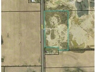
5428 N State Road 15
43-07-17-200-129.000-016
29-68-18 PT NE SE 17-33-6 9.32A
Minequarry
Kosciusko
X
Indiana
18085C0165D
9.32 AC
2024
Indiana North Area
2024
Other Market Areas
961700
Warsaw, IN
DEMOGRAPHICS near 5428 N State Road 15
1 Mile
3 Mile
5 Mile
2024 Total Population
79
5,439
17,560
2029 Population
77
5,390
17,617
Pop Growth 2024-2029
(2.53%)
(0.90%)
+ 0.32%
Average Age
36
37
40
2024 Total Households
29
1,977
6,944
HH Growth 2024-2029
0.00%
(1.06%)
+ 0.23%
Median Household Inc
$52,500
$65,589
$65,023
Avg Household Size
2.70
2.60
2.40
2024 Avg HH Vehicles
2.00
2.00
2.00
Median Home Value
$150,000
$167,018
$180,894
Median Year Built
1988
1994
1987
Nearby Places
Map Layers
Map Styles
 Street
 Aerial
- Restaurants
- Banks
- Shops
- Fitness
- Groceries
SALE & LEASE HISTORY
LISTING DATE
SALE/LEASE

Sep 24, 2016
For Sale
Nearby Properties
Address
Land Use
TOTAL SIZE
Lot Size
Zoning
Address
Land Use
TOTAL SIZE
Lot Size
Zoning
11,448 SF
19.57 AC
C-3 A
Address
Land Use
TOTAL SIZE
Lot Size
Zoning
50,534 SF
9.94 AC
C-3 A
Address
Land Use
TOTAL SIZE
Lot Size
Zoning
63,312 SF
11.67 AC
I-2 L
Address
Land Use
TOTAL SIZE
Lot Size
Zoning
182,921 SF
9.16 AC
I-2 L
Address
Land Use
TOTAL SIZE
Lot Size
Zoning
206,395 SF
21.88 AC
C-5 S
Address
Land Use
TOTAL SIZE
Lot Size
Zoning
59,252 SF
8.78 AC
C-3 A
Address
Land Use
TOTAL SIZE
Lot Size
Zoning
151,378 SF
24.48 AC
I-2 L
Address
Land Use
TOTAL SIZE
Lot Size
Zoning
9.59 AC
I-2 L
Address
Land Use
TOTAL SIZE
Lot Size
Zoning
6,900 SF
8.60 AC
COMME
Address
Land Use
TOTAL SIZE
Lot Size
Zoning
146,347 SF
18.44 AC
C-5 S
Address
Land Use
TOTAL SIZE
Lot Size
Zoning
55,085 SF
7.31 AC
I-2 L
Address
Land Use
TOTAL SIZE
Lot Size
Zoning
13,518 SF
1.55 AC
C-3 A
Address
Land Use
TOTAL SIZE
Lot Size
Zoning
4,200 SF
10.11 AC
COMME
Address
Land Use
TOTAL SIZE
Lot Size
Zoning
936 SF
64.10 AC
AG
Address
Land Use
TOTAL SIZE
Lot Size
Zoning
133,703 SF
6.99 AC
I-2 L
Address
Land Use
TOTAL SIZE
Lot Size
Zoning
50,865 SF
2.05 AC
C-3 A
Address
Land Use
TOTAL SIZE
Lot Size
Zoning
319,847 SF
15 AC
I-2 L
Address
Land Use
TOTAL SIZE
Lot Size
Zoning
41,482 SF
3.48 AC
COMME
Address
Land Use
TOTAL SIZE
Lot Size
Zoning
1,350 SF
6.86 AC
R-3
Address
Land Use
TOTAL SIZE
Lot Size
Zoning
62,279 SF
21.31 AC
IND-2
Address
Land Use
TOTAL SIZE
Lot Size
Zoning
68,961 SF
5.80 AC
C-3 A
Address
Land Use
TOTAL SIZE
Lot Size
Zoning
44,544 SF
7.68 AC
I-2 L
Address
Land Use
TOTAL SIZE
Lot Size
Zoning
15,118 SF
1.46 AC
I-1 L
Address
Land Use
TOTAL SIZE
Lot Size
Zoning
19,635 SF
8.77 AC
I-2 L
Address
Land Use
TOTAL SIZE
Lot Size
Zoning
10,998 SF
2.62 AC
C-3 A
Address
Land Use
TOTAL SIZE
Lot Size
Zoning
9,568 SF
2.38 AC
R-2
Address
Land Use
TOTAL SIZE
Lot Size
Zoning
1,350 SF
24.20 AC
RESID
Address
Land Use
TOTAL SIZE
Lot Size
Zoning
7,824 SF
3.56 AC
R-3
Address
Land Use
TOTAL SIZE
Lot Size
Zoning
13,600 SF
3.97 AC
PUD P
Address
Land Use
TOTAL SIZE
Lot Size
Zoning
16,500 SF
1.49 AC
PUD P
The World's #1 Commercial Real Estate Marketplace
Connect with us
© 2025 CoStar Group
The information above has been obtained from sources believed reliable. While we do not doubt its accuracy we have not verified it and make no guarantee, warranty or representation about it. It is your responsibility to independently confirm its accuracy and completeness. Any projections, opinions, assumptions, or estimates used are for example only and do not represent the current or future performance of the property. The value of this transaction to you depends on tax and other factors which should be evaluated by your tax, financial, and legal advisors. You and your advisors should conduct a careful, independent investigation of the property to determine to your satisfaction the suitability of the property for your needs.