Property Record
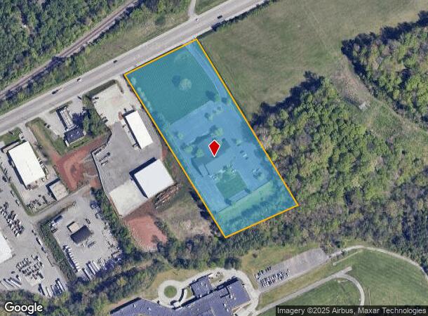
5430 Rutledge Pike, Knoxville, TN 37924


NEARBY LISTINGS FOR SALE OR LEASE
Property Detail
5430 Rutledge Pike
071BA-007
Bridges Funeral Home Replat
Funeralhome
SUBDIVISIONNAME BRIDGES FUNERAL HOME REPLAT MAPPLATB 20 061201 MAPPLATP 0046128 DIMENSIONS 360.34 X 875.77 X IR R
X
Knox
47093C0163G
Tennessee
2025
7.10 AC
2025
East
005202
Knoxville
12,112 SF
Knoxville, TN
DEMOGRAPHICS near 5430 Rutledge Pike
1 Mile
3 Mile
5 Mile
2024 Total Population
3,206
30,141
90,944
2029 Population
3,516
33,004
99,540
Pop Growth 2024-2029
+ 9.67%
+ 9.50%
+ 9.45%
Average Age
41
41
40
2024 Total Households
1,328
12,654
39,811
HH Growth 2024-2029
+ 9.79%
+ 9.59%
+ 9.66%
Median Household Inc
$45,185
$47,699
$46,881
Avg Household Size
2.30
2.30
2.20
2024 Avg HH Vehicles
2.00
2.00
2.00
Median Home Value
$173,766
$190,414
$200,183
Median Year Built
1973
1972
1970
Nearby Places
Map Layers
Map Styles
 Street
 Aerial
- Restaurants
- Banks
- Shops
- Fitness
- Groceries
PUBLIC TRANSPORTATION
AIRPORT
McGhee Tyson
DRIVE
WALK
Distance
McGhee Tyson
39 min
23.1 mi
Nearby Properties
Address
Land Use
TOTAL SIZE
Lot Size
Zoning
Address
Land Use
TOTAL SIZE
Lot Size
Zoning
605,000 SF
57.37 AC
Address
Land Use
TOTAL SIZE
Lot Size
Zoning
224,536 SF
81.84 AC
Address
Land Use
TOTAL SIZE
Lot Size
Zoning
1,134 SF
6.97 AC
Address
Land Use
TOTAL SIZE
Lot Size
Zoning
2,700 SF
22.24 AC
Address
Land Use
TOTAL SIZE
Lot Size
Zoning
3,550 SF
8 AC
Address
Land Use
TOTAL SIZE
Lot Size
Zoning
27,420 SF
1.16 AC
Address
Land Use
TOTAL SIZE
Lot Size
Zoning
105,408 SF
9.33 AC
Address
Land Use
TOTAL SIZE
Lot Size
Zoning
89,492 SF
5.88 AC
Address
Land Use
TOTAL SIZE
Lot Size
Zoning
227,592 SF
22.25 AC
Address
Land Use
TOTAL SIZE
Lot Size
Zoning
2,922 SF
10.94 AC
Address
Land Use
TOTAL SIZE
Lot Size
Zoning
160,000 SF
39.50 AC
Address
Land Use
TOTAL SIZE
Lot Size
Zoning
26,484 SF
6.77 AC
Address
Land Use
TOTAL SIZE
Lot Size
Zoning
6,120 SF
16.39 AC
Address
Land Use
TOTAL SIZE
Lot Size
Zoning
106,946 SF
12.57 AC
Address
Land Use
TOTAL SIZE
Lot Size
Zoning
59,410 SF
6 AC
Address
Land Use
TOTAL SIZE
Lot Size
Zoning
142,092 SF
13.90 AC
Address
Land Use
TOTAL SIZE
Lot Size
Zoning
128,639 SF
12.39 AC
Address
Land Use
TOTAL SIZE
Lot Size
Zoning
100 SF
423.35 AC
Address
Land Use
TOTAL SIZE
Lot Size
Zoning
87,256 SF
21.45 AC
Address
Land Use
TOTAL SIZE
Lot Size
Zoning
30,956 SF
8.31 AC
Address
Land Use
TOTAL SIZE
Lot Size
Zoning
107,290 SF
8.03 AC
Address
Land Use
TOTAL SIZE
Lot Size
Zoning
114,636 SF
10.89 AC
Address
Land Use
TOTAL SIZE
Lot Size
Zoning
63,149 SF
6.30 AC
Address
Land Use
TOTAL SIZE
Lot Size
Zoning
92,592 SF
1.89 AC
Address
Land Use
TOTAL SIZE
Lot Size
Zoning
93,427 SF
15.54 AC
Address
Land Use
TOTAL SIZE
Lot Size
Zoning
56,700 SF
5.20 AC
Address
Land Use
TOTAL SIZE
Lot Size
Zoning
28,612 SF
4.40 AC
Address
Land Use
TOTAL SIZE
Lot Size
Zoning
1,150 SF
20.42 AC
Address
Land Use
TOTAL SIZE
Lot Size
Zoning
83,145 SF
31.66 AC
Address
Land Use
TOTAL SIZE
Lot Size
Zoning
2,000 SF
8.41 AC
The World's #1 Commercial Real Estate Marketplace
Connect with us
© 2026 CoStar Group
The information above has been obtained from sources believed reliable. While we do not doubt its accuracy we have not verified it and make no guarantee, warranty or representation about it. It is your responsibility to independently confirm its accuracy and completeness. Any projections, opinions, assumptions, or estimates used are for example only and do not represent the current or future performance of the property. The value of this transaction to you depends on tax and other factors which should be evaluated by your tax, financial, and legal advisors. You and your advisors should conduct a careful, independent investigation of the property to determine to your satisfaction the suitability of the property for your needs.