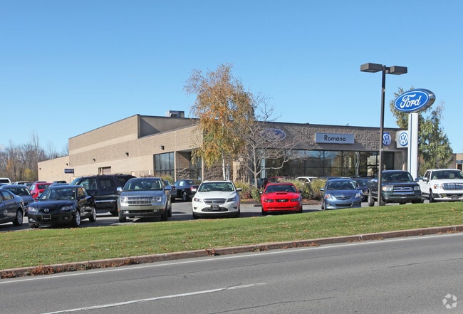
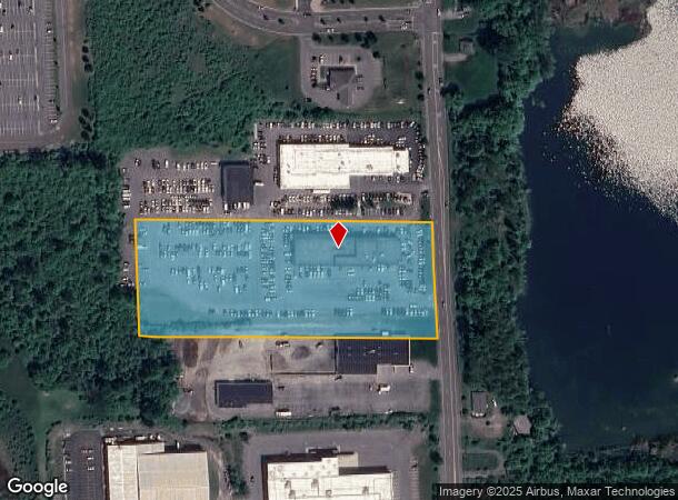
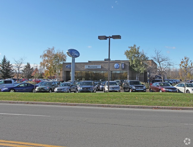
Property Record
5431 N Burdick St, Fayetteville, NY 13066
NEARBY LISTINGS FOR SALE OR LEASE
Property Detail
5431 N Burdick St
313889-086-000-0001-003-003-0000
FL 64
Vehiclerentalsvehiclesales
Onondaga
X
New York
36067C0242F
3.003
2025
5.28 AC
2024
SE Outer Onondaga County
015000
Syracuse
25,017 SF
Syracuse, NY
DEMOGRAPHICS near 5431 N Burdick St
1 Mile
3 Mile
5 Mile
2024 Total Population
4,816
27,069
74,995
2029 Population
4,685
26,411
73,216
Pop Growth 2024-2029
(2.72%)
(2.43%)
(2.37%)
Average Age
47
44
43
2024 Total Households
2,313
11,251
30,980
HH Growth 2024-2029
(2.94%)
(2.60%)
(2.52%)
Median Household Inc
$87,544
$98,018
$79,122
Avg Household Size
2.10
2.30
2.30
2024 Avg HH Vehicles
2.00
2.00
2.00
Median Home Value
$218,547
$221,742
$203,764
Median Year Built
1970
1966
1962
Nearby Places
- Restaurants
- Banks
- Shops
- Fitness
- Groceries
PUBLIC TRANSPORTATION
AIRPORT
Syracuse Hancock International
DRIVE
WALK
Distance
Syracuse Hancock International
25 min
15.3 mi
Freight Ports
Albany, NY Port
DRIVE
WALK
Distance
Albany, NY Port
174 min
138.2 mi
Nearby Properties
Address
Land Use
TOTAL SIZE
Lot Size
Zoning
Address
Land Use
TOTAL SIZE
Lot Size
Zoning
175,424 SF
7.85 AC
RA
Address
Land Use
TOTAL SIZE
Lot Size
Zoning
876,645 SF
51.07 AC
05 - COMME
Address
Land Use
TOTAL SIZE
Lot Size
Zoning
3,909 SF
24.98 AC
RA
Address
Land Use
TOTAL SIZE
Lot Size
Zoning
102,905 SF
32 AC
01 - NOT Z
Address
Land Use
TOTAL SIZE
Lot Size
Zoning
6.24 AC
RA
Address
Land Use
TOTAL SIZE
Lot Size
Zoning
240,800 SF
23.01 AC
05 - COMME
Address
Land Use
TOTAL SIZE
Lot Size
Zoning
145,588 SF
75.45 AC
RA
Address
Land Use
TOTAL SIZE
Lot Size
Zoning
4,722 SF
35.39 AC
R5
Address
Land Use
TOTAL SIZE
Lot Size
Zoning
163,518 SF
19.24 AC
07 - MIXED
Address
Land Use
TOTAL SIZE
Lot Size
Zoning
115,150 SF
13.32 AC
RS
Address
Land Use
TOTAL SIZE
Lot Size
Zoning
95.24 AC
05 - COMME
Address
Land Use
TOTAL SIZE
Lot Size
Zoning
160,767 SF
20.52 AC
05 - COMME
Address
Land Use
TOTAL SIZE
Lot Size
Zoning
21,882 SF
13.56 AC
05 - COMME
Address
Land Use
TOTAL SIZE
Lot Size
Zoning
78,950 SF
14.52 AC
NS
Address
Land Use
TOTAL SIZE
Lot Size
Zoning
122,122 SF
10.03 AC
05 - COMME
Address
Land Use
TOTAL SIZE
Lot Size
Zoning
116,748 SF
7.67 AC
R1
Address
Land Use
TOTAL SIZE
Lot Size
Zoning
24.71 AC
RA
Address
Land Use
TOTAL SIZE
Lot Size
Zoning
207,675 SF
8.23 AC
02 - SINGL
Address
Land Use
TOTAL SIZE
Lot Size
Zoning
56,416 SF
18.27 AC
05 - COMME
Address
Land Use
TOTAL SIZE
Lot Size
Zoning
132,450 SF
13.53 AC
05 - COMME
Address
Land Use
TOTAL SIZE
Lot Size
Zoning
3,000 SF
75.84 AC
C
Address
Land Use
TOTAL SIZE
Lot Size
Zoning
25,050 SF
19.04 AC
07 - MIXED
Address
Land Use
TOTAL SIZE
Lot Size
Zoning
128,733 SF
9.76 AC
RS
Address
Land Use
TOTAL SIZE
Lot Size
Zoning
103,965 SF
6.03 AC
R2
Address
Land Use
TOTAL SIZE
Lot Size
Zoning
165,568 SF
75.80 AC
02 - SINGL
Address
Land Use
TOTAL SIZE
Lot Size
Zoning
37.08 AC
Address
Land Use
TOTAL SIZE
Lot Size
Zoning
115,893 SF
10.45 AC
05 - COMME
Address
Land Use
TOTAL SIZE
Lot Size
Zoning
101,950 SF
7.32 AC
R2
Address
Land Use
TOTAL SIZE
Lot Size
Zoning
1.86 AC
C
Address
Land Use
TOTAL SIZE
Lot Size
Zoning
81,970 SF
29.34 AC
07 - MIXED
The World's #1 Commercial Real Estate Marketplace
Connect with us
© 2025 CoStar Group
The information above has been obtained from sources believed reliable. While we do not doubt its accuracy we have not verified it and make no guarantee, warranty or representation about it. It is your responsibility to independently confirm its accuracy and completeness. Any projections, opinions, assumptions, or estimates used are for example only and do not represent the current or future performance of the property. The value of this transaction to you depends on tax and other factors which should be evaluated by your tax, financial, and legal advisors. You and your advisors should conduct a careful, independent investigation of the property to determine to your satisfaction the suitability of the property for your needs.