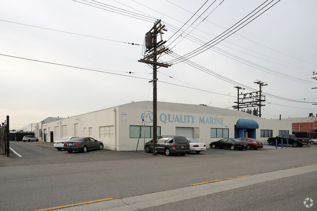
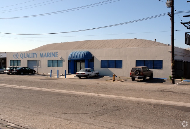
Property Record
5432 W 104Th St, Los Angeles, CA 90045
NEARBY LISTINGS FOR SALE OR LEASE
Property Detail
5432 W 104Th St
Los Angeles-Long Beach-Glendale, CA
14596
4129-034-009
TRACT NO 14596 LOT 8
Lightindustrial
Los Angeles
X
California
06037C1760F
8
2024
0.46 AC
2025
Westside
980028
Los Angeles
10,140 SF
DEMOGRAPHICS near 5432 W 104Th St
1 Mile
3 Mile
5 Mile
2024 Total Population
15,740
232,227
631,937
2029 Population
15,269
225,317
613,208
Pop Growth 2024-2029
(2.99%)
(2.98%)
(2.96%)
Average Age
37
39
39
2024 Total Households
4,687
82,901
230,192
HH Growth 2024-2029
(2.94%)
(3.09%)
(3.13%)
Median Household Inc
$62,777
$75,959
$83,596
Avg Household Size
3.30
2.70
2.70
2024 Avg HH Vehicles
2.00
2.00
2.00
Median Home Value
$717,325
$854,312
$873,244
Median Year Built
1959
1962
1961
Nearby Places
Map Layers
Map Styles
 Street
 Aerial
- Restaurants
- Banks
- Shops
- Fitness
- Groceries
PUBLIC TRANSPORTATION
AIRPORT
Los Angeles International
DRIVE
WALK
Distance
Los Angeles International
5 min
2.3 mi
Long Beach (Daugherty Field)
DRIVE
WALK
Distance
Long Beach (Daugherty Field)
24 min
18.1 mi
Bob Hope
DRIVE
WALK
Distance
Bob Hope
37 min
27.1 mi
Freight Ports
Port of Long Beach
DRIVE
WALK
Distance
Port of Long Beach
27 min
20.0 mi
Nearby Properties
Address
Land Use
TOTAL SIZE
Lot Size
Zoning
Address
Land Use
TOTAL SIZE
Lot Size
Zoning
2,531,696 SF
79.60 AC
INCR*
Address
Land Use
TOTAL SIZE
Lot Size
Zoning
1,807,845 SF
7.28 AC
ESC3
Address
Land Use
TOTAL SIZE
Lot Size
Zoning
584,746 SF
20.38 AC
MNIP
Address
Land Use
TOTAL SIZE
Lot Size
Zoning
Address
Land Use
TOTAL SIZE
Lot Size
Zoning
Address
Land Use
TOTAL SIZE
Lot Size
Zoning
Address
Land Use
TOTAL SIZE
Lot Size
Zoning
Address
Land Use
TOTAL SIZE
Lot Size
Zoning
1,315,931 SF
3.36 AC
ESC3
Address
Land Use
TOTAL SIZE
Lot Size
Zoning
402,060 SF
3.58 AC
LAC2
Address
Land Use
TOTAL SIZE
Lot Size
Zoning
670,596 SF
11.60 AC
LAR4
Address
Land Use
TOTAL SIZE
Lot Size
Zoning
565,264 SF
5.95 AC
Address
Land Use
TOTAL SIZE
Lot Size
Zoning
337,106 SF
9.56 AC
ESCM*
Address
Land Use
TOTAL SIZE
Lot Size
Zoning
724,715 SF
5.76 AC
INCR*
Address
Land Use
TOTAL SIZE
Lot Size
Zoning
522,511 SF
4.91 AC
LARAS4
Address
Land Use
TOTAL SIZE
Lot Size
Zoning
329,810 SF
2.21 AC
LAC2
Address
Land Use
TOTAL SIZE
Lot Size
Zoning
622,357 SF
3.42 AC
LAC2
Address
Land Use
TOTAL SIZE
Lot Size
Zoning
944,791 SF
22.53 AC
ESCM*
Address
Land Use
TOTAL SIZE
Lot Size
Zoning
421,934 SF
8.24 AC
ESCM
Address
Land Use
TOTAL SIZE
Lot Size
Zoning
459,058 SF
8.84 AC
ESC3*
Address
Land Use
TOTAL SIZE
Lot Size
Zoning
632,476 SF
10.56 AC
LAC2
Address
Land Use
TOTAL SIZE
Lot Size
Zoning
329,322 SF
1.28 AC
LAC2
Address
Land Use
TOTAL SIZE
Lot Size
Zoning
784,680 SF
18.28 AC
LAM1
Address
Land Use
TOTAL SIZE
Lot Size
Zoning
284,937 SF
3 AC
LARAS4
Address
Land Use
TOTAL SIZE
Lot Size
Zoning
652,774 SF
3.60 AC
LAC2
Address
Land Use
TOTAL SIZE
Lot Size
Zoning
553,161 SF
21.61 AC
ESM2*
Address
Land Use
TOTAL SIZE
Lot Size
Zoning
514,125 SF
3.11 AC
LAC2
Address
Land Use
TOTAL SIZE
Lot Size
Zoning
418,131 SF
3.03 AC
LCC1
Address
Land Use
TOTAL SIZE
Lot Size
Zoning
793,455 SF
31.88 AC
ESM2*
Address
Land Use
TOTAL SIZE
Lot Size
Zoning
1,410,144 SF
6.35 AC
ESM2*
Address
Land Use
TOTAL SIZE
Lot Size
Zoning
189,244 SF
3.64 AC
ESCM*
The World's #1 Commercial Real Estate Marketplace
Connect with us
© 2025 CoStar Group
The information above has been obtained from sources believed reliable. While we do not doubt its accuracy we have not verified it and make no guarantee, warranty or representation about it. It is your responsibility to independently confirm its accuracy and completeness. Any projections, opinions, assumptions, or estimates used are for example only and do not represent the current or future performance of the property. The value of this transaction to you depends on tax and other factors which should be evaluated by your tax, financial, and legal advisors. You and your advisors should conduct a careful, independent investigation of the property to determine to your satisfaction the suitability of the property for your needs.