Property Record
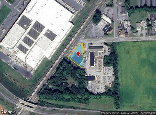
544 Webbs Ln, Dover, DE 19904


NEARBY LISTINGS FOR SALE OR LEASE
Property Detail
544 Webbs Ln
2-00-08500-02-0100-000
East Dover Hundred
Commercialnec
SOME INFO KEYED FROM LEGAL DESC, BUT COMPLETE LEGAL NOT CAPTURED
X
Kent
10001C0168H
Delaware
2025
0.71 AC
2025
Kent County
041500
Philadelphia
13,170 SF
Dover, DE
DEMOGRAPHICS near 544 Webbs Ln
1 Mile
3 Mile
5 Mile
2024 Total Population
4,788
48,573
83,604
2029 Population
5,126
52,206
89,650
Pop Growth 2024-2029
+ 7.06%
+ 7.48%
+ 7.23%
Average Age
39
39
39
2024 Total Households
1,771
18,875
31,601
HH Growth 2024-2029
+ 7.28%
+ 7.74%
+ 7.50%
Median Household Inc
$57,157
$59,557
$62,228
Avg Household Size
2.70
2.50
2.50
2024 Avg HH Vehicles
2.00
2.00
2.00
Median Home Value
$198,349
$267,950
$269,571
Median Year Built
1966
1984
1988
Nearby Places
Map Layers
Map Styles
 Street
 Aerial
- Restaurants
- Banks
- Shops
- Fitness
- Groceries
SALE & LEASE HISTORY
LISTING DATE
SALE/LEASE

Apr 09, 2019
For Lease
Nearby Properties
Address
Land Use
TOTAL SIZE
Lot Size
Zoning
Address
Land Use
TOTAL SIZE
Lot Size
Zoning
308,750 SF
102.10 AC
R10
Address
Land Use
TOTAL SIZE
Lot Size
Zoning
Address
Land Use
TOTAL SIZE
Lot Size
Zoning
494,672 SF
35.80 AC
NA
Address
Land Use
TOTAL SIZE
Lot Size
Zoning
189,363 SF
123.90 AC
IO
Address
Land Use
TOTAL SIZE
Lot Size
Zoning
172,440 SF
28.86 AC
RM2
Address
Land Use
TOTAL SIZE
Lot Size
Zoning
322,096 SF
18.20 AC
SC2
Address
Land Use
TOTAL SIZE
Lot Size
Zoning
95,706 SF
22.94 AC
R10
Address
Land Use
TOTAL SIZE
Lot Size
Zoning
135,552 SF
39.05 AC
AC
Address
Land Use
TOTAL SIZE
Lot Size
Zoning
567,080 SF
30.22 AC
IPM
Address
Land Use
TOTAL SIZE
Lot Size
Zoning
179,601 SF
42.90 AC
IO
Address
Land Use
TOTAL SIZE
Lot Size
Zoning
93,186 SF
89.27 AC
IPM
Address
Land Use
TOTAL SIZE
Lot Size
Zoning
228,076 SF
15.50 AC
BG
Address
Land Use
TOTAL SIZE
Lot Size
Zoning
129,471 SF
TND
Address
Land Use
TOTAL SIZE
Lot Size
Zoning
108,450 SF
11 AC
RM
Address
Land Use
TOTAL SIZE
Lot Size
Zoning
116,604 SF
3.20 AC
IO
Address
Land Use
TOTAL SIZE
Lot Size
Zoning
189,000 SF
13.40 AC
RG2
Address
Land Use
TOTAL SIZE
Lot Size
Zoning
187,104 SF
7.80 AC
RM1
Address
Land Use
TOTAL SIZE
Lot Size
Zoning
72,794 SF
11.57 AC
IO
Address
Land Use
TOTAL SIZE
Lot Size
Zoning
Address
Land Use
TOTAL SIZE
Lot Size
Zoning
60,324 SF
6.70 AC
IO
Address
Land Use
TOTAL SIZE
Lot Size
Zoning
Address
Land Use
TOTAL SIZE
Lot Size
Zoning
109,262 SF
15.03 AC
NA
Address
Land Use
TOTAL SIZE
Lot Size
Zoning
421,941 SF
23.70 AC
IPM
Address
Land Use
TOTAL SIZE
Lot Size
Zoning
188,100 SF
9.70 AC
RG2
Address
Land Use
TOTAL SIZE
Lot Size
Zoning
113,226 SF
2.50 AC
IO
Address
Land Use
TOTAL SIZE
Lot Size
Zoning
105,470 SF
6.90 AC
IO
Address
Land Use
TOTAL SIZE
Lot Size
Zoning
136,440 SF
6.60 AC
RM1
Address
Land Use
TOTAL SIZE
Lot Size
Zoning
168,550 SF
22.40 AC
IO
Address
Land Use
TOTAL SIZE
Lot Size
Zoning
52,250 SF
8.50 AC
RG2
Address
Land Use
TOTAL SIZE
Lot Size
Zoning
The World's #1 Commercial Real Estate Marketplace
Connect with us
© 2026 CoStar Group
The information above has been obtained from sources believed reliable. While we do not doubt its accuracy we have not verified it and make no guarantee, warranty or representation about it. It is your responsibility to independently confirm its accuracy and completeness. Any projections, opinions, assumptions, or estimates used are for example only and do not represent the current or future performance of the property. The value of this transaction to you depends on tax and other factors which should be evaluated by your tax, financial, and legal advisors. You and your advisors should conduct a careful, independent investigation of the property to determine to your satisfaction the suitability of the property for your needs.