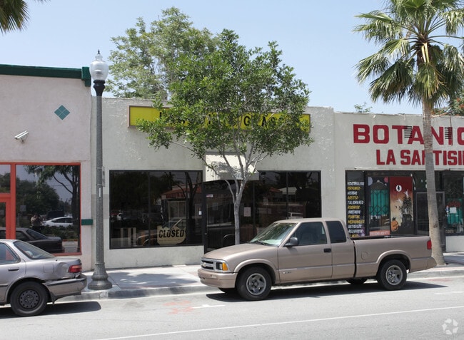
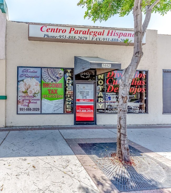
Property Record
5442 Mission Blvd, Jurupa Valley, CA 92509
NEARBY LISTINGS FOR SALE OR LEASE
Property Detail
5442 Mission Blvd
Riverside-San Bernardino-Ontario, CA
Assessors Map 10
181-063-021
.06 ACRES M/L IN POR LOT 12 AM 001/010 ASSESSORS MAP 10
Storebuilding
Riverside
X
California
06065C0710H
12
2024
0.06 AC
2025
Riverside
040203
Inland Empire (California)
1,560 SF
DEMOGRAPHICS near 5442 Mission Blvd
1 Mile
3 Mile
5 Mile
2024 Total Population
15,362
98,078
258,808
2029 Population
16,065
103,141
270,763
Pop Growth 2024-2029
+ 4.58%
+ 5.16%
+ 4.62%
Average Age
33
36
35
2024 Total Households
3,835
27,945
73,289
HH Growth 2024-2029
+ 4.04%
+ 4.79%
+ 4.36%
Median Household Inc
$53,216
$78,346
$75,921
Avg Household Size
3.80
3.30
3.20
2024 Avg HH Vehicles
2.00
2.00
2.00
Median Home Value
$333,019
$442,314
$445,061
Median Year Built
1975
1966
1973
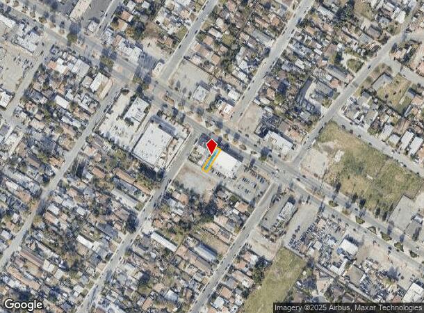
Nearby Places
Map Layers
Map Styles
 Street
 Aerial
- Restaurants
- Banks
- Shops
- Fitness
- Groceries
PUBLIC TRANSPORTATION
COMMUTER RAIL
Riverside-Downtown (91 Line - Southern California Regional Rail Authority (Metrolink), Inland Empire-Orange County Line - Southern California Regional Rail Authority (Metrolink), Riverside Line - Southern California Regional Rail Authority (Metrolink))
DRIVE
WALK
Distance
Riverside-Downtown (91 Line - Southern California Regional Rail Authority (Metrolink), Inland Empire-Orange County Line - Southern California Regional Rail Authority (Metrolink), Riverside Line - Southern California Regional Rail Authority (Metrolink))
8 min
2.8 mi
Pedley (Riverside Line - Southern California Regional Rail Authority (Metrolink))
DRIVE
WALK
Distance
Pedley (Riverside Line - Southern California Regional Rail Authority (Metrolink))
10 min
5.2 mi
AIRPORT
Ontario International
DRIVE
WALK
Distance
Ontario International
20 min
14.1 mi
John Wayne/Orange County
DRIVE
WALK
Distance
John Wayne/Orange County
56 min
44.6 mi
Freight Ports
Port of Long Beach
DRIVE
WALK
Distance
Port of Long Beach
78 min
58.7 mi
SALE & LEASE HISTORY
LISTING DATE
SALE/LEASE

Aug 09, 2018
For Sale
Nearby Properties
Address
Land Use
TOTAL SIZE
Lot Size
Zoning
Address
Land Use
TOTAL SIZE
Lot Size
Zoning
1,186,950 SF
54.77 AC
Address
Land Use
TOTAL SIZE
Lot Size
Zoning
1,025,132 SF
46.44 AC
Address
Land Use
TOTAL SIZE
Lot Size
Zoning
1,264,064 SF
64.44 AC
Address
Land Use
TOTAL SIZE
Lot Size
Zoning
1,000,177 SF
46 AC
Address
Land Use
TOTAL SIZE
Lot Size
Zoning
412,950 SF
23.16 AC
C2
Address
Land Use
TOTAL SIZE
Lot Size
Zoning
247,416 SF
10.17 AC
Address
Land Use
TOTAL SIZE
Lot Size
Zoning
350,278 SF
1.21 AC
Address
Land Use
TOTAL SIZE
Lot Size
Zoning
156,241 SF
2.55 AC
Address
Land Use
TOTAL SIZE
Lot Size
Zoning
55.22 AC
AMSP
Address
Land Use
TOTAL SIZE
Lot Size
Zoning
139,454 SF
0.97 AC
DSP
Address
Land Use
TOTAL SIZE
Lot Size
Zoning
37,729 SF
3.23 AC
Address
Land Use
TOTAL SIZE
Lot Size
Zoning
210,004 SF
11.68 AC
Address
Land Use
TOTAL SIZE
Lot Size
Zoning
87,600 SF
0.39 AC
Address
Land Use
TOTAL SIZE
Lot Size
Zoning
244,495 SF
17.53 AC
MH
Address
Land Use
TOTAL SIZE
Lot Size
Zoning
134,944 SF
2.52 AC
Address
Land Use
TOTAL SIZE
Lot Size
Zoning
122,023 SF
6.83 AC
Address
Land Use
TOTAL SIZE
Lot Size
Zoning
192,903 SF
11.37 AC
Address
Land Use
TOTAL SIZE
Lot Size
Zoning
272,472 SF
24.49 AC
N2
Address
Land Use
TOTAL SIZE
Lot Size
Zoning
69,660 SF
0.62 AC
C3
Address
Land Use
TOTAL SIZE
Lot Size
Zoning
180,215 SF
14.73 AC
Address
Land Use
TOTAL SIZE
Lot Size
Zoning
446,832 SF
5.03 AC
Address
Land Use
TOTAL SIZE
Lot Size
Zoning
83,572 SF
2.93 AC
Address
Land Use
TOTAL SIZE
Lot Size
Zoning
140,198 SF
8.84 AC
Address
Land Use
TOTAL SIZE
Lot Size
Zoning
156,688 SF
6.09 AC
BMP
Address
Land Use
TOTAL SIZE
Lot Size
Zoning
306,278 SF
2.50 AC
C3
Address
Land Use
TOTAL SIZE
Lot Size
Zoning
85,322 SF
0.48 AC
Address
Land Use
TOTAL SIZE
Lot Size
Zoning
396,368 SF
18.58 AC
AMSP
The World's #1 Commercial Real Estate Marketplace
Connect with us
© 2025 CoStar Group
The information above has been obtained from sources believed reliable. While we do not doubt its accuracy we have not verified it and make no guarantee, warranty or representation about it. It is your responsibility to independently confirm its accuracy and completeness. Any projections, opinions, assumptions, or estimates used are for example only and do not represent the current or future performance of the property. The value of this transaction to you depends on tax and other factors which should be evaluated by your tax, financial, and legal advisors. You and your advisors should conduct a careful, independent investigation of the property to determine to your satisfaction the suitability of the property for your needs.