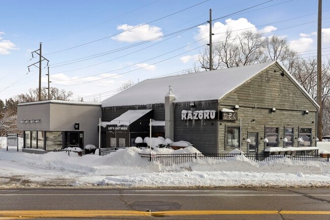
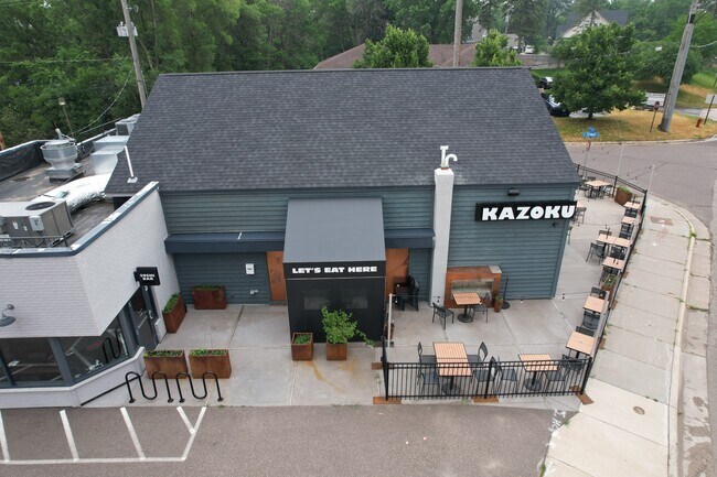
Property Record
5445 Eden Prairie Rd, Minnetonka, MN 55345
NEARBY LISTINGS FOR SALE OR LEASE
Property Detail
5445 Eden Prairie Rd
33-117-22-11-0005
Unplatted 33 117 22
Commercialnec
UNPLATTED 33 117 22 THAT PART OF THE ABANDONED R/W OF THE ST P M AND M RY ACROSS THE NE 1/4 OF SEC 33 LYING BET THE E LINE OF CO ROAD NO 4 AND A LINE AT RIGHT T 100X260
X
Hennepin
27053C0339F
Minnesota
2024
0.47 AC
2024
Ridgedale
026208
Minneapolis/St Paul
2,571 SF
Minneapolis-St. Paul-Bloomington, MN-WI
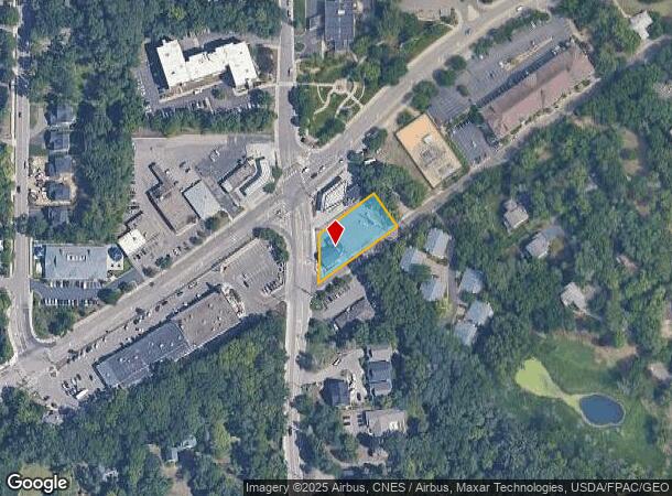
DEMOGRAPHICS near 5445 Eden Prairie Rd
1 Mile
3 Mile
5 Mile
2024 Total Population
5,250
57,041
156,832
2029 Population
5,121
56,056
155,387
Pop Growth 2024-2029
(2.46%)
(1.73%)
(0.92%)
Average Age
47
43
42
2024 Total Households
2,233
24,062
65,920
HH Growth 2024-2029
(2.64%)
(1.77%)
(1.03%)
Median Household Inc
$110,722
$102,783
$104,250
Avg Household Size
2.30
2.30
2.30
2024 Avg HH Vehicles
2.00
2.00
2.00
Median Home Value
$434,517
$389,277
$428,987
Median Year Built
1975
1979
1981
Nearby Places
Map Layers
Map Styles
 Street
 Aerial
- Restaurants
- Banks
- Shops
- Fitness
- Groceries
PUBLIC TRANSPORTATION
AIRPORT
Minneapolis-St Paul International/Wold-Chamberlain
DRIVE
WALK
Distance
Minneapolis-St Paul International/Wold-Chamberlain
21 min
15.6 mi
Freight Ports
Port of Shreveport
DRIVE
WALK
Distance
Port of Shreveport
1 min
867.1 mi
SALE & LEASE HISTORY
LISTING DATE
SALE/LEASE

Nov 14, 2016
For Lease
Jan 24, 2023
For Sale
Jan 24, 2021
For Sale
Nearby Properties
Address
Land Use
TOTAL SIZE
Lot Size
Zoning
Address
Land Use
TOTAL SIZE
Lot Size
Zoning
7.68 AC
Address
Land Use
TOTAL SIZE
Lot Size
Zoning
4.89 AC
Address
Land Use
TOTAL SIZE
Lot Size
Zoning
0.90 AC
Address
Land Use
TOTAL SIZE
Lot Size
Zoning
3.07 AC
Address
Land Use
TOTAL SIZE
Lot Size
Zoning
4.84 AC
Address
Land Use
TOTAL SIZE
Lot Size
Zoning
138,997 SF
14.03 AC
OFC
Address
Land Use
TOTAL SIZE
Lot Size
Zoning
4.55 AC
Address
Land Use
TOTAL SIZE
Lot Size
Zoning
3.15 AC
Address
Land Use
TOTAL SIZE
Lot Size
Zoning
233,320 SF
17.37 AC
PUD
Address
Land Use
TOTAL SIZE
Lot Size
Zoning
93,982 SF
9.33 AC
OFC
Address
Land Use
TOTAL SIZE
Lot Size
Zoning
314,234 SF
2.31 AC
RM25
Address
Land Use
TOTAL SIZE
Lot Size
Zoning
122,801 SF
8.41 AC
RM25
Address
Land Use
TOTAL SIZE
Lot Size
Zoning
13.43 AC
Address
Land Use
TOTAL SIZE
Lot Size
Zoning
8.38 AC
PUD
Address
Land Use
TOTAL SIZE
Lot Size
Zoning
46,726 SF
2.65 AC
PUD
Address
Land Use
TOTAL SIZE
Lot Size
Zoning
70,129 SF
13.03 AC
RM25
Address
Land Use
TOTAL SIZE
Lot Size
Zoning
129,037 SF
16.73 AC
RM25
Address
Land Use
TOTAL SIZE
Lot Size
Zoning
11.56 AC
Address
Land Use
TOTAL SIZE
Lot Size
Zoning
29,078 SF
12.84 AC
PUD
Address
Land Use
TOTAL SIZE
Lot Size
Zoning
20.18 AC
RM65
Address
Land Use
TOTAL SIZE
Lot Size
Zoning
2,676 SF
3.17 AC
PUD
Address
Land Use
TOTAL SIZE
Lot Size
Zoning
7.38 AC
Address
Land Use
TOTAL SIZE
Lot Size
Zoning
7.06 AC
PUD
Address
Land Use
TOTAL SIZE
Lot Size
Zoning
49,925 SF
18.37 AC
B1
Address
Land Use
TOTAL SIZE
Lot Size
Zoning
129,168 SF
16.01 AC
PUD
Address
Land Use
TOTAL SIZE
Lot Size
Zoning
7,209 SF
2.53 AC
B1
Address
Land Use
TOTAL SIZE
Lot Size
Zoning
87,000 SF
5.27 AC
R5
Address
Land Use
TOTAL SIZE
Lot Size
Zoning
188,805 SF
15.72 AC
C-REG-SER
Address
Land Use
TOTAL SIZE
Lot Size
Zoning
23.66 AC
Address
Land Use
TOTAL SIZE
Lot Size
Zoning
47,443 SF
10.11 AC
RM25
The World's #1 Commercial Real Estate Marketplace
Connect with us
© 2025 CoStar Group
The information above has been obtained from sources believed reliable. While we do not doubt its accuracy we have not verified it and make no guarantee, warranty or representation about it. It is your responsibility to independently confirm its accuracy and completeness. Any projections, opinions, assumptions, or estimates used are for example only and do not represent the current or future performance of the property. The value of this transaction to you depends on tax and other factors which should be evaluated by your tax, financial, and legal advisors. You and your advisors should conduct a careful, independent investigation of the property to determine to your satisfaction the suitability of the property for your needs.