Property Record
5447 Saint Charles Rd, Berkeley, IL 60163
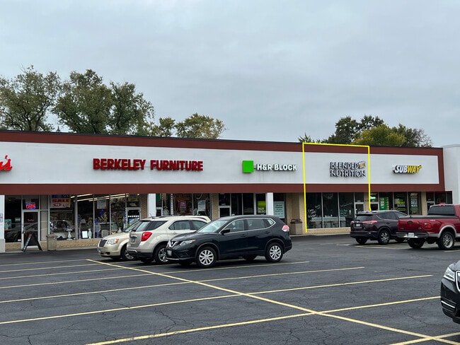


Property Detail
5447 Saint Charles Rd
Chicago-Naperville-Elgin, IL-IN
(SUBDIVISION) OF W100FT OF LT6 EX N17FT IN BLK1 IN WO LF RD HIGHLANDS BEING ROBERTSON & YOUNGS SUB SEC7 SEC 07-39-12
15-07-213-005-0000
Cook
Commercialbuilding
Illinois
B and X Area of moderate flood hazard, usually the area between the limits of the 100-year and 500-year floods.
6
2023
0.18 AC
2025
Melrose Park Area
816800
Chicago
NEARBY LISTINGS FOR SALE OR LEASE
DEMOGRAPHICS near 5447 Saint Charles Rd
1 mile
3 mile
5 mile
2025 Total Population
15,419
139,553
322,596
2030 Population
15,521
140,214
325,219
Pop Growth 2025-2030
+ 0.66%
+ 0.47%
+ 0.81%
Average Age
41
40
41
2025 Total Households
5,135
47,335
115,432
HH Growth 2025-2030
+ 0.45%
+ 0.39%
+ 0.78%
Median Household Inc
$81,299
$90,348
$90,193
Avg Household Size
2.90
2.80
2.70
2025 Avg HH Vehicles
2.00
2.00
2.00
Median Home Value
$243,806
$297,347
$314,609
Median Year Built
1956
1957
1957
Nearby Places
Map Layers
Map Styles
 Street
 Aerial
Transit
 Traffic
 Biking
Places
Listings with unknown addresses are not visible on the map
- Restaurants
- Banks
- Shops
- Fitness
- Groceries
PUBLIC TRANSPORTATION
COMMUTER RAIL
Berkeley Station (Union Pacific West Line - Northeast Illinois Regional Commuter Railroad (Metra))
Drive
Walk
Distance
Berkeley Station (Union Pacific West Line - Northeast Illinois Regional Commuter Railroad (Metra))
3 min
19 min
0.9 mi
Bellwood Station (Union Pacific West Line - Northeast Illinois Regional Commuter Railroad (Metra))
Drive
Walk
Distance
Bellwood Station (Union Pacific West Line - Northeast Illinois Regional Commuter Railroad (Metra))
3 min
1.5 mi
AIRPORT
Chicago O'Hare International
Drive
Walk
Distance
Chicago O'Hare International
19 min
9.8 mi
Chicago Midway International
Drive
Walk
Distance
Chicago Midway International
23 min
13.5 mi
Freight Ports
Port Milwaukee
Drive
Walk
Distance
Port Milwaukee
101 min
83.9 mi
SALE & LEASE HISTORY
LISTING DATE
SALE/LEASE

Sep 25, 2016
For Lease
Oct 20, 2023
For Lease
Oct 20, 2023
For Lease
Aug 01, 2024
For Lease
Nearby Properties
Address
Land Use
TOTAL SIZE
Lot Size
Zoning
Address
Land Use
TOTAL SIZE
Lot Size
Zoning
820,106 SF
14.78 AC
Address
Land Use
TOTAL SIZE
Lot Size
Zoning
Address
Land Use
TOTAL SIZE
Lot Size
Zoning
1,089,750 SF
59.83 AC
I
Address
Land Use
TOTAL SIZE
Lot Size
Zoning
435,740 SF
17.74 AC
C
Address
Land Use
TOTAL SIZE
Lot Size
Zoning
86.63 AC
Address
Land Use
TOTAL SIZE
Lot Size
Zoning
250,870 SF
19.23 AC
Address
Land Use
TOTAL SIZE
Lot Size
Zoning
309,570 SF
1.02 AC
Address
Land Use
TOTAL SIZE
Lot Size
Zoning
15.17 AC
Address
Land Use
TOTAL SIZE
Lot Size
Zoning
224,145 SF
2.48 AC
Address
Land Use
TOTAL SIZE
Lot Size
Zoning
240,073 SF
1.04 AC
Address
Land Use
TOTAL SIZE
Lot Size
Zoning
973,922 SF
53.84 AC
I
Address
Land Use
TOTAL SIZE
Lot Size
Zoning
271,822 SF
26.29 AC
Address
Land Use
TOTAL SIZE
Lot Size
Zoning
204,600 SF
9.45 AC
M
Address
Land Use
TOTAL SIZE
Lot Size
Zoning
969,696 SF
44.30 AC
Address
Land Use
TOTAL SIZE
Lot Size
Zoning
0.84 AC
Address
Land Use
TOTAL SIZE
Lot Size
Zoning
152,332 SF
3.60 AC
Address
Land Use
TOTAL SIZE
Lot Size
Zoning
221,111 SF
20.62 AC
Address
Land Use
TOTAL SIZE
Lot Size
Zoning
516,605 SF
16.29 AC
Address
Land Use
TOTAL SIZE
Lot Size
Zoning
98,990 SF
3.52 AC
C
Address
Land Use
TOTAL SIZE
Lot Size
Zoning
28,774 SF
4.30 AC
C
Address
Land Use
TOTAL SIZE
Lot Size
Zoning
790,000 SF
31.71 AC
Address
Land Use
TOTAL SIZE
Lot Size
Zoning
520,000 SF
2.96 AC
Address
Land Use
TOTAL SIZE
Lot Size
Zoning
6.26 AC
Address
Land Use
TOTAL SIZE
Lot Size
Zoning
190,719 SF
10.10 AC
Address
Land Use
TOTAL SIZE
Lot Size
Zoning
1,156,393 SF
6.55 AC
Address
Land Use
TOTAL SIZE
Lot Size
Zoning
6.11 AC
Address
Land Use
TOTAL SIZE
Lot Size
Zoning
Address
Land Use
TOTAL SIZE
Lot Size
Zoning
276,458 SF
16.14 AC
Address
Land Use
TOTAL SIZE
Lot Size
Zoning
128,536 SF
17.06 AC
C
Address
Land Use
TOTAL SIZE
Lot Size
Zoning
128,536 SF
11.24 AC
C
The World's #1 Commercial Real Estate Marketplace
Connect with us
© 2026 CoStar Group
The information above has been obtained from sources believed reliable. While we do not doubt its accuracy we have not verified it and make no guarantee, warranty or representation about it. It is your responsibility to independently confirm its accuracy and completeness. Any projections, opinions, assumptions, or estimates used are for example only and do not represent the current or future performance of the property. The value of this transaction to you depends on tax and other factors which should be evaluated by your tax, financial, and legal advisors. You and your advisors should conduct a careful, independent investigation of the property to determine to your satisfaction the suitability of the property for your needs.