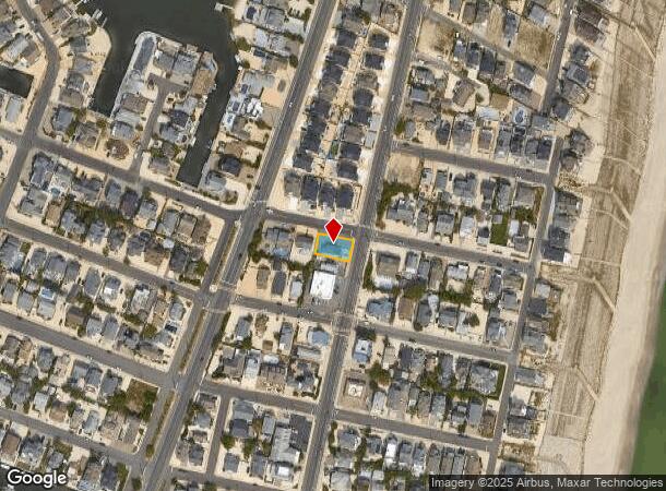
Property Record
545 Route 35 No N, Brick, NJ 08738
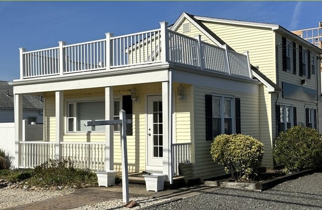
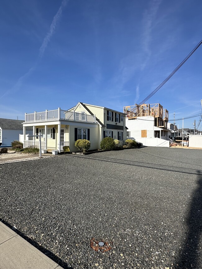
This Property Is For Sale
Current Lease Availabilities
NEARBY LISTINGS FOR SALE OR LEASE
Property Detail
545 Route 35 No N
07-00011-17-00001
60X95 2,3
Commercialnec
Ocean
AO
New Jersey
34029C0218F
1
2024
0.13 AC
2025
Ocean County
739200
Northern New Jersey
1,760 SF
New York-Jersey City-White Plains, NY-NJ
DEMOGRAPHICS near 545 Route 35 No N
1 Mile
3 Mile
5 Mile
2024 Total Population
5,411
20,398
81,825
2029 Population
6,531
23,816
90,768
Pop Growth 2024-2029
+ 20.70%
+ 16.76%
+ 10.93%
Average Age
58
53
45
2024 Total Households
2,886
9,927
34,514
HH Growth 2024-2029
+ 20.62%
+ 17.04%
+ 11.29%
Median Household Inc
$76,502
$91,655
$93,496
Avg Household Size
1.80
2.00
2.30
2024 Avg HH Vehicles
2.00
2.00
2.00
Median Home Value
$744,772
$661,750
$436,638
Median Year Built
1979
1979
1974
Nearby Places
- Restaurants
- Banks
- Shops
- Fitness
- Groceries
PUBLIC TRANSPORTATION
COMMUTER RAIL
Bay Head (North Jersey Coast Line - NJ Transit Commuter Rail (NJ Transit))
DRIVE
WALK
Distance
Bay Head (North Jersey Coast Line - NJ Transit Commuter Rail (NJ Transit))
11 min
5.3 mi
Point Pleasant Beach (North Jersey Coast Line - NJ Transit Commuter Rail (NJ Transit))
DRIVE
WALK
Distance
Point Pleasant Beach (North Jersey Coast Line - NJ Transit Commuter Rail (NJ Transit))
13 min
6.6 mi
Freight Ports
New York Container Terminal
DRIVE
WALK
Distance
New York Container Terminal
76 min
56.0 mi
Nearby Properties
Address
Land Use
TOTAL SIZE
Lot Size
Zoning
Address
Land Use
TOTAL SIZE
Lot Size
Zoning
117 AC
RR1
Address
Land Use
TOTAL SIZE
Lot Size
Zoning
2.67 AC
SMF
Address
Land Use
TOTAL SIZE
Lot Size
Zoning
Address
Land Use
TOTAL SIZE
Lot Size
Zoning
29,422 SF
1.30 AC
Address
Land Use
TOTAL SIZE
Lot Size
Zoning
1.29 AC
Address
Land Use
TOTAL SIZE
Lot Size
Zoning
1,677 SF
3 AC
R-3A
Address
Land Use
TOTAL SIZE
Lot Size
Zoning
10,003 SF
0.32 AC
PU
Address
Land Use
TOTAL SIZE
Lot Size
Zoning
1.23 AC
SMF
Address
Land Use
TOTAL SIZE
Lot Size
Zoning
1,679 SF
2.17 AC
SMF
Address
Land Use
TOTAL SIZE
Lot Size
Zoning
1.22 AC
SMF
Address
Land Use
TOTAL SIZE
Lot Size
Zoning
Address
Land Use
TOTAL SIZE
Lot Size
Zoning
2,268 SF
6.91 AC
R75
Address
Land Use
TOTAL SIZE
Lot Size
Zoning
Address
Land Use
TOTAL SIZE
Lot Size
Zoning
2,430 SF
11.68 AC
B2
Address
Land Use
TOTAL SIZE
Lot Size
Zoning
2.76 AC
Address
Land Use
TOTAL SIZE
Lot Size
Zoning
1.28 AC
R-1
Address
Land Use
TOTAL SIZE
Lot Size
Zoning
13,168 SF
0.66 AC
Address
Land Use
TOTAL SIZE
Lot Size
Zoning
5,289 SF
2.89 AC
Address
Land Use
TOTAL SIZE
Lot Size
Zoning
5,624 SF
1.28 AC
GB
Address
Land Use
TOTAL SIZE
Lot Size
Zoning
192 SF
0.71 AC
GB
Address
Land Use
TOTAL SIZE
Lot Size
Zoning
16.90 AC
B2
Address
Land Use
TOTAL SIZE
Lot Size
Zoning
1.33 AC
R75
Address
Land Use
TOTAL SIZE
Lot Size
Zoning
120.72 AC
RR1
Address
Land Use
TOTAL SIZE
Lot Size
Zoning
0.87 AC
R-1
Address
Land Use
TOTAL SIZE
Lot Size
Zoning
0.84 AC
R-1
Address
Land Use
TOTAL SIZE
Lot Size
Zoning
0.85 AC
R-1
Address
Land Use
TOTAL SIZE
Lot Size
Zoning
6,614 SF
0.67 AC
R-1
Address
Land Use
TOTAL SIZE
Lot Size
Zoning
0.70 AC
R-3B
Address
Land Use
TOTAL SIZE
Lot Size
Zoning
5.17 AC
B2
Address
Land Use
TOTAL SIZE
Lot Size
Zoning
2.70 AC
R5
The World's #1 Commercial Real Estate Marketplace
Connect with us
© 2025 CoStar Group
The information above has been obtained from sources believed reliable. While we do not doubt its accuracy we have not verified it and make no guarantee, warranty or representation about it. It is your responsibility to independently confirm its accuracy and completeness. Any projections, opinions, assumptions, or estimates used are for example only and do not represent the current or future performance of the property. The value of this transaction to you depends on tax and other factors which should be evaluated by your tax, financial, and legal advisors. You and your advisors should conduct a careful, independent investigation of the property to determine to your satisfaction the suitability of the property for your needs.