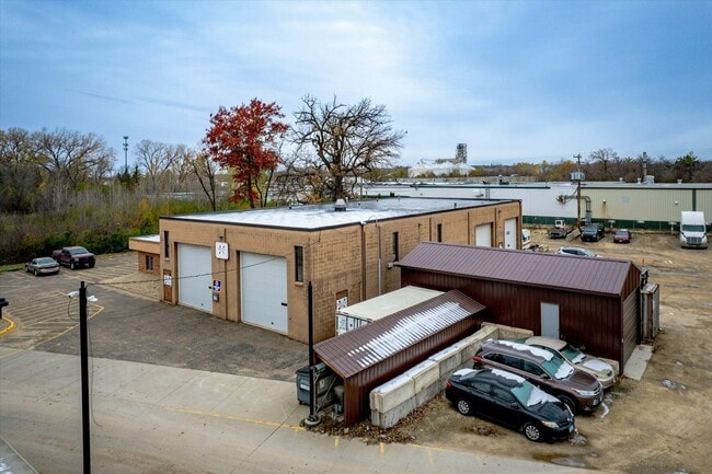
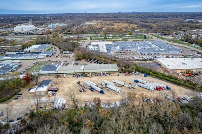
Property Record
5450 W 126Th St, Savage, MN 55378
NEARBY LISTINGS FOR SALE OR LEASE
Property Detail
5450 W 126Th St
Minneapolis-St. Paul-Bloomington, MN-WI
SECTION 16 TOWNSHIP 115 RANGE 021 60' STRIP IN NW1/4 NE1/4-ROAD COM 71.1' E OF NW COR NE1/4, S 278.84' TO POB, E
26-916-002-0
Scott
Industrialacreage
Minnesota
2025
0.95 AC
2025
Southwest
080201
Minneapolis/St Paul
DEMOGRAPHICS near 5450 W 126Th St
1 Mile
3 Mile
5 Mile
2024 Total Population
4,406
60,551
152,542
2029 Population
4,649
62,295
155,676
Pop Growth 2024-2029
+ 5.52%
+ 2.88%
+ 2.05%
Average Age
39
39
40
2024 Total Households
1,700
22,189
59,087
HH Growth 2024-2029
+ 5.71%
+ 2.77%
+ 1.85%
Median Household Inc
$85,986
$99,729
$94,768
Avg Household Size
2.60
2.60
2.50
2024 Avg HH Vehicles
2.00
2.00
2.00
Median Home Value
$310,988
$340,961
$345,162
Median Year Built
1986
1986
1983
Nearby Places
Map Layers
Map Styles
 Street
 Aerial
- Restaurants
- Banks
- Shops
- Fitness
- Groceries
PUBLIC TRANSPORTATION
AIRPORT
Minneapolis-St Paul International/Wold-Chamberlain
DRIVE
WALK
Distance
Minneapolis-St Paul International/Wold-Chamberlain
25 min
15.3 mi
Freight Ports
Port Milwaukee
DRIVE
WALK
Distance
Port Milwaukee
390 min
349.1 mi
SALE & LEASE HISTORY
LISTING DATE
SALE/LEASE

Nov 10, 2023
For Lease
Nov 10, 2023
For Sale
Nearby Properties
Address
Land Use
TOTAL SIZE
Lot Size
Zoning
Address
Land Use
TOTAL SIZE
Lot Size
Zoning
378,396 SF
20.25 AC
Address
Land Use
TOTAL SIZE
Lot Size
Zoning
114,152 SF
18.42 AC
Address
Land Use
TOTAL SIZE
Lot Size
Zoning
581,195 SF
37 AC
Address
Land Use
TOTAL SIZE
Lot Size
Zoning
184,747 SF
8.44 AC
Address
Land Use
TOTAL SIZE
Lot Size
Zoning
45,147 SF
11.24 AC
Address
Land Use
TOTAL SIZE
Lot Size
Zoning
394,700 SF
13.23 AC
Address
Land Use
TOTAL SIZE
Lot Size
Zoning
85,614 SF
11.77 AC
Address
Land Use
TOTAL SIZE
Lot Size
Zoning
436,995 SF
22.36 AC
Address
Land Use
TOTAL SIZE
Lot Size
Zoning
10.57 AC
Address
Land Use
TOTAL SIZE
Lot Size
Zoning
83,736 SF
11.69 AC
Address
Land Use
TOTAL SIZE
Lot Size
Zoning
234,348 SF
11.21 AC
Address
Land Use
TOTAL SIZE
Lot Size
Zoning
239,047 SF
9.14 AC
Address
Land Use
TOTAL SIZE
Lot Size
Zoning
310,400 SF
18.60 AC
Address
Land Use
TOTAL SIZE
Lot Size
Zoning
216,700 SF
43.17 AC
Address
Land Use
TOTAL SIZE
Lot Size
Zoning
217,534 SF
18.77 AC
Address
Land Use
TOTAL SIZE
Lot Size
Zoning
136,535 SF
4.99 AC
Address
Land Use
TOTAL SIZE
Lot Size
Zoning
324,094 SF
44.01 AC
Address
Land Use
TOTAL SIZE
Lot Size
Zoning
153,369 SF
4.84 AC
Address
Land Use
TOTAL SIZE
Lot Size
Zoning
369,600 SF
20.22 AC
Address
Land Use
TOTAL SIZE
Lot Size
Zoning
150,867 SF
100.29 AC
Address
Land Use
TOTAL SIZE
Lot Size
Zoning
179,761 SF
7.04 AC
Address
Land Use
TOTAL SIZE
Lot Size
Zoning
245,291 SF
12.64 AC
Address
Land Use
TOTAL SIZE
Lot Size
Zoning
206,005 SF
13.97 AC
Address
Land Use
TOTAL SIZE
Lot Size
Zoning
75,339 SF
3.99 AC
Address
Land Use
TOTAL SIZE
Lot Size
Zoning
231,928 SF
16.63 AC
Address
Land Use
TOTAL SIZE
Lot Size
Zoning
179,288 SF
12.88 AC
Address
Land Use
TOTAL SIZE
Lot Size
Zoning
421,893 SF
21.17 AC
Address
Land Use
TOTAL SIZE
Lot Size
Zoning
340,588 SF
16.54 AC
Address
Land Use
TOTAL SIZE
Lot Size
Zoning
13.99 AC
Address
Land Use
TOTAL SIZE
Lot Size
Zoning
125,157 SF
5.26 AC
The World's #1 Commercial Real Estate Marketplace
Connect with us
© 2025 CoStar Group
The information above has been obtained from sources believed reliable. While we do not doubt its accuracy we have not verified it and make no guarantee, warranty or representation about it. It is your responsibility to independently confirm its accuracy and completeness. Any projections, opinions, assumptions, or estimates used are for example only and do not represent the current or future performance of the property. The value of this transaction to you depends on tax and other factors which should be evaluated by your tax, financial, and legal advisors. You and your advisors should conduct a careful, independent investigation of the property to determine to your satisfaction the suitability of the property for your needs.