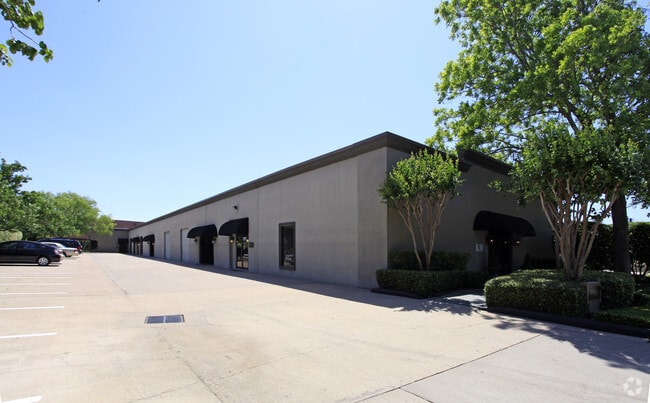
Property Record
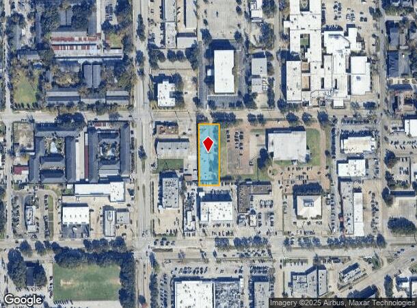
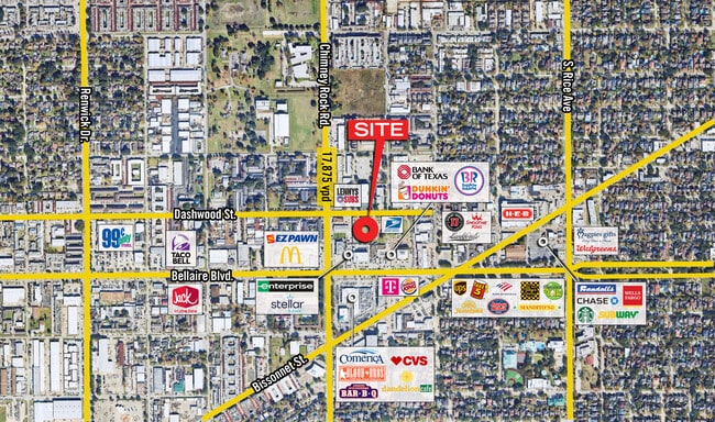
5455 Dashwood St, Bellaire, TX 77401

Current Lease Availabilities
NEARBY LISTINGS FOR SALE OR LEASE
Property Detail
5455 Dashwood St
0370550160045
Westmoreland Farms
Warehouse
TR 45B BLK 16 WESTMORELAND FARMS
AE
Harris
48201C0855L
Texas
2024
0.69 AC
2025
Bellaire
421000
Houston
14,150 SF
Houston-The Woodlands-Sugar Land, TX
DEMOGRAPHICS near 5455 Dashwood St
1 Mile
3 Mile
5 Mile
2024 Total Population
31,013
240,277
557,986
2029 Population
32,099
247,714
574,790
Pop Growth 2024-2029
+ 3.50%
+ 3.10%
+ 3.01%
Average Age
34
36
37
2024 Total Households
11,045
99,707
239,257
HH Growth 2024-2029
+ 3.49%
+ 3.16%
+ 3.08%
Median Household Inc
$39,215
$61,780
$58,925
Avg Household Size
2.70
2.30
2.30
2024 Avg HH Vehicles
2.00
2.00
1.00
Median Home Value
$767,248
$510,619
$446,445
Median Year Built
1979
1980
1981
Nearby Places
Map Layers
Map Styles
 Street
 Aerial
- Restaurants
- Banks
- Shops
- Fitness
- Groceries
PUBLIC TRANSPORTATION
COMMUTER RAIL
DRIVE
WALK
Distance
17 min
9.8 mi
AIRPORT
William P Hobby
DRIVE
WALK
Distance
William P Hobby
32 min
17.9 mi
George Bush Intcntl/Houston
DRIVE
WALK
Distance
George Bush Intcntl/Houston
38 min
28.2 mi
Freight Ports
Port of Houston
DRIVE
WALK
Distance
Port of Houston
29 min
18.2 mi
Nearby Properties
Address
Land Use
TOTAL SIZE
Lot Size
Zoning
Address
Land Use
TOTAL SIZE
Lot Size
Zoning
576,253 SF
5.91 AC
Address
Land Use
TOTAL SIZE
Lot Size
Zoning
716,631 SF
7.04 AC
Address
Land Use
TOTAL SIZE
Lot Size
Zoning
2,626,393 SF
6.70 AC
Address
Land Use
TOTAL SIZE
Lot Size
Zoning
329,832 SF
1.75 AC
Address
Land Use
TOTAL SIZE
Lot Size
Zoning
1,062,592 SF
7.41 AC
Address
Land Use
TOTAL SIZE
Lot Size
Zoning
771,702 SF
2.51 AC
Address
Land Use
TOTAL SIZE
Lot Size
Zoning
576,200 SF
2.65 AC
Address
Land Use
TOTAL SIZE
Lot Size
Zoning
777,791 SF
47.90 AC
Address
Land Use
TOTAL SIZE
Lot Size
Zoning
549,506 SF
2.05 AC
Address
Land Use
TOTAL SIZE
Lot Size
Zoning
392,218 SF
1.21 AC
Address
Land Use
TOTAL SIZE
Lot Size
Zoning
305,760 SF
2.22 AC
Address
Land Use
TOTAL SIZE
Lot Size
Zoning
1,819,963 SF
5.30 AC
Address
Land Use
TOTAL SIZE
Lot Size
Zoning
782,092 SF
8.87 AC
Address
Land Use
TOTAL SIZE
Lot Size
Zoning
214,297 SF
15.23 AC
Address
Land Use
TOTAL SIZE
Lot Size
Zoning
1,202,191 SF
39.08 AC
Address
Land Use
TOTAL SIZE
Lot Size
Zoning
338,285 SF
4.60 AC
Address
Land Use
TOTAL SIZE
Lot Size
Zoning
495,834 SF
1.49 AC
Address
Land Use
TOTAL SIZE
Lot Size
Zoning
1,098,342 SF
8.81 AC
Address
Land Use
TOTAL SIZE
Lot Size
Zoning
216,178 SF
1.28 AC
Address
Land Use
TOTAL SIZE
Lot Size
Zoning
128,404 SF
2.88 AC
Address
Land Use
TOTAL SIZE
Lot Size
Zoning
323,456 SF
3.91 AC
Address
Land Use
TOTAL SIZE
Lot Size
Zoning
760,932 SF
14.37 AC
Address
Land Use
TOTAL SIZE
Lot Size
Zoning
515,130 SF
2.72 AC
Address
Land Use
TOTAL SIZE
Lot Size
Zoning
234,153 SF
5.37 AC
Address
Land Use
TOTAL SIZE
Lot Size
Zoning
590,425 SF
8.87 AC
Address
Land Use
TOTAL SIZE
Lot Size
Zoning
281,973 SF
11.56 AC
Address
Land Use
TOTAL SIZE
Lot Size
Zoning
126,877 SF
34.71 AC
Address
Land Use
TOTAL SIZE
Lot Size
Zoning
521,287 SF
3.90 AC
Address
Land Use
TOTAL SIZE
Lot Size
Zoning
1,011,299 SF
4 AC
Address
Land Use
TOTAL SIZE
Lot Size
Zoning
589,957 SF
5.30 AC
The World's #1 Commercial Real Estate Marketplace
Connect with us
© 2025 CoStar Group
The information above has been obtained from sources believed reliable. While we do not doubt its accuracy we have not verified it and make no guarantee, warranty or representation about it. It is your responsibility to independently confirm its accuracy and completeness. Any projections, opinions, assumptions, or estimates used are for example only and do not represent the current or future performance of the property. The value of this transaction to you depends on tax and other factors which should be evaluated by your tax, financial, and legal advisors. You and your advisors should conduct a careful, independent investigation of the property to determine to your satisfaction the suitability of the property for your needs.