Property Record
5455 W Gulf To Lake Hwy, Lecanto, FL 34461

NEARBY LISTINGS FOR SALE OR LEASE
-
-
View all Lecanto listings for sale on LoopNet.com
Property Detail
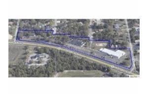
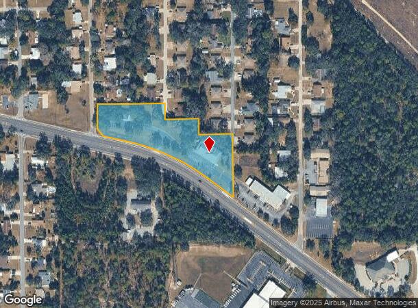
5455 W Gulf To Lake Hwy
Homosassa Springs, FL
Unrec Tracts In 30-18S-18E
18E-18S-30-0000-23000-001A
FOREST HILLS UNREC SUB TRACTS 1A 2A 3A & 4A FURTHER DESCIN OR BK 853 PGS 1970 & 1972 & OR BK 859 PG 1310 1991 LESSOUTS: OR BK 867 PG 1944(PCL 150 ADDED TO 70000)
Charitableorganization
Citrus
AE
Florida
12017C0194D
1a
2024
3.33 AC
2025
Florida Central North Area
451400
Other Market Areas
8,304 SF
DEMOGRAPHICS near 5455 W Gulf To Lake Hwy
1 Mile
3 Mile
5 Mile
2024 Total Population
2,899
11,129
39,655
2029 Population
3,258
12,508
44,895
Pop Growth 2024-2029
+ 12.38%
+ 12.39%
+ 13.21%
Average Age
52
51
53
2024 Total Households
1,256
4,869
17,766
HH Growth 2024-2029
+ 12.02%
+ 12.08%
+ 12.97%
Median Household Inc
$40,921
$54,265
$49,445
Avg Household Size
2.10
2.20
2.10
2024 Avg HH Vehicles
2.00
2.00
2.00
Median Home Value
$208,289
$210,878
$227,654
Median Year Built
1989
1990
1989
Nearby Places
Map Layers
Map Styles
 Street
 Aerial
- Restaurants
- Banks
- Shops
- Fitness
- Groceries
Nearby Properties
Address
Land Use
TOTAL SIZE
Lot Size
Zoning
Address
Land Use
TOTAL SIZE
Lot Size
Zoning
405,045 SF
18.52 AC
PSI
Address
Land Use
TOTAL SIZE
Lot Size
Zoning
135,334 SF
11.45 AC
GNC
Address
Land Use
TOTAL SIZE
Lot Size
Zoning
901,824 SF
14.37 AC
GNC
Address
Land Use
TOTAL SIZE
Lot Size
Zoning
92,500 SF
5.11 AC
PSO
Address
Land Use
TOTAL SIZE
Lot Size
Zoning
104,427 SF
11.98 AC
MDR
Address
Land Use
TOTAL SIZE
Lot Size
Zoning
664,950 SF
20.21 AC
IND
Address
Land Use
TOTAL SIZE
Lot Size
Zoning
209,094 SF
15.63 AC
GNC
Address
Land Use
TOTAL SIZE
Lot Size
Zoning
73,297 SF
163.02 AC
TCU
Address
Land Use
TOTAL SIZE
Lot Size
Zoning
98,862 SF
18.36 AC
RUR
Address
Land Use
TOTAL SIZE
Lot Size
Zoning
84,896 SF
23.49 AC
PSI
Address
Land Use
TOTAL SIZE
Lot Size
Zoning
57,652 SF
11.85 AC
GNC
Address
Land Use
TOTAL SIZE
Lot Size
Zoning
95,088 SF
103.82 AC
PSIMH
Address
Land Use
TOTAL SIZE
Lot Size
Zoning
55,949 SF
4.71 AC
GNC
Address
Land Use
TOTAL SIZE
Lot Size
Zoning
22.87 AC
GNC
Address
Land Use
TOTAL SIZE
Lot Size
Zoning
214,450 SF
9.18 AC
GNC
Address
Land Use
TOTAL SIZE
Lot Size
Zoning
155,752 SF
32.74 AC
PDR
Address
Land Use
TOTAL SIZE
Lot Size
Zoning
54,753 SF
14.95 AC
PSI
Address
Land Use
TOTAL SIZE
Lot Size
Zoning
231,816 SF
7.30 AC
PDR
Address
Land Use
TOTAL SIZE
Lot Size
Zoning
18,424 SF
5.01 AC
GNC
Address
Land Use
TOTAL SIZE
Lot Size
Zoning
36,430 SF
14.26 AC
GNC
Address
Land Use
TOTAL SIZE
Lot Size
Zoning
5,526 SF
4.72 AC
GNC
Address
Land Use
TOTAL SIZE
Lot Size
Zoning
20,492 SF
2.61 AC
GNC
Address
Land Use
TOTAL SIZE
Lot Size
Zoning
125,720 SF
5.48 AC
GNC
Address
Land Use
TOTAL SIZE
Lot Size
Zoning
23,540 SF
8.97 AC
PSO
Address
Land Use
TOTAL SIZE
Lot Size
Zoning
47,636 SF
8.67 AC
PSO
Address
Land Use
TOTAL SIZE
Lot Size
Zoning
15.12 AC
GNC
Address
Land Use
TOTAL SIZE
Lot Size
Zoning
6,807 SF
3.64 AC
GNC
Address
Land Use
TOTAL SIZE
Lot Size
Zoning
33,638 SF
40.09 AC
PSI
Address
Land Use
TOTAL SIZE
Lot Size
Zoning
227,376 SF
9.41 AC
PDR
Address
Land Use
TOTAL SIZE
Lot Size
Zoning
8,738 SF
1.93 AC
GNC
The World's #1 Commercial Real Estate Marketplace
Connect with us
© 2025 CoStar Group
The information above has been obtained from sources believed reliable. While we do not doubt its accuracy we have not verified it and make no guarantee, warranty or representation about it. It is your responsibility to independently confirm its accuracy and completeness. Any projections, opinions, assumptions, or estimates used are for example only and do not represent the current or future performance of the property. The value of this transaction to you depends on tax and other factors which should be evaluated by your tax, financial, and legal advisors. You and your advisors should conduct a careful, independent investigation of the property to determine to your satisfaction the suitability of the property for your needs.