Property Record
5457 Franklin Rd Sw, Roanoke, VA 24014
NEARBY LISTINGS FOR SALE OR LEASE
Property Detail
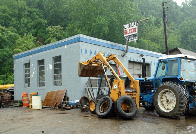
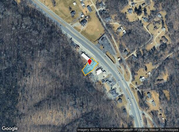
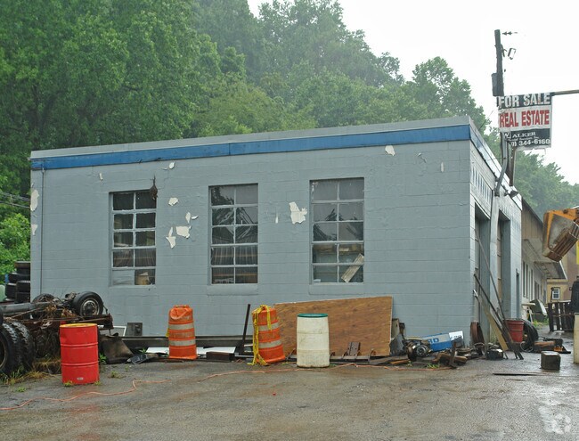
5457 Franklin Rd Sw
Roanoke, VA
Rt 220 South Commercial
098.02-02-09.01-0000
TR A - NARROWS
Realpropertynec
Roanoke
AE
Virginia
51067C0055C
0.30 AC
2025
Southwest Roanoke
2025
Roanoke
030900
DEMOGRAPHICS near 5457 Franklin Rd Sw
1 Mile
3 Mile
5 Mile
2024 Total Population
638
14,096
64,931
2029 Population
639
14,010
64,157
Pop Growth 2024-2029
+ 0.16%
(0.61%)
(1.19%)
Average Age
45
45
42
2024 Total Households
283
6,352
29,443
HH Growth 2024-2029
0.00%
(0.63%)
(1.26%)
Median Household Inc
$41,055
$74,203
$62,709
Avg Household Size
2.20
2.20
2.10
2024 Avg HH Vehicles
2.00
2.00
2.00
Median Home Value
$346,341
$317,671
$245,795
Median Year Built
1980
1981
1968
Nearby Places
Map Layers
Map Styles
 Street
 Aerial
- Restaurants
- Banks
- Shops
- Fitness
- Groceries
PUBLIC TRANSPORTATION
COMMUTER RAIL
DRIVE
WALK
Distance
12 min
6.9 mi
AIRPORT
Roanoke/Blacksburg Regional (Woodrum Field)
DRIVE
WALK
Distance
Roanoke/Blacksburg Regional (Woodrum Field)
21 min
12.3 mi
Nearby Properties
Address
Land Use
TOTAL SIZE
Lot Size
Zoning
Address
Land Use
TOTAL SIZE
Lot Size
Zoning
10,030 SF
32.18 AC
RMF
Address
Land Use
TOTAL SIZE
Lot Size
Zoning
2.75 AC
Address
Land Use
TOTAL SIZE
Lot Size
Zoning
6,298 SF
43.38 AC
C2
Address
Land Use
TOTAL SIZE
Lot Size
Zoning
146,345 SF
5.97 AC
MX
Address
Land Use
TOTAL SIZE
Lot Size
Zoning
56,496 SF
19.14 AC
I2C
Address
Land Use
TOTAL SIZE
Lot Size
Zoning
187,130 SF
29.96 AC
C2
Address
Land Use
TOTAL SIZE
Lot Size
Zoning
583 SF
7.16 AC
INPUD
Address
Land Use
TOTAL SIZE
Lot Size
Zoning
7.75 AC
Address
Land Use
TOTAL SIZE
Lot Size
Zoning
71,400 SF
10.24 AC
R1
Address
Land Use
TOTAL SIZE
Lot Size
Zoning
57,615 SF
4.06 AC
MX
Address
Land Use
TOTAL SIZE
Lot Size
Zoning
136,895 SF
19.45 AC
C2C
Address
Land Use
TOTAL SIZE
Lot Size
Zoning
38,958 SF
7.99 AC
MX
Address
Land Use
TOTAL SIZE
Lot Size
Zoning
79,605 SF
2.50 AC
C2C
Address
Land Use
TOTAL SIZE
Lot Size
Zoning
9,792 SF
6.72 AC
RMF
Address
Land Use
TOTAL SIZE
Lot Size
Zoning
12,345 SF
4.85 AC
RMF
Address
Land Use
TOTAL SIZE
Lot Size
Zoning
71,819 SF
21.12 AC
ARS
Address
Land Use
TOTAL SIZE
Lot Size
Zoning
98,823 SF
3.76 AC
C2
Address
Land Use
TOTAL SIZE
Lot Size
Zoning
106,511 SF
10.58 AC
CG
Address
Land Use
TOTAL SIZE
Lot Size
Zoning
49,094 SF
5.02 AC
CLS
Address
Land Use
TOTAL SIZE
Lot Size
Zoning
4,000 SF
10.33 AC
R4
Address
Land Use
TOTAL SIZE
Lot Size
Zoning
26,438 SF
4.81 AC
C2
Address
Land Use
TOTAL SIZE
Lot Size
Zoning
4.22 AC
INPUD
Address
Land Use
TOTAL SIZE
Lot Size
Zoning
51,923 SF
3.43 AC
ROS/IN
Address
Land Use
TOTAL SIZE
Lot Size
Zoning
61,170 SF
3.84 AC
C2C
Address
Land Use
TOTAL SIZE
Lot Size
Zoning
12,051 SF
6.17 AC
R4
Address
Land Use
TOTAL SIZE
Lot Size
Zoning
36,903 SF
3.54 AC
C2C
Address
Land Use
TOTAL SIZE
Lot Size
Zoning
68,616 SF
1.69 AC
C2
Address
Land Use
TOTAL SIZE
Lot Size
Zoning
13,356 SF
5.67 AC
R3
Address
Land Use
TOTAL SIZE
Lot Size
Zoning
28,719 SF
3.43 AC
CG
Address
Land Use
TOTAL SIZE
Lot Size
Zoning
4,353 SF
4.63 AC
C2C
The World's #1 Commercial Real Estate Marketplace
Connect with us
© 2025 CoStar Group
The information above has been obtained from sources believed reliable. While we do not doubt its accuracy we have not verified it and make no guarantee, warranty or representation about it. It is your responsibility to independently confirm its accuracy and completeness. Any projections, opinions, assumptions, or estimates used are for example only and do not represent the current or future performance of the property. The value of this transaction to you depends on tax and other factors which should be evaluated by your tax, financial, and legal advisors. You and your advisors should conduct a careful, independent investigation of the property to determine to your satisfaction the suitability of the property for your needs.