Property Record
546 2Nd St, Portsmouth, OH 45662


NEARBY LISTINGS FOR SALE OR LEASE
-
-
View all Portsmouth listings for sale on LoopNet.com
Property Detail
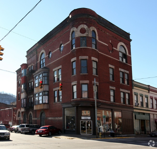
546 2Nd St
Portsmouth, OH
City
29-0410.000
CITY NE COR. 41FT 3IN X 104 LOT 47 MAP 10-001 546 2ND ST
Commercialnec
Scioto
X
Ohio
39145C0382F
47
2024
0.10 AC
2024
Other Market Areas
003600
DEMOGRAPHICS near 546 2Nd St
1 Mile
3 Mile
5 Mile
2024 Total Population
3,406
20,219
29,756
2029 Population
3,367
19,800
29,090
Pop Growth 2024-2029
(1.15%)
(2.07%)
(2.24%)
Average Age
38
40
41
2024 Total Households
1,318
8,506
12,523
HH Growth 2024-2029
(0.46%)
(2.05%)
(2.24%)
Median Household Inc
$17,295
$29,148
$30,963
Avg Household Size
1.80
2.20
2.20
2024 Avg HH Vehicles
1.00
2.00
2.00
Median Home Value
$75,850
$79,095
$82,405
Median Year Built
1948
1953
1956
Nearby Places
Map Layers
Map Styles
 Street
 Aerial
- Restaurants
- Banks
- Shops
- Fitness
- Groceries
PUBLIC TRANSPORTATION
COMMUTER RAIL
DRIVE
WALK
Distance
4 min
2.9 mi
AIRPORT
Tri-State/Milton J Ferguson Field
DRIVE
WALK
Distance
Tri-State/Milton J Ferguson Field
57 min
44.3 mi
Nearby Properties
Address
Land Use
TOTAL SIZE
Lot Size
Zoning
Address
Land Use
TOTAL SIZE
Lot Size
Zoning
15.67 AC
Address
Land Use
TOTAL SIZE
Lot Size
Zoning
3.57 AC
Address
Land Use
TOTAL SIZE
Lot Size
Zoning
0.26 AC
Address
Land Use
TOTAL SIZE
Lot Size
Zoning
0.30 AC
Address
Land Use
TOTAL SIZE
Lot Size
Zoning
2.47 AC
Address
Land Use
TOTAL SIZE
Lot Size
Zoning
4.17 AC
Address
Land Use
TOTAL SIZE
Lot Size
Zoning
11.26 AC
Address
Land Use
TOTAL SIZE
Lot Size
Zoning
Address
Land Use
TOTAL SIZE
Lot Size
Zoning
2.71 AC
Address
Land Use
TOTAL SIZE
Lot Size
Zoning
0.91 AC
Address
Land Use
TOTAL SIZE
Lot Size
Zoning
16.98 AC
Address
Land Use
TOTAL SIZE
Lot Size
Zoning
1.18 AC
Address
Land Use
TOTAL SIZE
Lot Size
Zoning
17,946 SF
2.33 AC
Address
Land Use
TOTAL SIZE
Lot Size
Zoning
1.58 AC
Address
Land Use
TOTAL SIZE
Lot Size
Zoning
Address
Land Use
TOTAL SIZE
Lot Size
Zoning
28.24 AC
Address
Land Use
TOTAL SIZE
Lot Size
Zoning
25,200 SF
10 AC
Address
Land Use
TOTAL SIZE
Lot Size
Zoning
0.12 AC
Address
Land Use
TOTAL SIZE
Lot Size
Zoning
1.57 AC
Address
Land Use
TOTAL SIZE
Lot Size
Zoning
0.25 AC
Address
Land Use
TOTAL SIZE
Lot Size
Zoning
3.09 AC
Address
Land Use
TOTAL SIZE
Lot Size
Zoning
2.80 AC
Address
Land Use
TOTAL SIZE
Lot Size
Zoning
8.04 AC
Address
Land Use
TOTAL SIZE
Lot Size
Zoning
6.37 AC
Address
Land Use
TOTAL SIZE
Lot Size
Zoning
1.82 AC
Address
Land Use
TOTAL SIZE
Lot Size
Zoning
1.91 AC
Address
Land Use
TOTAL SIZE
Lot Size
Zoning
1.52 AC
Address
Land Use
TOTAL SIZE
Lot Size
Zoning
16.45 AC
Address
Land Use
TOTAL SIZE
Lot Size
Zoning
0.88 AC
Address
Land Use
TOTAL SIZE
Lot Size
Zoning
0.85 AC
The World's #1 Commercial Real Estate Marketplace
Connect with us
© 2026 CoStar Group
The information above has been obtained from sources believed reliable. While we do not doubt its accuracy we have not verified it and make no guarantee, warranty or representation about it. It is your responsibility to independently confirm its accuracy and completeness. Any projections, opinions, assumptions, or estimates used are for example only and do not represent the current or future performance of the property. The value of this transaction to you depends on tax and other factors which should be evaluated by your tax, financial, and legal advisors. You and your advisors should conduct a careful, independent investigation of the property to determine to your satisfaction the suitability of the property for your needs.