Property Record
5460 Baxter Rd, Rockford, IL 61109


NEARBY LISTINGS FOR SALE OR LEASE
Property Detail
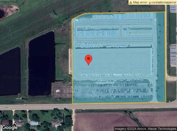
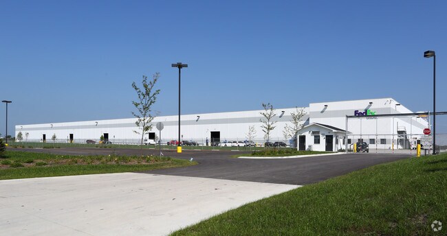
5460 Baxter Rd
Rockford, IL
Rock 39 Un 3
16-28-400-019
ROCK 39 UNIT THREE PT S1/2 SEC 28-43-2THAT PT LYG IN CHERRY VALLEY TWSP COMM SW COR SE1/4 TH N 50 FT TO POB TH NAPPROX 840.37 FT NE APPROX 140.35 FT E
Industrialgeneral
Winnebago
X
Illinois
17141C0150D
1
2024
19.20 AC
2024
I-39 Cor/Winnebago Cy
003705
Chicago
187,215 SF
DEMOGRAPHICS near 5460 Baxter Rd
1 Mile
3 Mile
5 Mile
2024 Total Population
80
3,757
23,132
2029 Population
76
3,698
22,764
Pop Growth 2024-2029
(5.00%)
(1.57%)
(1.59%)
Average Age
48
45
41
2024 Total Households
31
1,541
9,489
HH Growth 2024-2029
(3.23%)
(1.49%)
(1.50%)
Median Household Inc
$95,833
$81,515
$60,613
Avg Household Size
2.60
2.40
2.40
2024 Avg HH Vehicles
3.00
2.00
2.00
Median Home Value
$285,713
$160,696
$146,293
Median Year Built
1975
1979
1977
Nearby Places
Map Layers
Map Styles
 Street
 Aerial
- Restaurants
- Banks
- Shops
- Fitness
- Groceries
PUBLIC TRANSPORTATION
AIRPORT
Chicago/Rockford International
DRIVE
WALK
Distance
Chicago/Rockford International
17 min
6.5 mi
Freight Ports
Port Milwaukee
DRIVE
WALK
Distance
Port Milwaukee
116 min
98.8 mi
Nearby Properties
Address
Land Use
TOTAL SIZE
Lot Size
Zoning
Address
Land Use
TOTAL SIZE
Lot Size
Zoning
675,270 SF
40.29 AC
Address
Land Use
TOTAL SIZE
Lot Size
Zoning
351,935 SF
21.26 AC
Address
Land Use
TOTAL SIZE
Lot Size
Zoning
141,293 SF
37.74 AC
IG
Address
Land Use
TOTAL SIZE
Lot Size
Zoning
53,130 SF
20.95 AC
IG
Address
Land Use
TOTAL SIZE
Lot Size
Zoning
13,650 SF
20.45 AC
IL
Address
Land Use
TOTAL SIZE
Lot Size
Zoning
51,815 SF
7.81 AC
IL
Address
Land Use
TOTAL SIZE
Lot Size
Zoning
15,488 SF
35.60 AC
IH
Address
Land Use
TOTAL SIZE
Lot Size
Zoning
21,492 SF
14.24 AC
AG
Address
Land Use
TOTAL SIZE
Lot Size
Zoning
13,284 SF
66.81 AC
AG
Address
Land Use
TOTAL SIZE
Lot Size
Zoning
3,024 SF
154.92 AC
Address
Land Use
TOTAL SIZE
Lot Size
Zoning
7,558 SF
23.86 AC
AG
Address
Land Use
TOTAL SIZE
Lot Size
Zoning
20,994 SF
2.98 AC
IL
Address
Land Use
TOTAL SIZE
Lot Size
Zoning
5,402 SF
10.36 AC
AG
Address
Land Use
TOTAL SIZE
Lot Size
Zoning
4,916 SF
26.55 AC
AG
Address
Land Use
TOTAL SIZE
Lot Size
Zoning
8,570 SF
72.67 AC
MX
Address
Land Use
TOTAL SIZE
Lot Size
Zoning
3,916 SF
160 AC
AG
Address
Land Use
TOTAL SIZE
Lot Size
Zoning
5.01 AC
Address
Land Use
TOTAL SIZE
Lot Size
Zoning
26,319 SF
7.88 AC
AG
Address
Land Use
TOTAL SIZE
Lot Size
Zoning
18,232 SF
5 AC
IH
Address
Land Use
TOTAL SIZE
Lot Size
Zoning
4,402 SF
12.10 AC
AG
Address
Land Use
TOTAL SIZE
Lot Size
Zoning
7,520 SF
13.36 AC
AG
Address
Land Use
TOTAL SIZE
Lot Size
Zoning
61.14 AC
AG
Address
Land Use
TOTAL SIZE
Lot Size
Zoning
6,749 SF
6 AC
RA
Address
Land Use
TOTAL SIZE
Lot Size
Zoning
3,913 SF
159.02 AC
AG
Address
Land Use
TOTAL SIZE
Lot Size
Zoning
68.25 AC
AG
Address
Land Use
TOTAL SIZE
Lot Size
Zoning
6,668 SF
100 AC
AG
Address
Land Use
TOTAL SIZE
Lot Size
Zoning
3,636 SF
10 AC
AG
Address
Land Use
TOTAL SIZE
Lot Size
Zoning
810 SF
52.47 AC
AG
Address
Land Use
TOTAL SIZE
Lot Size
Zoning
200 AC
AG
The World's #1 Commercial Real Estate Marketplace
Connect with us
© 2025 CoStar Group
The information above has been obtained from sources believed reliable. While we do not doubt its accuracy we have not verified it and make no guarantee, warranty or representation about it. It is your responsibility to independently confirm its accuracy and completeness. Any projections, opinions, assumptions, or estimates used are for example only and do not represent the current or future performance of the property. The value of this transaction to you depends on tax and other factors which should be evaluated by your tax, financial, and legal advisors. You and your advisors should conduct a careful, independent investigation of the property to determine to your satisfaction the suitability of the property for your needs.